Ohio River
The Ohio River is a 1,579km long river in the east-central United States. The name “Ohio” has been derived from the native Seneca language, where the term “Ohi:yo’” literally means “Good River”. The Ohio River serves as a source of drinking water for over five million people and more than 25 million people live in the Ohio River basin.
Geography

The two sources of the Ohio River are the Allegheny River and the Monongahela River. The Allegheny River rises in north-central Pennsylvania in the Allegheny Township at an elevation of 680m. The Monongahela River begins in the city of Fairmont in the State of West Virginia at an elevation of 270m. The two rivers meet at Point State Park in the city of Pittsburgh in Pennsylvania and form the Ohio River. The Ohio River then flows in a southwesterly direction and joins the Mississippi River at the city of Cairo in the State of Illinois.
Through its course, the Ohio River passes through six US States namely, Pennsylvania, West Virginia, Ohio, Kentucky, Indiana, and Illinois. The river flows along the state boundaries of Ohio and West Virginia, Ohio and Kentucky, Indiana and Kentucky, and Illinois and Kentucky. The Ohio River forms the eastern and the largest tributary of the Mississippi River. At the point where both the Ohio and Mississippi Rivers meet, the Ohio River is much bigger than the Mississippi River in terms of discharge volume. It is estimated that at their meeting point, the Ohio River has a discharge volume of 7,960m3/s, whereas the Mississippi River has a discharge volume of 5,897m3/s. It has also been found that the flow of the Ohio River is greater than that of the Mississippi River and hydrologically the Ohio River contributes more water to the Mississippi River than any other tributary.
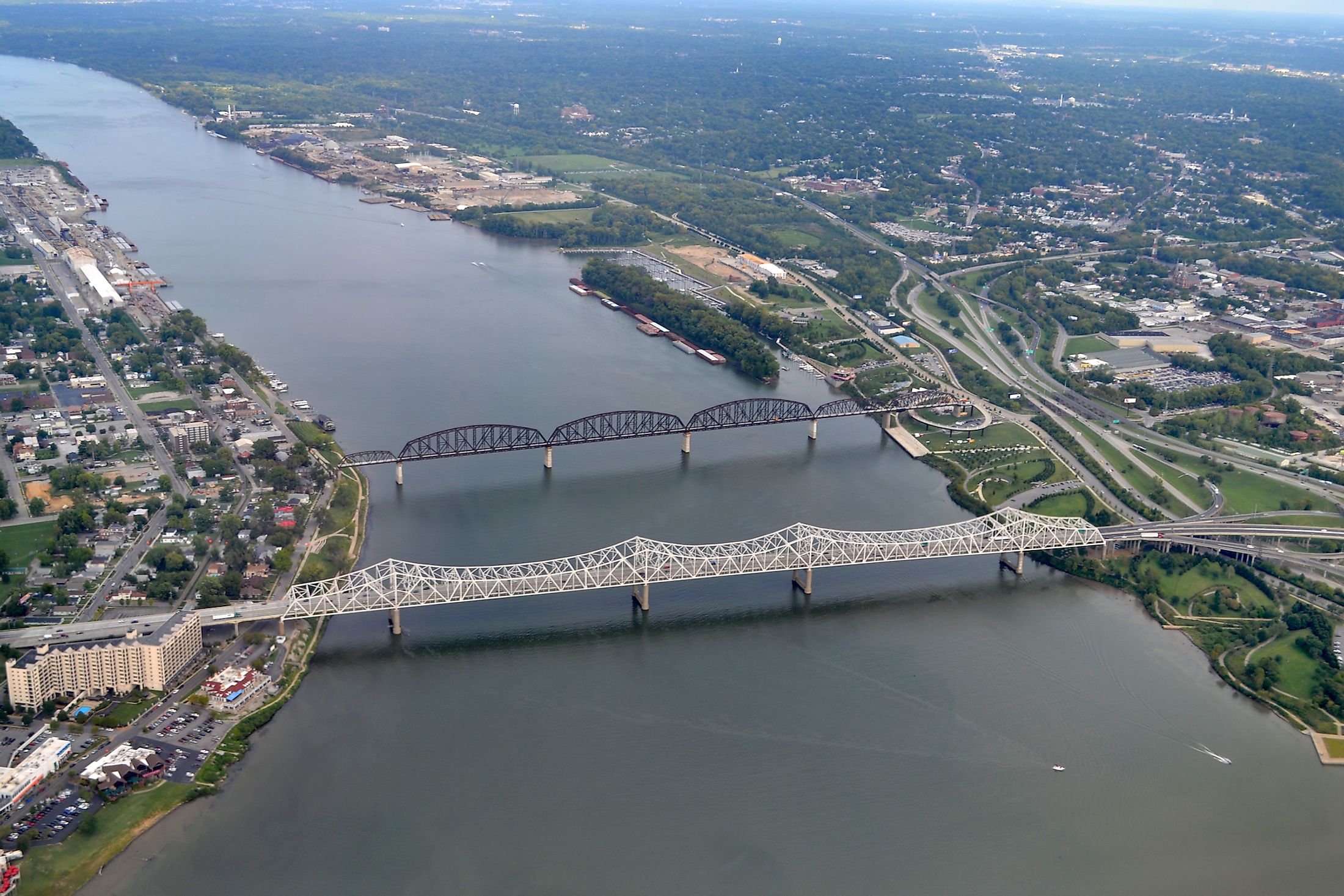
The Ohio River is naturally a shallow river that has been artificially deepened by constructing a series of dams. The river has a width of less than 0.8km between the cities of Pittsburgh and Wheeling and a width of 1.6km from the city of Cincinnati to Louisville. The river’s deepest point is 51m on the western side of Louisville in Kentucky. From Louisville to its confluence with the Mississippi River at Cairo, the river has a depth of 6m. The lowest elevation of the river is at 96m at the point where it joins the Mississippi River. The dams help to raise the water level, assist in controlling floods and make the river navigable.
The lower Ohio River just below the city of Louisville has been obstructed by rapids known as the “Falls of the Ohio” and makes it impassable for navigation. However, the construction of the McAlpine Locks & Dam has helped to bypass the rapids and allow commercial navigation from Forks of Ohio to the Port of New Orleans. Over 184 million tons of cargo are transported through the river annually.
Some of the major tributaries of the Ohio River include Tennessee River, Cumberland River, Wabash River, Allegheny River, Muskingum River, Kentucky River, Green River, Great Miami River, etc. The Ohio River basin covers an area of 490,600 sq. km and drains parts of 14 US States in the Northeast, Mid-Atlantic, Midwest, and Deep South regions.
Geology

Geologically, the Ohio River is relatively young. Before the river was formed, large parts of the North American continent were covered by water which formed a saltwater lake. During this time, the bedrock of the Ohio valley was also formed. It is believed that the Ohio River was formed on a piecemeal basis that began about 2.5 and 3 million years ago. The movement of glaciers during the early ice ages helped in forming the current river drainages of several rivers that ultimately created the Ohio River System as well as the course of the headwaters of the Ohio River. The Teays River was the largest of these rivers. It is believed that the present-day Ohio River flows within the segments of the ancient Teays River.
Climate and Ecology

The Ohio River is situated in a “climatic transition area” and the waters of the river run along the borders of humid subtropical and humid continental climate areas. During winter, the river regularly freezes at the city of Pittsburgh, while at the confluence of the Ohio and Tennessee Rivers in the city of Paducah in Kentucky, the Ohio River remains ice-free throughout the year. About 160 species of fish and 50 rare species of mussels have been recorded in the Ohio River.
The Ohio River is considered the most polluted river in the United States. Agricultural runoff and wastewater from industrial processes are major causes of water pollution in the Ohio River.
Brief History

The Ohio River had great significance for the Native American people as many ancient civilizations took place along its valley. For several years, the Native Americans used the river for transportation and trading purposes and helped in connecting various communities. The native American tribes of Kaw, Ponca, Omaha, Osage lived near the Ohio River but had to leave the area under the pressure of the dominant Iroquois. The first European explorers to see the Ohio River were René-Robert Cavelier and Sieur de La Salle in 1669. They named the river “la belle riviere” or “the beautiful river”. During the 18th century, the Ohio River served as the southern boundary of the Northwest Territory and a border between the British settlements in Kentucky and the native American Indian communities in Ohio. Along with the Mason-Dixon Line, the Ohio River also serves as a symbolic divider between the slave states in the south and the free states in the north.