Largest Landlocked Countries In The World
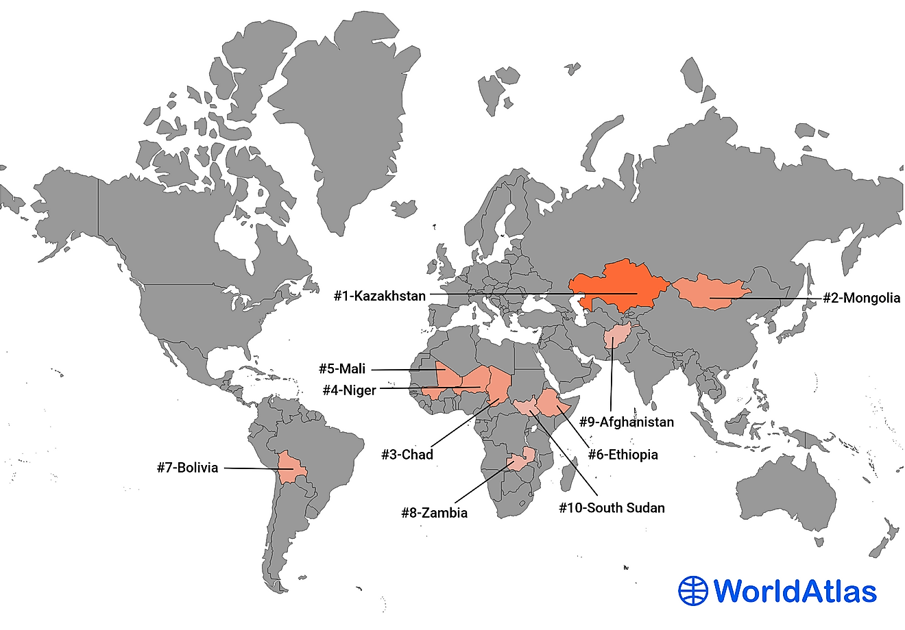
A landlocked country lacks a coastline or direct access to an ocean or sea. The world has a total of 44 landlocked countries with the largest being Kazakhstan. The 10 largest by size are:
- Kazakhstan - 2,724,900 km²
- Mongolia - 1,564,116 km²
- Chad - 1,284,000 km²
- Niger - 1,267,000 km²
- Mali - 1,240,192 km²
- Ethiopia - 1,104,300 km²
- Bolivia - 1,098,581 km²
- Zambia - 752,618 km²
- Afghanistan - 652,230 km²
- South Sudan - 644,329 km²
Landlocked countries have many advantages and disadvantages. These countries are relatively well-sheltered from adverse weather effects caused by oceans such as tsunamis and hurricanes and the ability to monitor goods coming into or leaving the country through the borders. Landlocked countries are safe from invasions by sea. However, these countries especially developing ones have challenges in the importation and exportation of goods forcing them to rely on their connected neighbors. Transport costs and customs duties become expensive for the landlocked countries. To access the coastline, landlocked countries are forced to maintain friendly relations with countries with coastlines even when they do not agree.
https://www.worldatlas.com/maps/afghanistan
10. South Sudan - 644,329 km²
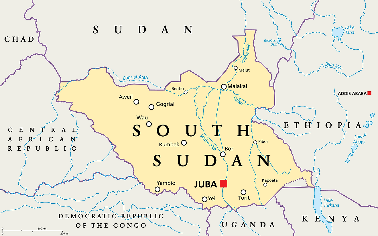
With an area of 644,329 km², South Sudan is the 10th largest landlocked country in the world. Located in East Central Africa, South Sudan is bordered by Ethiopia, Sudan, Central African Republic, Uganda, Kenya, and the Democratic Republic of the Congo. It is home to an estimated population of 11,062,110.
9. Afghanistan - 652,230 km²
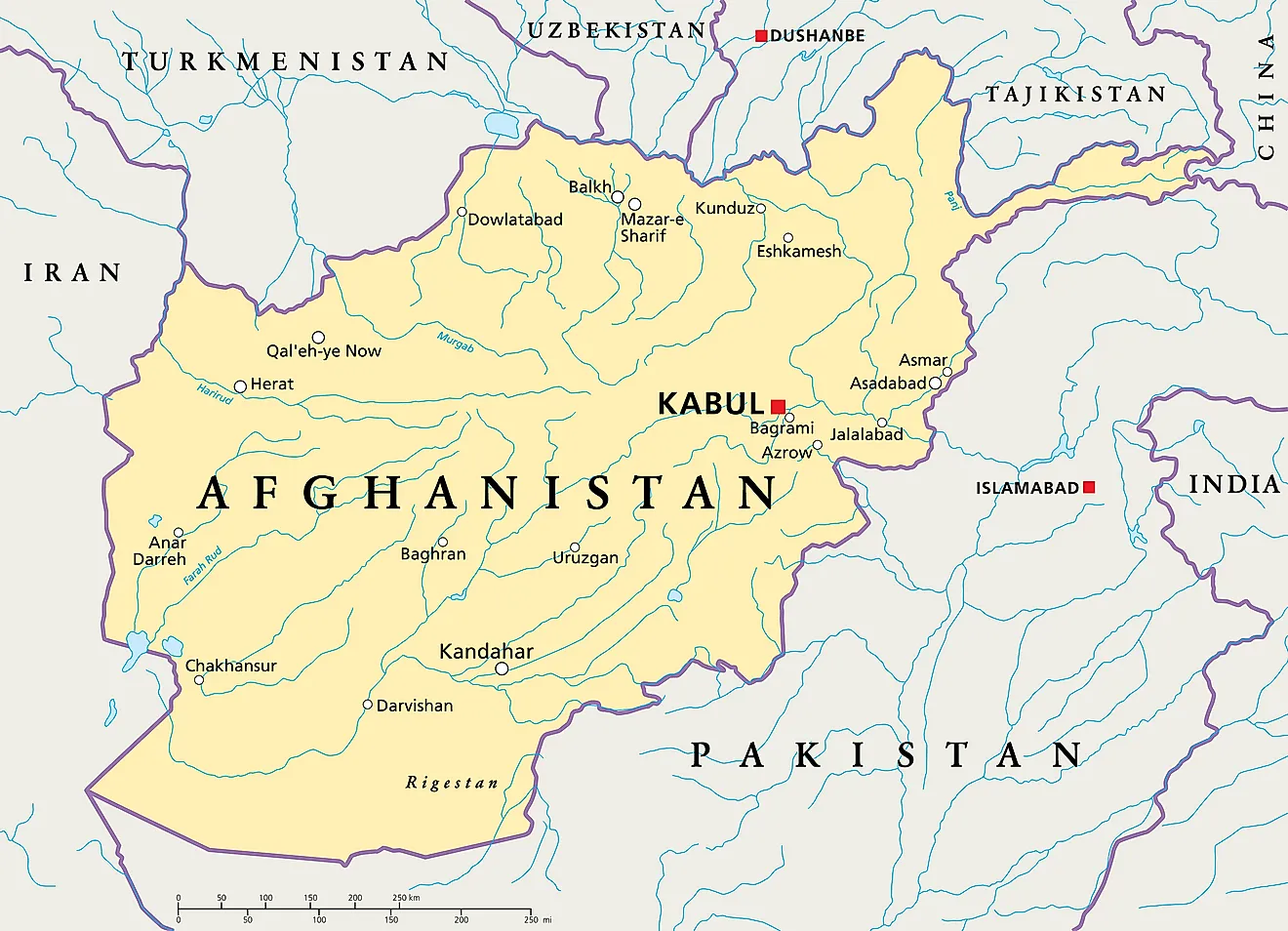
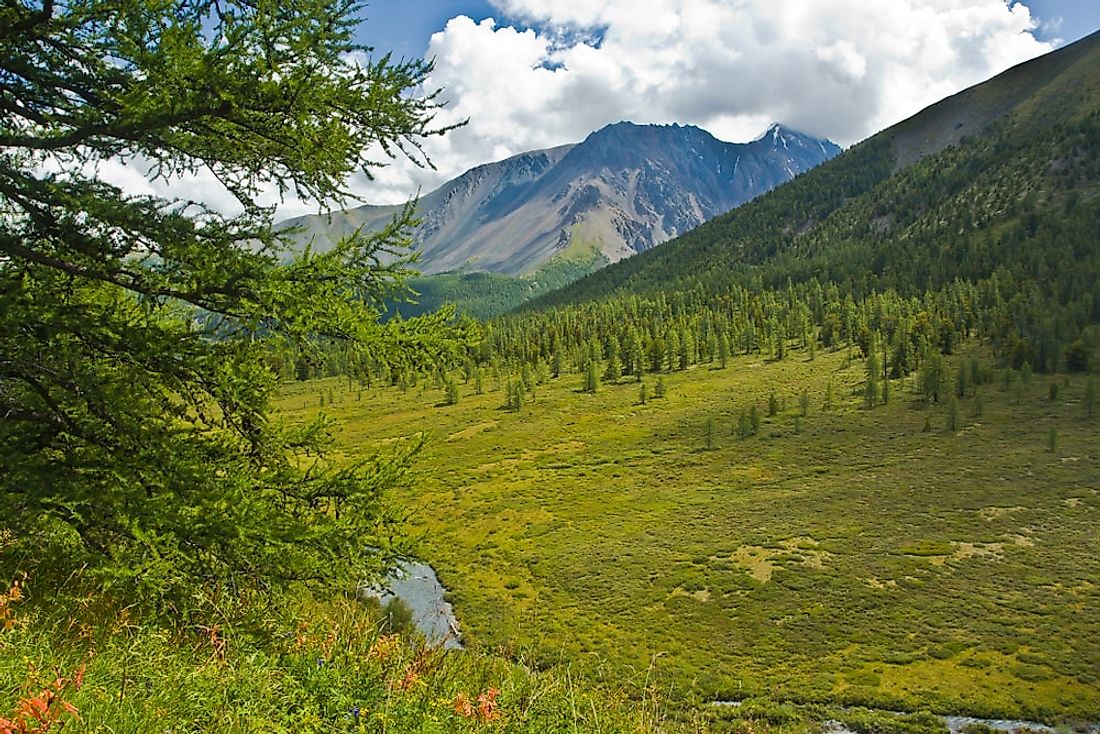
Afghanistan is a South Asian landlocked country with an area of 652,230 km² and a population of 38,041,750. Afghanistan is bordering 6 countries including Pakistan, Tajikistan, Turkmenistan, Uzbekistan, China, and Iran.
8. Zambia - 752,618 km²
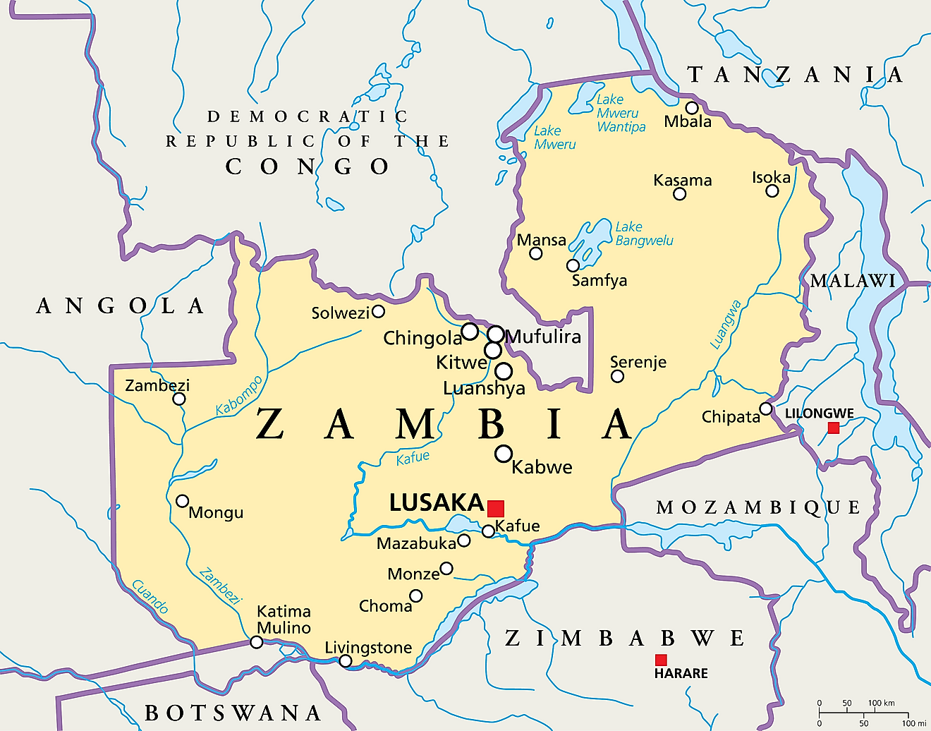
Zambia is a landlocked South African country with an area of 752,618 km² bordering 8 countries including Zimbabwe, Angola, Botswana, the Democratic Republic of Congo, Namibia, Tanzania, Mozambique, and Malawi. The country has a population of 17,861,030. people.
7. Bolivia - 1,098,581 km²
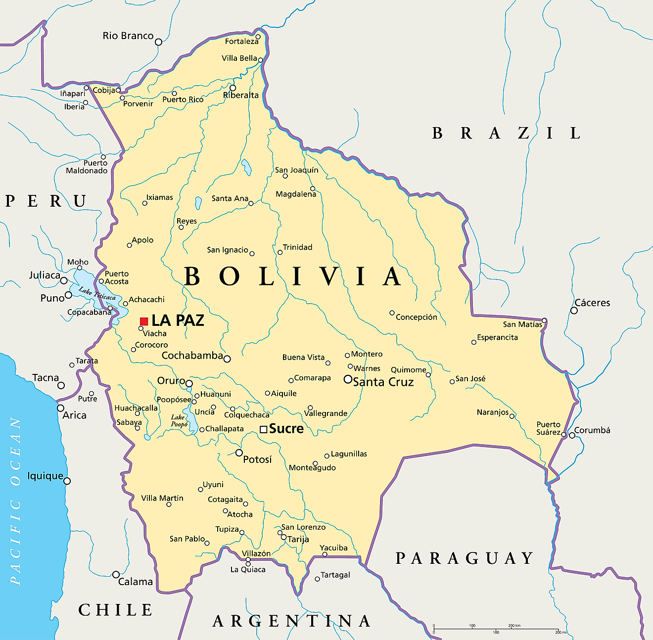
Bolivia is a central South American country bordering 5 countries including Argentina, Brazil, Chile, Paraguay, and Peru. Bolivia has an area of 1,098,581 km² making it the seventh largest landlocked country in the world and has a population of 11,513,100 people.
6. Ethiopia - 1,104,300 km²
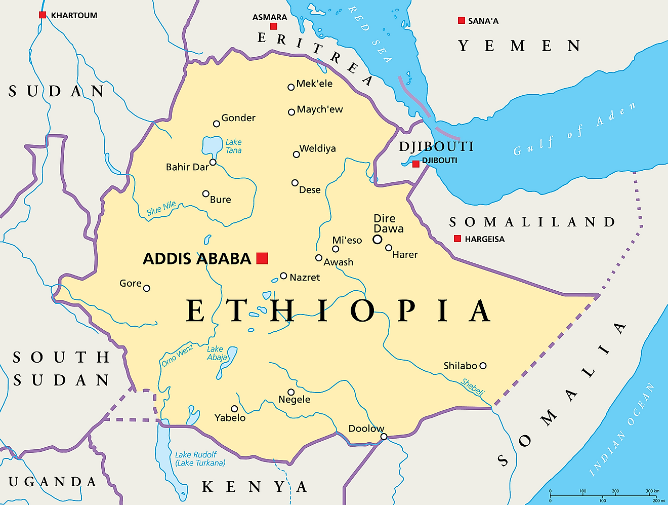
Ethiopia is a landlocked country in Eastern Africa with an area of 1,104,300 km² and a population of 112,078,730. The country borders 6 countries including Sudan, Kenya, Eritrea, Djibouti, South Sudan, and Somalia and is the sixth largest landlocked country in the world.
5. Mali - 1,240,192 km²
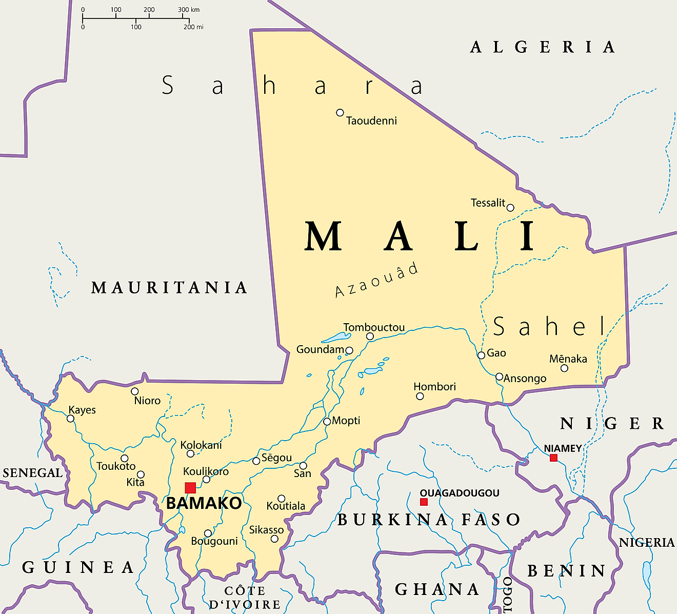
Mali has an area of 1,240,192 km² making it the fifth largest landlocked country in the world. The country is located in West Africa bordering 7 countries including Algeria, Guinea, Cote d'Ivoire, Burkina Faso and Niger. The country has a population 19,658,030.
4. Niger - 1,267,000 km²
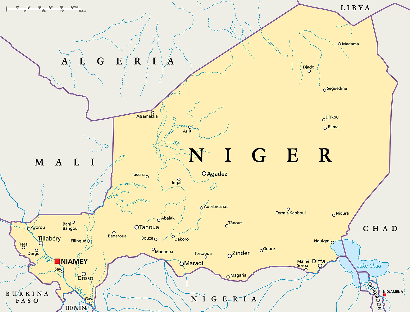
Niger is the world's fourth largest landlocked country with an area of 1,267,000 km². Niger is surrounded by 7 countries of West Africa including Algeria, Benin, Burkina Faso, Chad, Libya, Mali, and Nigeria. Niger has a population of 23,310,720 people.
3. Chad - 1,284,000 km²
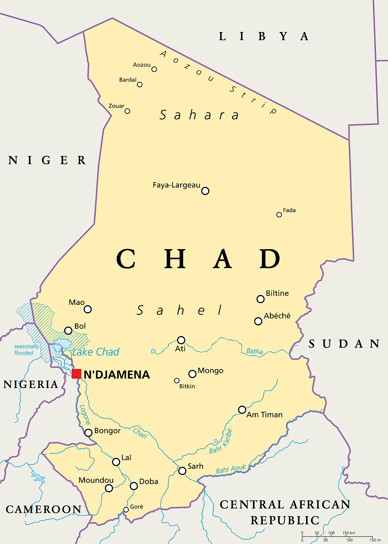
Chad is a central African country with a total area of 1,284,000 km² making it the third largest landlocked country in the world and a population of 15,946,880 people. The country borders 6 countries including Cameroon, Central African Republic, Libya, Niger, Nigeria, and Sudan.
2. Mongolia - 1,564,116 km²
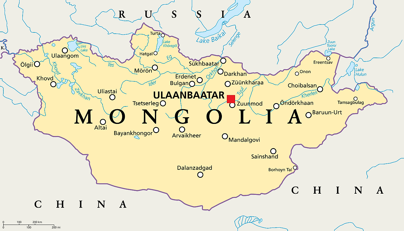
Mongolia is the second largest landlocked country in the world with a total area of 1,564,116 km². Mongolia is located in northern Asia bordering 2 countries China and Russia. The population of the country is 3,225,170.
1. Kazakhstan - 2,724,900 km²
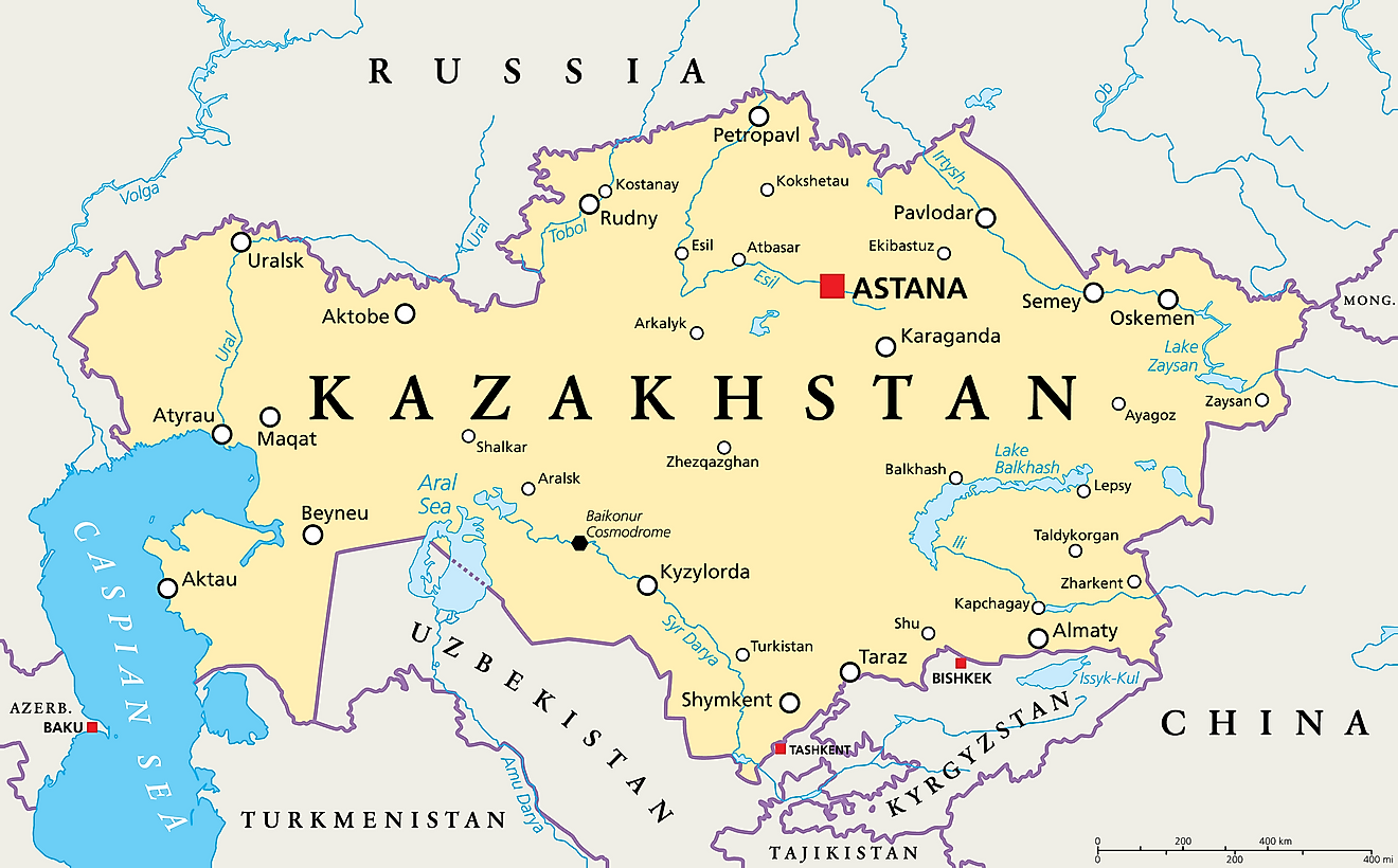
Kazakhstan is the largest landlocked country in the world with an area of 2,724,900 km² and the ninth largest in the world. Kazakhstan is located in Central Asia bordering 5 countries, China, Kyrgyzstan, Russia, Turkmenistan, and Uzbekistan. The country has a population of 18,513,930 people.
Landlocked Countries By Area
| Rank | Country | Area (km2) |
|---|---|---|
| 1 | Kazakhstan | 2,724,900 |
| 2 | Mongolia | 1,564,116 |
| 3 | Chad | 1,284,000 |
| 4 | Niger | 1,267,000 |
| 5 | Mali | 1,240,192 |
| 6 | Ethiopia | 1,104,300 |
| 7 | Bolivia | 1,098,581 |
| 8 | Zambia | 752,618 |
| 9 | Afghanistan | 652,230 |
| 10 | South Sudan | 644,329 |
| 11 | Central African Republic | 622,984 |
| 12 | Botswana | 581,730 |
| 13 | Turkmenistan | 488,100 |
| 14 | Uzbekistan | 447,400 |
| 15 | Paraguay | 406,752 |
| 16 | Zimbabwe | 390,757 |
| 17 | Burkina Faso | 274,200 |
| 18 | Uganda | 241,038 |
| 19 | Laos | 236,800 |
| 20 | Belarus | 207,600 |
| 21 | Kyrgyzstan | 191,951 |
| 22 | Nepal | 147,181 |
| 23 | Tajikistan | 144,100 |
| 24 | Malawi | 118,484 |
| 25 | Hungary | 93,028 |
| 26 | Azerbaijan | 86,600 |
| 27 | Austria | 83,871 |
| 28 | Czech Republic | 78,867 |
| 29 | Serbia | 77,474 |
| 30 | Slovakia | 49,035 |
| 31 | Switzerland | 41,277 |
| 32 | Bhutan | 38,394 |
| 33 | Moldova | 33,851 |
| 34 | Lesotho | 30,355 |
| 35 | Armenia | 29,743 |
| 36 | Burundi | 27,830 |
| 37 | Rwanda | 26,338 |
| 38 | North Macedonia | 25,713 |
| 39 | Eswatini | 17,364 |
| 40 | Luxembourg | 2,586 |
| 41 | Andorra | 468 |
| 42 | Liechtenstein | 160 |
| 43 | San Marino | 61 |
| 44 | Vatican City | 0.44 |