Maps of American Samoa
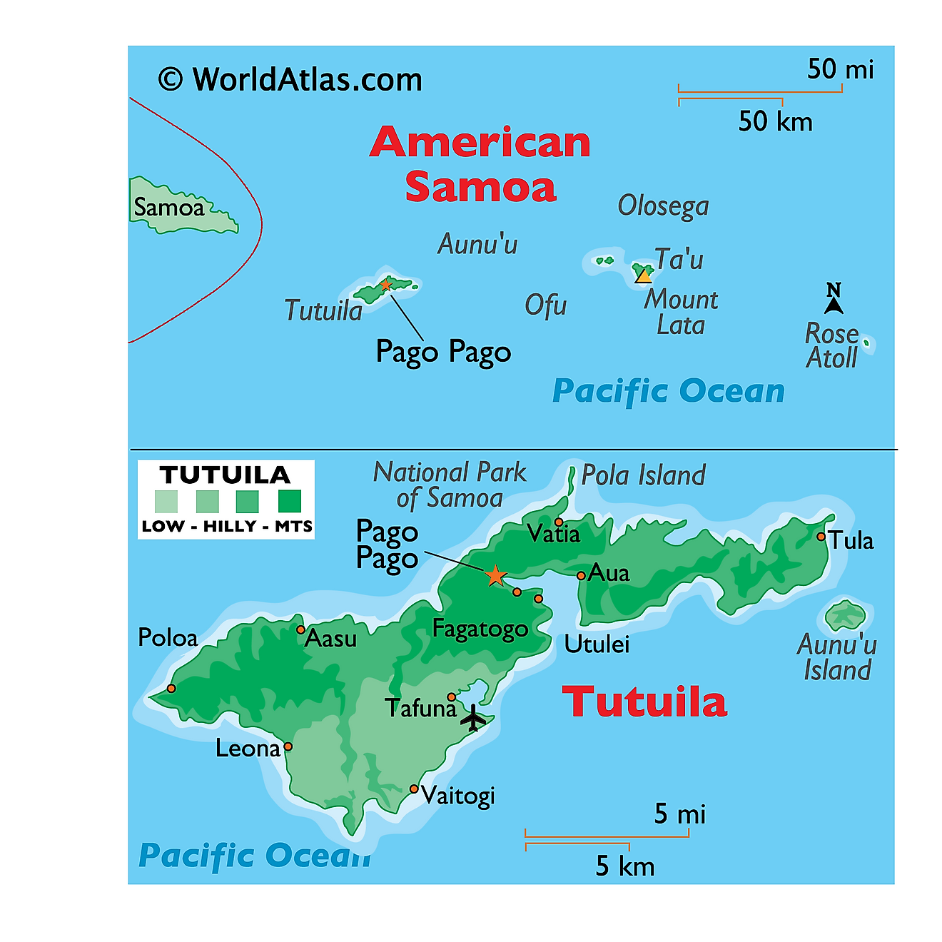
Covering a total land area of 199 sq.km, American Samoa is composed of 5 principal islands (Tutuila, Ta'u, Olosega, Ofu and Aunuu) and 2 coral atolls. It is the southernmost unincorporated overseas territory of the United States, located in the South Pacific Ocean. Out of the 5 principal islands and 2 coral atolls, the Rose Atoll is uninhabited and is a Marine National Monument. Tutuila island is the largest island in American Samoa.
As observed on the physical map of American Samoa above, the islands are largely mountainous due to their volcanic origin. These rugged islands also have narrow coastal plains. Matafao’s Peak is the highest point in Tutuila, at 2142ft (653m). The Tau, Olosega and Ofu islands form the Manu’a island group at the east of Tutuila, constituting the 2nd largest island area.
Located in the Manu’a islands, on the island of Ta’u is, Lata Mountain – the highest point of American Samoa marked on the physical map above by a yellow triangle. It is 966 m (3,169 ft) tall. The lowest point is the Pacific Ocean (0m). At the extremities of the islands, coral reefs are common.
Map of Districts And Islands Of American Samoa
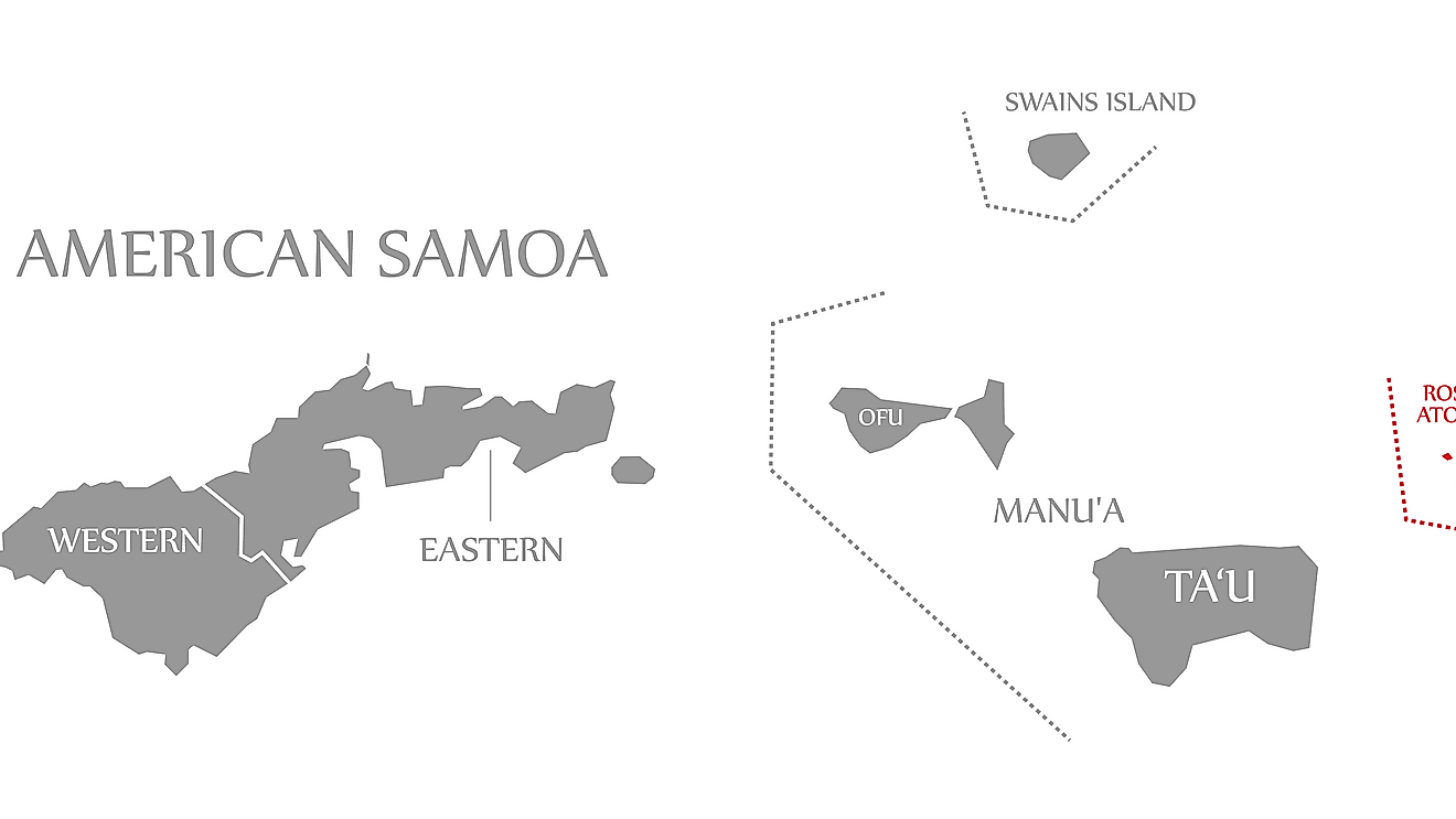
American Samoa is administratively divided into 3 districts and 2 islands (unorganized atolls). Eastern District, Western District and Manu’a District are the 3 districts; Rose Island and Swains Island are the 2 islands. These districts are further subdivided into 15 counties. These counties further comprise of 76 villages.
Covering a total land area of 199 sq.km, American Samoa is composed of 5 principal islands (Tutuila, Tau, Olosega, Ofu and Aunuu) and 2 coral atolls. It is the southernmost unincorporated overseas territory of the United States and one of the two territories located in the Southern hemisphere.
Located on the eastern shore of the Tutuila Island (main island of American Samoa) is, Pago Pago – the territorial capital of American Samoa. It is one of the deepest natural harbors in the South Pacific region. Pago Pago is also the industrial, commercial and the only modern urban center in the island territory. Situated within the Pago Pago harbor is, Fagatogo village – the official seat of government of American Samoa. Tafuna is the largest and the most populous village in the island territory.
Where is American Samoa?
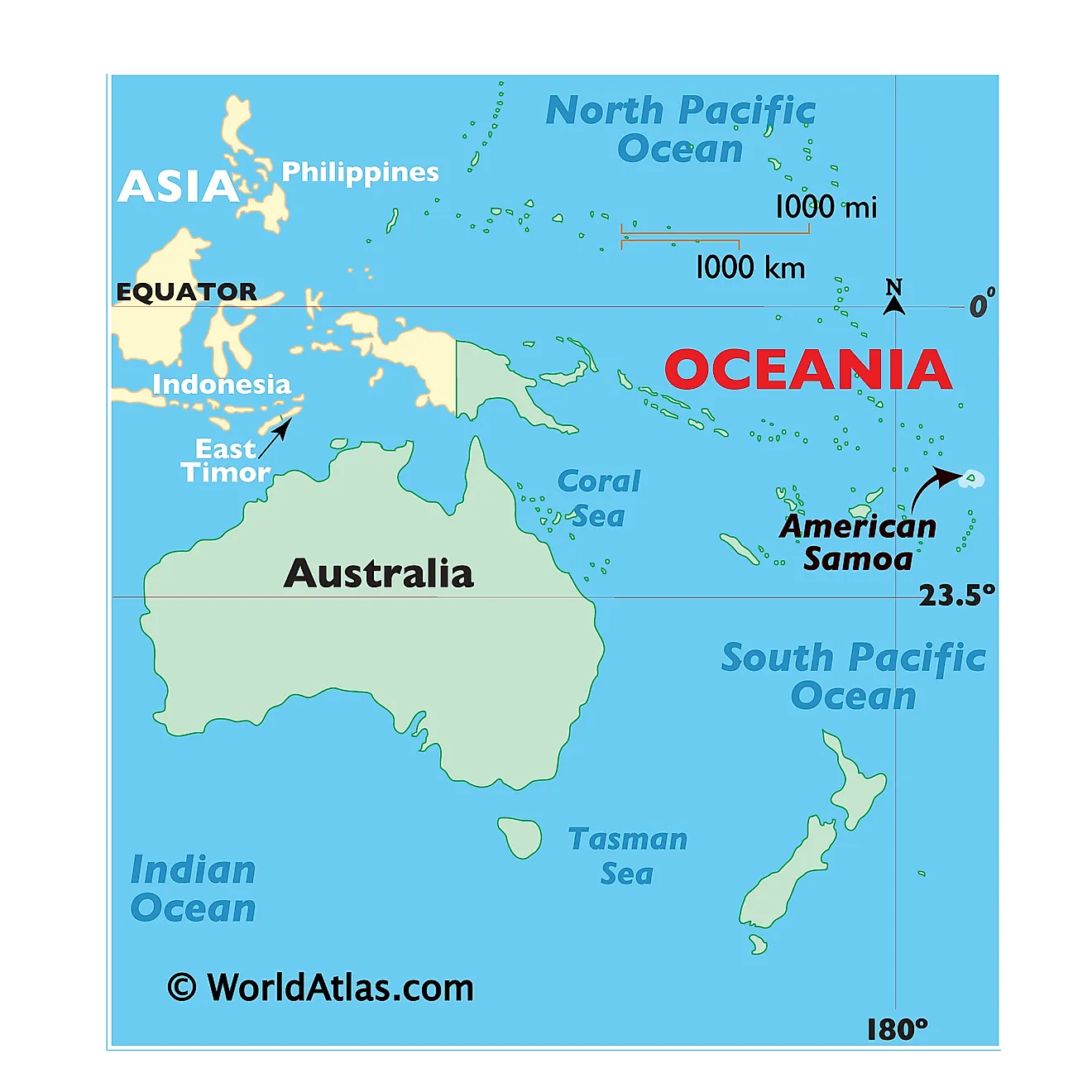
American Samoa – an unincorporated and unorganized island territory of the United States is located in the South Pacific Ocean. It is geographically positioned in the Western and Southern hemispheres of the Earth. American Samoa is situated to the east of Samoa, to the southwest of Hawaii and to the northeast of New Zealand. The island territory shares maritime borders with Samoa, Tonga, Cook Islands, Niue and Tokelau.
Regional Maps: Map of
Outline Map of American Samoa

The above map represents American Samoa – an unincorporated and unorganized island territory of the United States, located in the South Pacific Ocean. The above map can be downloaded, printed and used for geography education purposes like map-pointing and coloring activities.

The above outline map represents American Samoa – an unincorporated and unorganized island territory of the United States, located in the South Pacific Ocean.
Key Facts
| Legal Name | American Samoa |
|---|---|
| Flag |
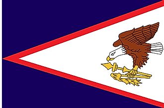
|
| Capital City | Pago Pago |
| 14 16 S, 170 42 W | |
| Total Area | 224.00 km2 |
| Land Area | 224.00 km2 |
| Water Area | N/A |
| Population | 55,312 |
| Currency | US Dollar (USD) |
| GDP | $636.00 Million |
| GDP Per Capita | $11,466.69 |
This page was last updated on February 25, 2021
