Antarctica Map / Map of Antarctica - Facts About Antarctica and the Antarctic Circle - Worldatlas.com

- Antarctica Glaciological Data Center
- Antarctica Project
- Antarctica Penguins
- Antarctica Seals
- Arctic Circle page
- Glaciers
- South Pole
- Travel to Antarctica


- Size: 13,209,000 sq km, 5,100,021 sq miles
(varies due to changing ice shelves) - Percent of Earth's Land: 8.9%
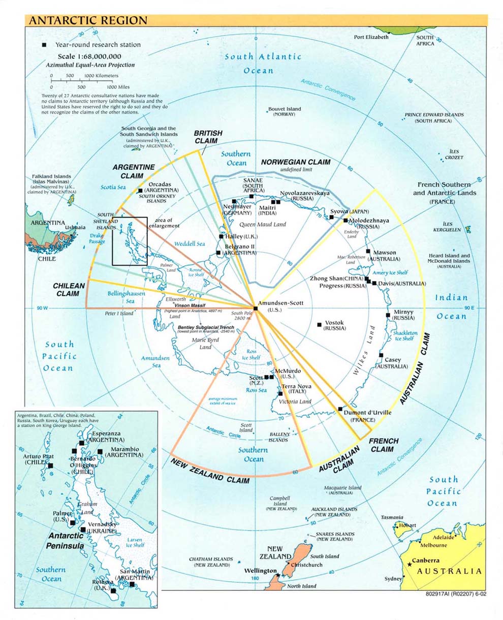
- Status Antarctica, almost 98% solid ice, was finally considered a continent in 1840, and not just a group of isolated islands. Today it has active territorial claims submitted by Argentina, Australia, Chile, France, New Zealand, Norway and the United Kingdom. (Many of these claims are not recognized by some countries and remain in a constant disputed status)
- Capital City none
- Climate Antarctica is the coldest and windiest spot on the planet. In fact, the lowest temperature ever recorded on Earth was recorded in Antarctica (-129.3ºF) and the mean winter temperatures range from -40º to -94ºF. Winds are commonly measured at up to 200 miles per hour.
- Current Weather at the South Pole.
- Highest Point Vinson Massif at 16,066 ft. (4,897 m) (map)
- Lowest Point Bentley Subglacial Trench, -2,555 m)
- Latitude/Longitude 90° S, 0.00° E
- Official Language none
- Official Currency none
- Population Officially none, but governmental research stations are populated with small groups of scientists at all times. In addition, during the 2011/2012 season, nearly 417,000 tourists visited the continent.


