American River, California
The American River is a long river that flows for about 192 km in Northern California from the Sierra Nevada Mountains to its meeting point with the Sacramento River in the state capital Sacramento. The American River serves as a major drinking water source for the people of Sacramento and has been dammed excessively for flood control, irrigation, and hydroelectric power generation. The American River and its tributaries support a diverse array of fish and wildlife besides offering a number of recreational activities.
Forks Of The American River
North Fork

Flowing for 142 km from its source in the Sierra Nevada to its mouth at Folsom Lake, the North Fork American River is the American River's longest tributary. The river begins its journey at the Mountain Meadow Lake, close to the 2,746m tall Granite Chief peak in the Tahoe National Forest. The river initially flows in the northwest direction and then swings westwards into a gorge parallel to the Forest Hill Divide in the south. Here, it is joined by the Big Granite Creek. The river then turns southwestwards, carving its way through the foothills of the Sierra Mountains. The river abruptly turns southwards near Colfax, and about 6.4 km downstream, it meets the Shirttail Creek. After this, the river is impounded by Lake Clementine, formed by the construction of the North Fork Dam. Below the dam, the river flows southwards, passing under the Auburn-Foresthill Bridge, where the Middle Fork American River joins it. The river continues its southward journey and drains into Folsom lake's northern arm.
Middle Fork

The American River's Middle Fork of the American River has a length of 100 km and begins on the south face of Granite Chief, just 2.7 km from the North Fork's source. The Middle Fork is extensively used for recreational activities, including fishing, trail running, whitewater rafting, etc. During the California Gold Rush, the Middle Fork was one of the richest gold mining areas and is recreationally mined even today. The part of the river in the Auburn State Recreation Area is one of California's most well-known whitewater runs.
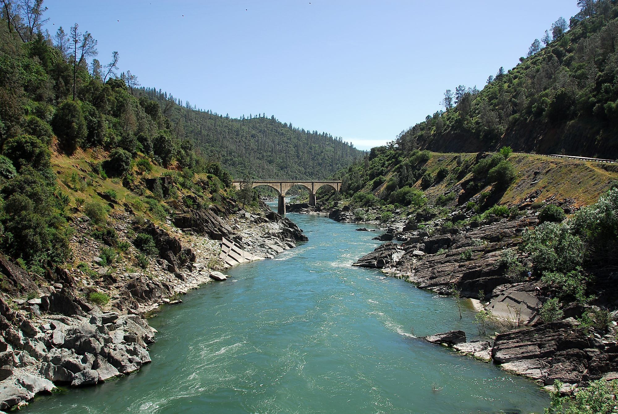
South Fork

The American River's South Fork has a length of 140 km and starts at Echo Summit in El Dorado County, south of Lake Tahoe. Between Chili Bar Dam and Folsom Lake, 20 miles of the South Fork's whitewater may be navigated by boat, making it the most approachable and family-friendly of the three forks. Whitewater rafting and motorized adventure destinations like the Rubicon Trail can be found along the South Fork.
Climate Along The American River

Due to the wide variety in elevation, the watershed of the American River cuts across several climate zones. The lower American River valley experiences a Mediterranean and temperate grassland environment. Particularly Sacramento County, where the main stem of the American River is situated, is renowned for having cold winters and hot summers with little precipitation on average. The North, Middle, and South Forks initially begin in the alpine regions along the Sierra Crest, then flow through subalpine, montane, and temperate coniferous woods. Since the majority of precipitation occurs between November and April as rain and snow, the American River area is vulnerable to seasonally dry conditions.
History Of The American River

The Nisenan Indians lived in the Yuba, Bear, and American River watersheds before immigrants came to the South Fork of the American River. During the California Gold Rush, the American River played a significant role. One of the biggest recorded human migrations to date began in 1848 when gold was found on the South Fork of the American River. The settlers then combed the banks of every creek, stream, and river in quest of gold.
Miners scourged the riverbanks with more damaging techniques as the gold grew harder to find. Since these harmful mining practices were outlawed in 1884, mining has slowed down, although gold is still present in the river. A final estimate of 750,000 pounds of gold was produced during the California Gold Rush. However, it also left behind terrible environmental effects: hydraulic mining utilized more than 7,500 tons of mercury, which resulted in 13 billion tons of erosion.
Wildlife Along The American River
Mountain quail, Steller's jays, western bluebirds, warblers, squirrels, chipmunks, coyotes, black bears, and mountain lions are some of the common bird and mammal species found along the river waters. The California red-legged frog, the American bald eagle, and the valley elderberry longhorn beetle are among the watershed's endangered species. The upper watershed streams offer native fish a high-quality habitat. Along the American River corridor, numerous habitats serve as the home of several wildlife species due to the topography variation and abundance of plant species.
Threats To The American River
In the coming years, the river basin's air and water temperatures will probably rise due to climate change as precipitation events become more unpredictable due to prolonged droughts. When deciding how much water to keep and release from reservoirs, water managers consider a variety of factors, including greater evaporation in the summer and changes in the timing of runoff. Future climatic pressures, including increasing sea levels, diminishing snowpack, shorter and more severe wet seasons, and warming temperatures, are predicted to make water management in the basin more difficult.


