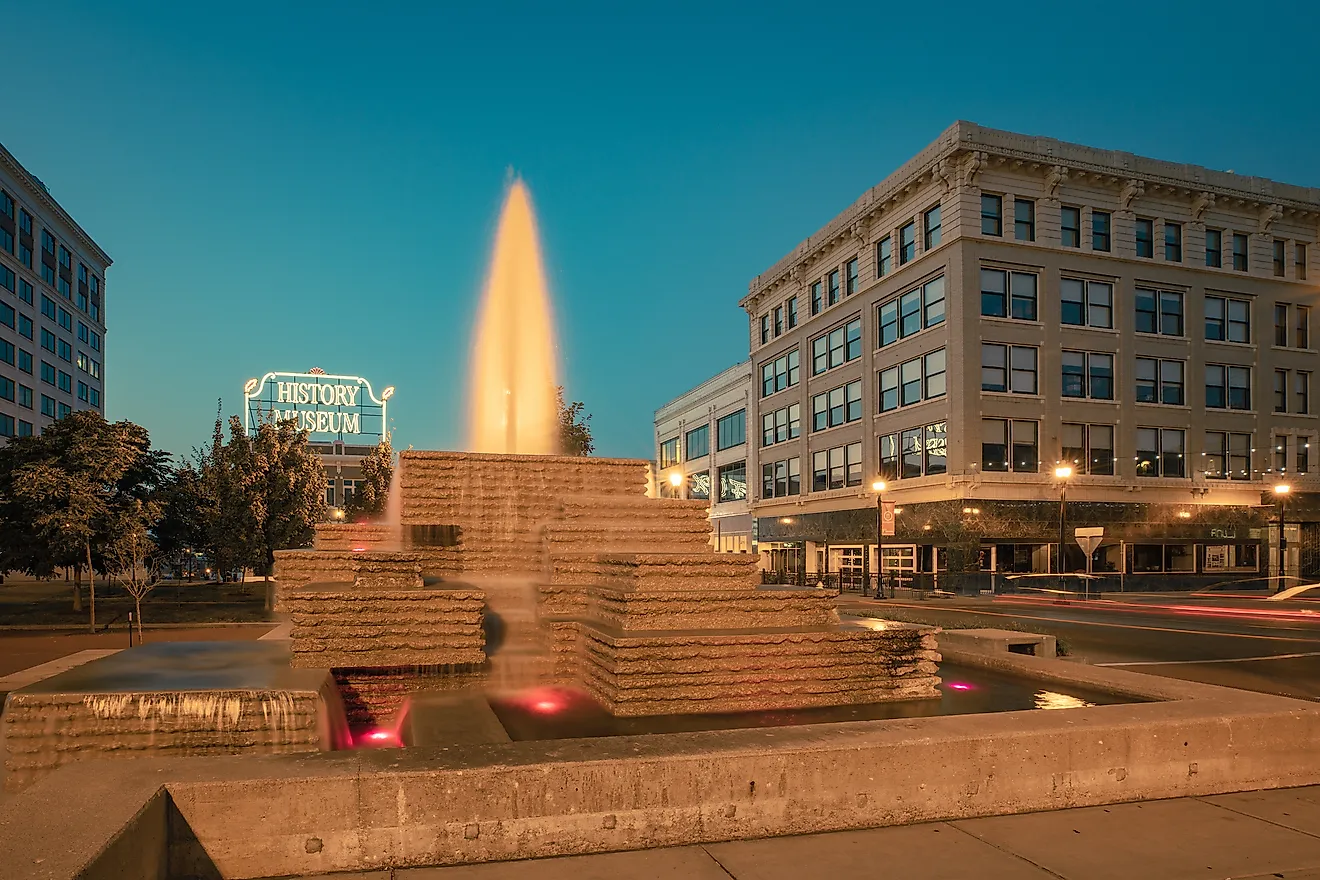
Monticello Dam
Monticello Dam is a concrete arch dam located outside the town of Winters in eastern Napa County, California. The 93-meter high dam was constructed between 1953 and 1957 and is located on the Putah Creek, which impounds it to form Lake Berryessa, California’s seventh-largest artificial lake. Monticello Dam is an important water source for farms in the Sacramento Valley and Solano County, including in Suisun, Vallejo, Fairfield, and Vacaville cities. It also supplies electricity to much of the North Bay area and cleans water for residents of Napa, Yolo, and Lake Counties. Monticello Dam is regulated by an uncontrolled spillway locally known as “Glory Hole.”
Structure Of The Monticello Dam

Monticello Dam is a medium-thick concrete arch reservoir with a total height of 93 meters above its foundation, making it the US's 22nd tallest concrete arch dam and the shortest dam in California. It rises 73 meters above the riverbank and has a crest length of 312 meters. The dam’s base is 30 meters thick, which tapers to 3.7 meters at the crest. The reservoir has a surface area of about 8,400 hectares and can hold up to 19.76 cubic kilometers of water when full. It can contain water up to a height of 130 meters, after which the excess water flows over the spillway. Almost 0.5 cubic kilometers of water flows into the reservoir every year from its 1,470-square-kilometer watershed.
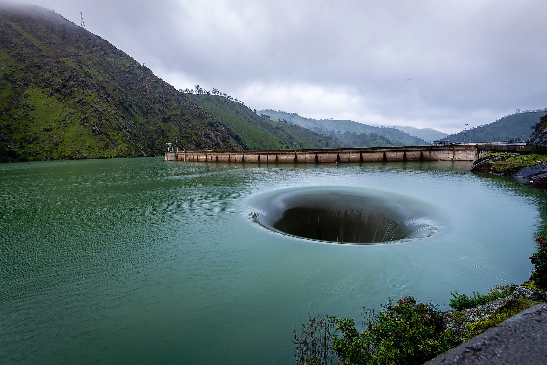
Monticello Dam Spillway

Monticello Dam has a funnel-like spillway known as “Glory Hole” where excess water in the dam flows into the Putah Creek. The spillway, situated behind the dam, is a drop inlet structure and was selected as the dam’s outlet because of the firm rock foundation and limited space. The Glory Hole measures 22 meters at lake level and 8.5 meters at the point of water exit. When the water in the dam rises above 130 meters, the excess water begins to flow into the spillway. The water drops down the about 60-meter funnel then makes a 90-degree turn into the Putah Creek, which feeds the Yolo Bypass.
The Glory hole can drain up to 1,370 cubic meters of water per second. However, water rarely spills over the spillway because the dam is never full most of the time. The last time the spillway was active was on February 26, 2019. The California Authority prohibits swimming since swimmers can easily be swept down the funnel.
History Of The Monticello Dam

Monticello Dam was built on fertile agricultural land as part of the mega Solano Project, whose aim was to provide irrigation water for 39,000 hectares of farmland in Yolo and Solano Counties. Although the land, where the project sits, was farmed since the early 19th century, it lacked a reliable water supply, especially in summer. The federal government authorized the Solano Project on November 11, 1948, with the land purchase finalized in 1953.
Initially, Monticello residents opposed the dam’s construction in the area citing social ties with their town. However, they finally agreed to the project, with some residents moving out by 1956 and others staying on until the dam’s completion. The initial stages of the construction involved relocating over 300 graves to higher grounds and cutting down trees in the area. The reservoir was completed on November 7, 1957. It was first filled about five years later, on April 18, 1963. Monticello is now completely covered by the artificial lake, with some of its ruins visible when the water levels are low.