Where is Denver County, Colorado?
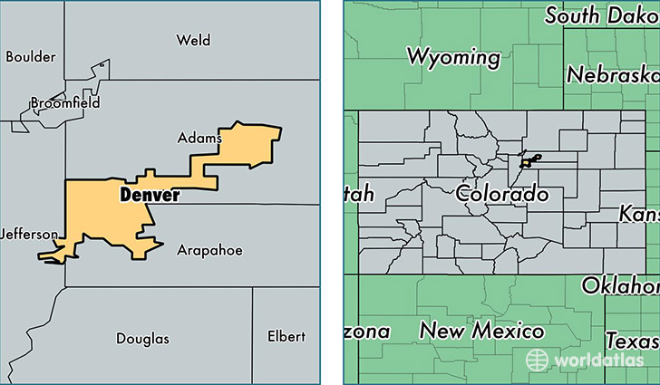
Denver County is a county equivalent area found in Colorado, USA. The county government of Denver is found in the county seat of Denver.
With a total 400.57 sq. km of land and water area, Denver County, Colorado is the 3073rd largest county equivalent area in the United States. Home to 663,862 people, Denver County has a total 293230 households earning 50313 on average per year.
Denver is the home to these professional sports teams: Rockies (MLB), Broncos (NFL), Denver Nuggets (NBA), Colorado Avalanche (NHL)
Denver County, Colorado - Quick Facts
| FIPS Code | 8031 |
| Area Codes | 303 |
| Time Zone | MST |
| Major Cities | Denver (population: 622,214) |
| Land Area | 256,318 sq miles |
| Water Area | 153 sq miles |
| Household Income | $50,313 |
| Housing Units | 293,230 |
| Median Home Value | $249,100 |
| High School Grads | 85% of population |
| Holders of Bachelors Degrees | 43% of population |
| Retail Spending | $11,810 per capita |
| Food & Accomodation Sales | $2,279,048 per capita |
| Universities and Colleges | Colorado School of Traditional Chinese Medicine, University of Colorado Denver, Metropolitan State College of Denver |
This page was last updated on June 30, 2016.