Spy Pond, Massachusetts
Spy Pond is a small water body situated close to Arlington's core. Surface drainage from the neighborhood and groundwater are used to feed the pond. Despite having limited access because most of the shoreline is private property, the historic Spy Pond is a stunning and priceless community treasure. It is believed that a massive chunk of glacial ice that broke off from the glacier and left a "kettle hole" filled with glacial waters had created the pond. No river or brook supports Spy Pond currently; only precipitation and runoff, particularly stormwater drainage from the nearby heavily populated residential areas, provide the water to the Spy Pond.
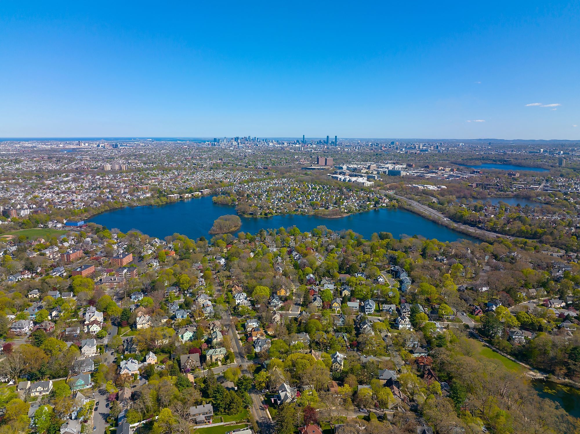
Geography Of Spy Pond

Spy Pond is a 103-acre water body situated 12.9 kilometers northwest of Boston in the southern part of the town of Arlington, in Middlesex County in the US State of Massachusetts. The districts of Arlington and Belmont, which together make up 73% and 27% of the watershed's 864 acres, are divided by State Route 2, which separates Arlington from Belmont and runs along the southwestern shore of Spy Pond. The Great Swamp, which encompassed a large portion of North Cambridge, rises from Spy Pond.
The Spy Pond reaches a maximum depth of 11m and an average depth of 3.7m. It also features a small 2-acre island named Elizabeth Island, which along with a shallow sil, divides the 103-acre basin into a north and a south basin. There are 43 drains in all that are known to empty into Spy Pond. Every time it rains, all but two or possibly three of these transport urban stormwater to the lake. Spy Pond's shoreline is home to modest to substantial residential development, and the pond is frequently utilized for passive wildlife observation, boating, swimming, and fishing.
Brief History Of Spy Pond
The pond's "spy" name has numerous sources attributed to it. One that hunters were looking for Fresh Pond ''spied" the stretch of water of this inquest and it became recognized as Spy Pond. The cutting and exporting of ice, primarily for use in the Caribbean trade, was Arlington's most significant activity in the middle of the 19th century. Spy Pond, which was in the foreground center, was the location of this activity. The Woods Ice Tool Manufacture was close by, and three Gage's Ice Houses were scattered around the pond. From the mid-19th century until the final ice building burned down in 1930, Spy Pond was the site of a significant ice industry. The Wisconsin Glacier left a mile-deep layer of ice in the area of Arlington, where Spy Pond currently stands, about fifty thousand years ago. The ice started to melt fifteen thousand years ago, leaving depressions or "kettle holes" in its wake. Spy Pond also developed into an industrial hub in the 19th century as businesspeople attempted to capitalize on this natural resource's advantages for export. Spy Pond developed into a source of clean water for nearby Boston in the summer and ice for shipping in the winter.
Geology Of Spy Pond
The "Fresh Pond Buried Valley" is where the Spy Pond is situated. A deep bedrock valley filled with silt runs from Wilmington, North Carolina, southeast to Boston Harbor. The highlands encircling the buried valley are covered in a thin, discontinuous layer of mud, whereas stratified deposits predominate within the valley itself. West of the buried valley's center axis is where Spy Pond can be found. The valley was covered in varying amounts of sand, gravel, and clay as the glacier ice retreated, advanced, and again retreated. The region was covered in clay while this lake was in existence. Then, as the glacial ice continued to recede northward, an alluvial fan of outwash debris was dumped over the region. Ice blocks, including Spy Pond, filled the modern lake basins during this time. The valleys in which the current streams are located were then scoured by late glacial torrents. Because the post-glacial streams would have filled in these basins otherwise, the ice blocks were likely still in place at this time. As a result, Spy Pond and the other ponds in the valley are considered kettle holes.
Wildlife In Spy Pond

The pond's main attractions are its fish and birds. Through the 1990s, Spy Pond was stocked with fish, but since then, there has been no stocking due to budget restrictions. The most often captured fish in this area are largemouth bass, yellow perch, and white perch. Additionally, throughout the year, the shores of the pond are home to almost 120 different species of birds. The most notable and divisive species of the bird population are Canadian geese.
It is highly unlikely that one will get bored at the Spy Pond while one is trolling, spinning, fly fishing, or baitcasting. At sunset, one must stop at the pond or go for a stroll on the bike path and relax by the water's edge. There is also a lot of grass, lilies, and deep shorelines with attractive overhangs where one can cast. Therefore, don't miss an opportunity to see this magnificent, historic Spy Pond.


