Cedar Lake
Cedar Lake is a Canadian lake in the province of Manitoba, north of Lake Winnipegosis. The Grand Rapids dam controls the water levels of Cedar Lake. Before the dam's construction, three smaller lakes existed in place of Cedar Lake, along with a forest. Today the Grand Rapids dam is a source of power for many Manitobans. Besides its geographical importance, Cedar Lake is also known for its fossils, which date back to the Cretacious period.

Geology

Cedar Lake is 1,353 km2 with an average elevation of 262 m. The minimum elevation of the lake is 250m, and the maximum elevation is 309m. The maximum depth of the lake is approximately 10m. The lake's bottom is a mix of gravel, limestone, and mud. The calcium-carbonate sediments on the bottom of the lake gives the lake's water a chalky blue coloring. Most of the region also has dolomite, a calcium-magnesium-carbonate rock similar to limestone, from the Paleozoic Era.
The Cedar Lake area's formation goes beyond the Paleozoic Era and has glacial origins. The Laurentide Ice Sheet created the Pas Moraine. The Moraine is a crescent-shaped ridge and prominent geological feature in central Manitoba. A lobe from the Laurentide ice sheet stopped roughly where Cedar Lake is today. The ice sheet deposited silt, clay, sand, gravel, and rock from the Hudson Bay area, and formed the Pas Moraine when the ice sheet retreated.
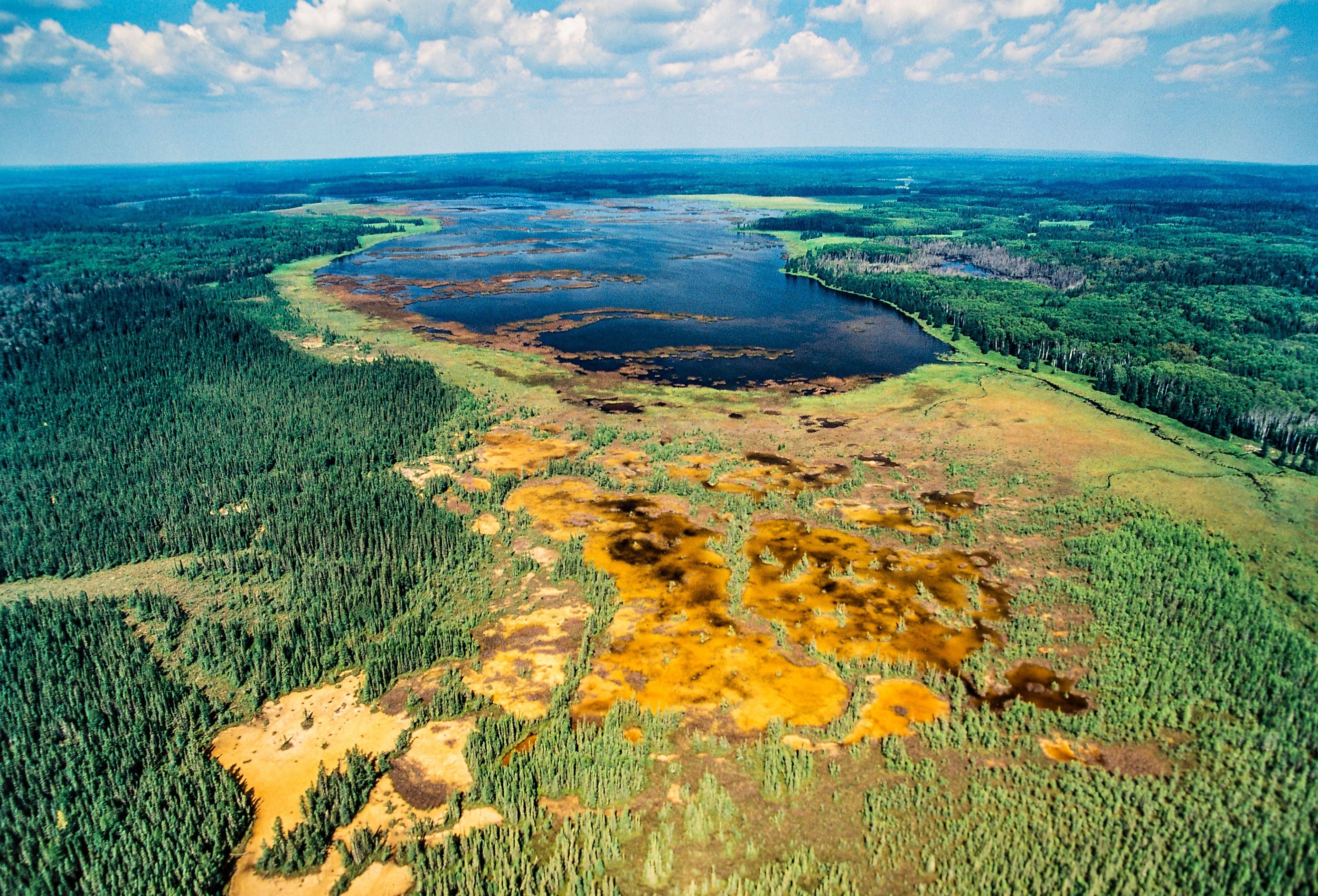
The Saskatchewan River Connection

Cedar Lake's main source of water is from the Saskatchewan river. The Saskatchewan river flows from Alberta's rocky mountains east through to Manitoba. As the Saskatchewan river meets Cedar Lake, the velocity of the water slows down. As the velocity slows, deposits of silt, clay, sand, and gravel, or alluvium, stop at the river's mouth. As the alluvium builds up, the river’s flow is sometimes stopped and the river seeks an easier path to join Cedar Lake. This process is called avulsion. The build-up of deposits formed a landform shaped like a triangle near Cedar Lake. This is known as a delta, and is located on the northwest side of Cedar Lake.
Grand Rapids Dam

The Grand Rapids Dam controls Cedar Lake's water level. The dam's construction in 1965 created Cedar lake. Prior to the construction of the dam, there were three smaller lakes in place of one larger lake. Upon the construction of the Grand Rapids Hydro dam, the forest area also flooded. This resulted in the three smaller lakes becoming one body of water. The flooding of the Cedar Lake basin created shallow, muddy lakes and bogs.
Remains of trees from the forest still reside underwater today. These provide cover for fish in the lake. Species of fish in cedar lake include Northern Pike, Walleye, Lake Whitefish, Cisco, Perch, and Burbot.
Amber Fossils

Cedar Lake is well known for its prehistoric amber fossil deposits that date back to the Cretacious period. The first recorded piece of Amber found in Cedar Lake was in 1891. Joseph Burr Tyrrell discovered the piece of amber in the beach sands on the western shore of the lake. The amber collected in Cedar Lake became known as Chemawinite. People melted down the amber and used it as a varnish. However, the flooding of the Cedar Basin area submerged many amber pieces underwater. Although today, some of the lighter pieces of amber have surfaced..
Conclusion
Today there are 23 towns and hamlets within a 100km radius of Cedar Lake. The lake's geology, abundance of fish and fame for amber fossils has made it a tourist destination for Manitoba travelers. While the lake is a source of tourism, it is also a source of controversy. The Grand Rapids dam's construction caused flooding in the Chemawawin community, forcing the people to relocate. There were groups of local people who protested this decision. More recent controversies around the dam include Manitoba Hydro's plan to automate the Grand Rapids facility.


