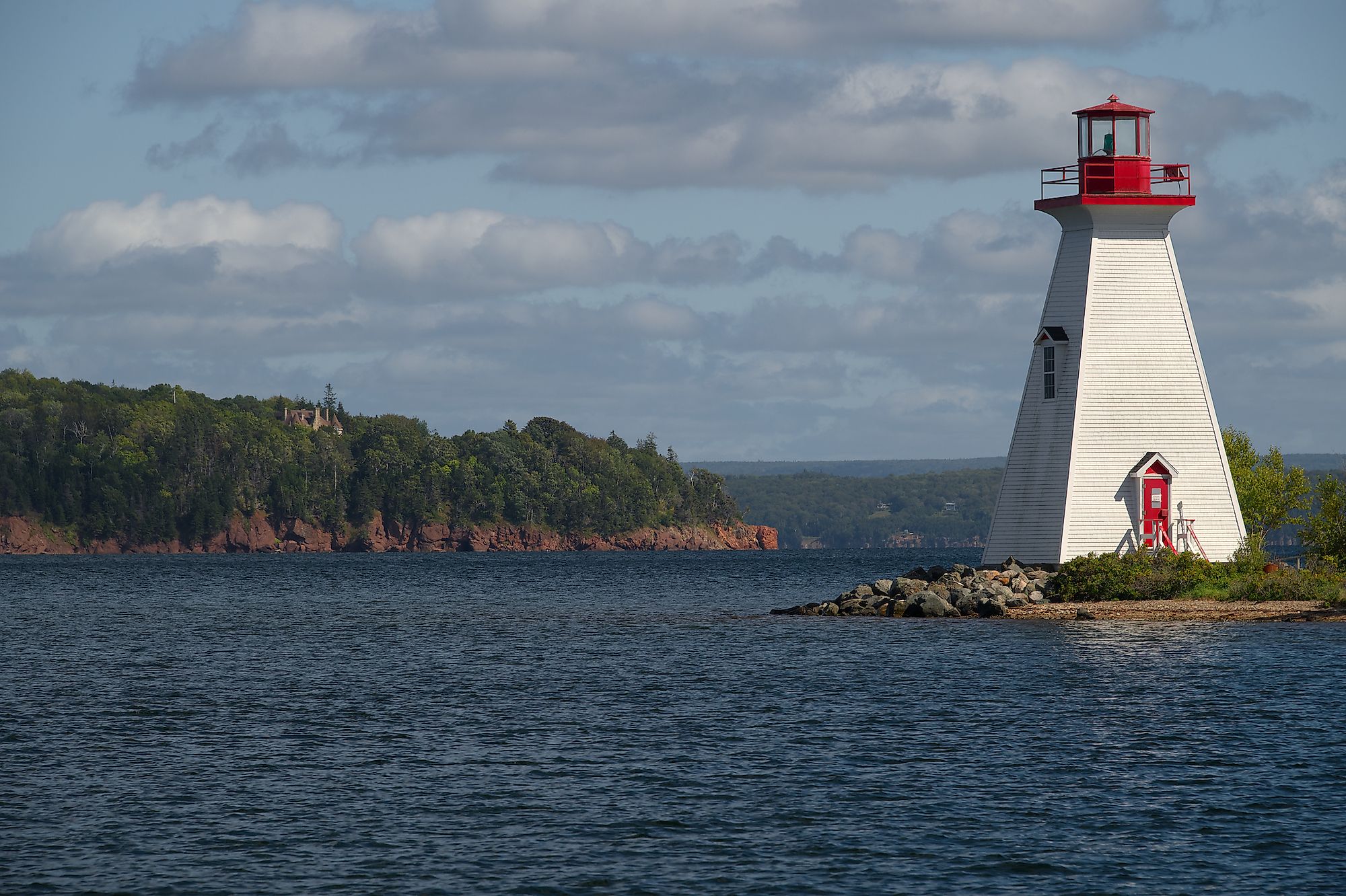
Bras d'Or Lake
Bras d'Or Lake, sometimes referred to as an inland sea, is an estuary located at the center of the irregularly shaped and rugged Cape Breton Island. The saline tidal water body covers approximately 1098 km2 of the island’s 10,311 km.2 It is connected to the Atlantic Ocean through the Little and Great Bras d'Or Channel and receives freshwater from rivers, making it a rich natural habitat and a popular fishing and cruising spot. The lake and the surrounding area were designated a UNESCO Biosphere Reserve in 2011. The lake’s name, a French word for “arm of gold,” is a corrupt form of the name “Labrador.”
Geography

Bras d'Or Lake is located in the middle of Cape Breton Island, an island in the northeastern portion of Nova Scotia, Canada. The lake spans 1,098 km2 and has a maximum length of 99.7 km and is 49.8 km wide at the widest point. Bras d'Or is 287 m deep at the deepest point, located in the East Bay, and has a volume of 32 km3. It has a total shoreline of about 999 km and a drainage basin of about 3,496 km2, located entirely in Canada.
Bras d'Or Lake is connected to the Atlantic Ocean via three arms, two on the northeast and one on the south. The two channels on the east are the Little and Great Bras d'Or Channels, which flow on either side of the Boularderie Island. The artificial Saint Peter’s Canal flows from the southern tip to the ocean through an isthmus. The lake is shallow on the west and deepest on the east, particularly the East Bay. The northwestern side is characterized by steep hills. The channels to the lake reduce the tidal range, making the lake a safe place to swim.

Several rivers feed into the lake, including Georges, Baddeck, Middle, and Denys Rivers. The freshwater inlet makes Bras d'Or Lake less saline compared to the open ocean surrounding it, with the salinity level varying from 2-2.9%. The lake freezes for much of the winter months and quickly warms up in springs allowing visitors to swim. The warm water provides a suitable condition for the eastern oyster. Some fish species found in the lake include mud hake, black-spotted stickleback, blueback herring, rainbow trout (introduced), and Greenland cod.
Human Settlement

Cape Breton Island has approximately 132,000 people scattered throughout the island, including the lake region. The island’s population is divided into five groups, Mi’kmaq, Scottish, Irish, Acadians, and English. Mi’kmaq were the first people to settle around the lake, arriving there at the end of the last ice age. Scottish inventor Alexander Graham Bell established his research laboratory at Beinn Bhreagh, an estate he founded and used the lake water for his experiments. However, other small settlements are scattered on the lake’s shore, including Little Bras d'Or, Baddeck, Whycocomagh, and Saint Peter’s. The 1,000-km-long shoreline is shared by Victoria, Inverness, and Richmond municipalities.