Santorini Island
The sovereign nation of Greece comprises several islands that are further organized into different island clusters depending upon their location. These island clusters include Sporades, Dodecanese, Crete, Ionian Islands, Cyclades, North Aegean Islands, and the Argo-Saronic Islands.
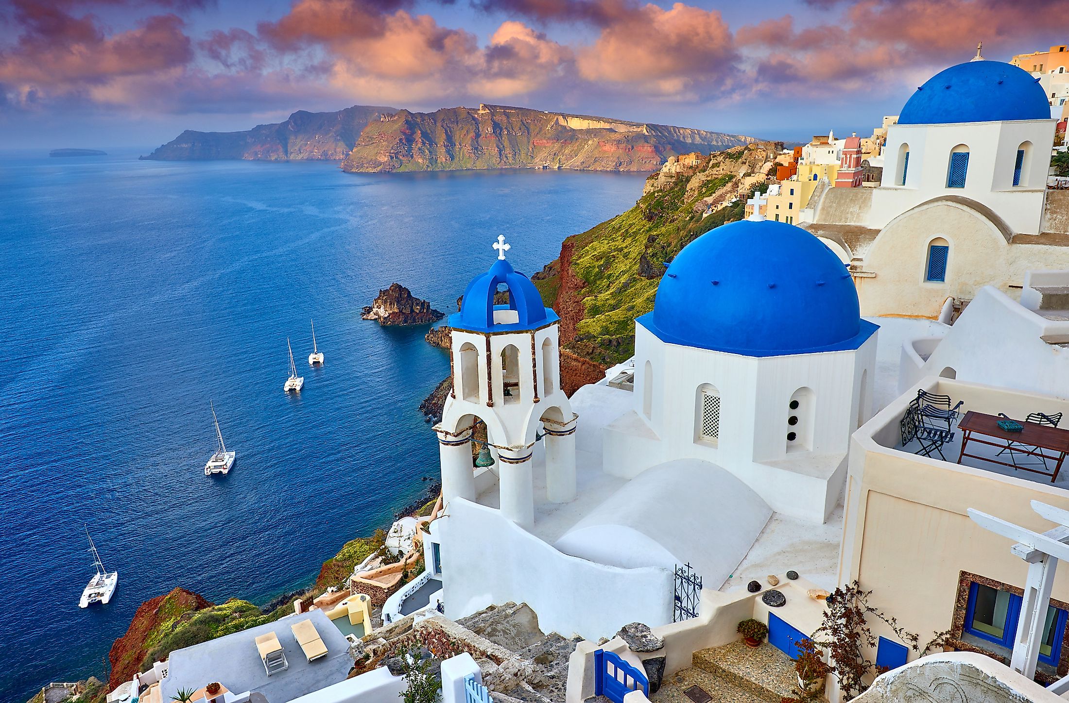
Santorini (officially, Thira) is a volcanic crater island that is located in the southern part of the Aegean Sea in southeastern Greece. Santorini is the southernmost island in the Cyclades island group. As per the 2011 Greek Kallikratis reform, Santorini forms a part of the Thira regional unit and the Santorini municipality is composed of the inhabited islands of Therasia and Santorini as well as the islands of Aspronisi, Christiana, Nea Kameni, and Palaia Kameni which are uninhabited.
In the 13th century, the island was named “Santorini” by the Latin Empire in the honor of the martyred Christian saint, Saint Irene. The island was previously known as Kalliste or Thera. In the 19th century, the name Thera was restored as the official name of the island and its principal city. In English, the island is still usually referred to as Santorini.
Geography

Santorini is the remaining portion of an exploded volcano and forms the most active volcanic center of the South Aegean Volcanic Arc. The principal island of Santorini covers an area of about 76 km2 and is well known for its sea-filled volcanic caldera that is surrounded by high colorful cliffs on its three sides. Situated at the center of the caldera are the two small active volcanic islets of Nea Kameni and Palaia Kameni. Located in the southeastern part of the island is Mount Profítis Ilías which rises to an elevation of 566 m and is the island’s highest point.
One of the largest volcanic eruptions in the planet’s history was recorded on Santorini Island. Known as the Minoan eruption, this volcanic eruption occurred about 3,600 years ago during the Minoan civilization. As a result of the volcanic eruption, a large caldera was formed which was surrounded by deposits of white pumice and volcanic ash.
According to Köppen climate classification, the island of Santorini experiences a semi-arid climate that also shows characteristics of a Mediterranean climate. The island faces mild and rainy winters and relatively warm and dry summers. Strong winds blow throughout the island during the summer season.
Brief History

Archaeological excavations at the site of the ancient Akrotiri city have revealed that the Santorini island was inhabited by ancient Minoans since 2000 BCE. During the Bronze Age, the neighboring island of Crete was the site of the Minoan Civilization, the earliest known advanced European civilization. It is widely believed that the huge volcanic eruption on Santorini island had caused a massive tsunami that led to the collapse of the Minoan Civilization on Crete. After the Bronze Age collapse, the island was occupied by the Phoenicians, who named the island “Callista.”
After the Phoenicians, the island was taken over by the Dorians, who founded the island’s principal city and named it in the honor of their leader, Theras. Along with other Greek territories, the island was then ruled by the erstwhile Roman Empire. After the split of the Roman Empire, the island was taken over by the Byzantine Empire. In the following years, the island passed through several hands and was ultimately occupied by the Ottomans. After the Greek War of Independence in 1821, Santorini was ceded by the Ottoman Empire to the Kingdom of Greece through the Treaty of Constantinople in 1832.


