Raglan, New Zealand
The surfing mecca of Raglan is known for its dramatically scenic black sand coastline and the Phoenix palms that line Bow Street, the main road of this coastal town. First featured in the 1966 cult surfing movie Endless Summer, the Manu Bay in the vicinity is famed for the longest, most accessible, and consistent left-hand break, where skilled surfers can ride a wave for up to two kilometers.

Set on the southern shore of the Raglan Harbour along State Highway 23, Raglan is a small beach-side town 48 km west of Hamilton in New Zealand. The Old Mountain Road was a very winding, steep-gradient rocky road formed in 1879 between Raglan and Hamilton. Proved unsuitable for motor traffic, a deviation road was completed by 1913, upgraded in the 1950s, and became a state highway in 1961. The township dates back to 1854, with the government-acquired land initially called the Whāingaroa village. A popular seaside getaway for city-dwellers, the town is also the center of surf tourism in the region since the 1960s, having hosted a world championship surfing event at Ruapuke beach in the past.
Geography And Climate Of Raglan
The average annual temperatures in Raglan are a high of 24°C in February and a low of 8°C in July, with an average precipitation of 1,447 mm a year. Raglan's skies are clearest in March, with the wettest month of July and 8.6 months spent under cloud cover.
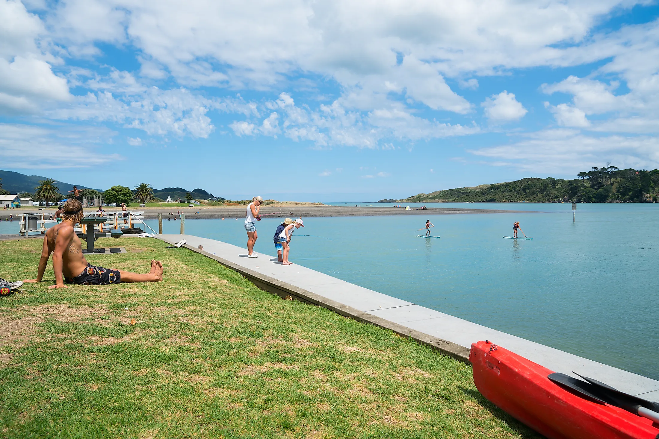
The town is associated with Raglan Harbour on the west coast of the North Island's Waikato region. Composed of two primary arms, Waitetuna left and Waingaro right, the 35 km2 harbor is divided by the Paritata Peninsula, with a catchment area of 525 km2, and a 220 km coastline. As the northernmost of three large inlets on the Waikato coast, the harbor is less than 2 km in breadth and runs 12 km inland from the entrance. The port receives the flow of 15 significant rivers and streams, with the largest, Waingaro and Waitetuna rivers, accounting for 60% of the catchment area.
There are extensive dunes and dune-dammed lakes with iron-rich sands north of the harbor mouth that have been considered for mining along with the area’s beaches. There is an extinct Mt. Karioi volcano to the southwest of the township that, according to the Māori legend, was a Māori Princess who lay down and died upon being rejected by her beloved. Bridal Veil Falls is 20 kilometers southeast of the township, and 4 km from there, sits an unusual Lake Disappear.
Settling

The Māori were the area's early settlers from the late 1700s, with the Ngāti Māhanga tribe occupying the harbor's land. Calling their home Whaingaroa, meaning “the long pursuit,” they referred to the Tainui waka’s search for its destination. The first Europeans were Wesleyan Missionaries James and Mary Wallis, who were welcomed by the Maori in 1835. Upon settling and following an extensive land sale by Chief Wiremu Neera Te Awaitaia, the area was converted into pasture in the mid-1850s. Initially used for dairy farming, it would transition later into sheep farming which was more suitable for the hilly terrain.
Conflict History
The name of Raglan was adopted in 1858 to honor Fitzroy Somerset, 1st Lord Raglan, who was a British commander in the Crimean War a few years back. During the Waikato war, the settlement was garrisoned by troops and protected by Te Awa-i-taia. Upon taking the ancestral land from the Maori during the Second World War, the government constructed a defensive-purposed military airfield. Not returned to the rightful owners following the war, a 62-acre of land was converted into a public Raglan golf course. The widespread protests and attempts to regain their land in 1978 resulted in 20 Maori protestors getting arrested on the golf course's ninth hole. Eventually given back, the land was used for local job-trainings, employment programs, and the Māori sovereignty movement.
Industry In Raglan
The area was initially dependent on flax and timber exports, with a dam constructed on a spring that was long used as a drinking supply in 1862. Used to power a 2.4 m waterwheel for a flax mill, the spring was utilized once again in the 1950s to pump water for the surrounding farms. Farming proving a mainstay; it still supports Raglan's economy today. Having relied on shipping until adequate roads were developed, the town still supports the commercial fishing industry. Many tourists and residents came via the improved roads, many of which would commute for work to Hamilton. After a prominent arts scene in the 1970s, tourism contributes significantly to the current economy.
Arts And Culture In Raglan

The coastal town location with picturesque landscapes and a laid-back atmosphere inspires the best artists and artisans to come to Raglan, such as the New Zealand's Cornerstone Roots and Zionhill reggae bands formed in Raglan. The Yot Club is a regular stop for musicians on national tours, while one can enjoy some live music every day at the Orca Restaurant and Bar, the Harbour View Hotel, the Raglan Club, and at the Valentines Cafe.
Native Maori artworks can be found at the Show Off Gallery, Kanuka Design, Matapihi Gallery, and even at the local cafes. A former Raglan School, the Arts Centre is a 19th-century heritage building on Stewart Street, where visual artists gather and display their works. Those who create fabric show off their works at the biennial ArtoWear competition. The history buffs will surely enjoy the District Museum of historical artifacts and archives from the region.
The famed Raglan Arts weekend takes place on the Labor Day weekend, which is the last Monday of October, showcasing the town's creative and bohemian vibes. On the second Sunday each month, the Raglan Old School Arts Centre hosts a Creative Market specializing in local crafts, food, and art. There is also the Raglan Arts Trail Guide with an Open Studio Weekend in late January, with preview exhibitions running for three weeks beforehand, and where one can chat up the friendly artists, ask questions and give insight into their work.
Activities In And Around Raglan

There are plenty of climbing opportunities and walking trails in the region, while bikers can enjoy the new mountain bike track. The Bridal Veil Falls set 4 km south of Te Mata also goes by the Maori name of Wairēinga, meaning ‘water of the underworld.’ Sourcing from the Pakoka River, the waterfall spills over a lip of basalt in a 55-meter free-fall into a natural amphitheater. The surrounding forest with orchids and five species of rātā presents a wonderful scene for an atmospheric walk or a picnic.

There's kayaking, canoeing, paddle-boating, or simply cruising along Raglan's nooks and crannies of ancient limestone formations for water fun fanatics. Just an hour's drive south to Kawhia, the famed black volcanic sands that hint at a turbulent underbelly of Raglan are known as the Hot Water Beach. The magic continues with digging into the dune sands, where one can form a personal hot water spa to enjoy.
Mt. Karioi at 756 meters is set southwest of Raglan Harbour, while the vegetation on the mountain's slopes has been sculpted by westerly winds. Famous explorers Abel Tasman and James Cook first saw the volcanic cone when sailing along the coast, aptly named the Woody Head by Cook. Running from the slopes of Mt. Karioi, a deep-cut stream winds down into a semi-circular basin with 60 m basalt cliffs of the dramatic Te Toto Gorge. The gardens in the gorge are a true insight into the Māori history. Having gardened in the area, there are stone rows, storage pits, terraces, and two small pā leftover from the 17th and 18th centuries.
With an equal mix of vivre and tranquility, Raglan has been attracting curious visitors for decades, presenting itself as a self-sustained township with hard-working residents full of character. The plethora of cafés, bars, surf shops, and galleries allows one to absorb the town's vibe, stock up on finds, and observe the everyday lives of the locals. Set in a converted woolshed overlooking the verdant hillside, the Rock-It Kitchen is an especially atmospheric dining option. A favorite among residents for breakfast and lunch, it serves local and organic cuisine, as well as the best Raglan Roast coffee.
Practitioners of various art forms, including photographers, potters, painters, poets, and tailors, are drawn to Raglan for inspiration from the sea, waterfalls, cliffs, caves, and the black sands, among some of the best beaches in New Zealand. The myriad of walking trails, the tranquil vibe of the nature, and the kiwi-centric center area of the water sports culture attract tourists from across the Waikato region and the world.