Carmarthen Bay
A bay is a large expanse of coastal water that leads to a larger expanse of water like a lake or a sea. Bays form when erosion causes a convex indentation in the surrounding land or by movements in the outer layer of the earth’s surface. Carmarthen Bay’s coastline formed during the Quaternary period. Marine and subaerial processes helped mold the shape of the bay.
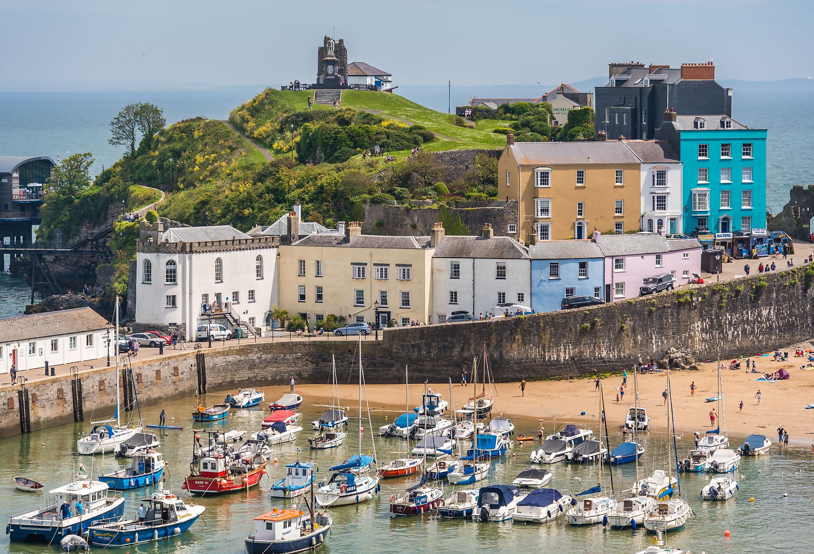
Where Is Carmarthen Bay?

Carmarthen Bay is a shallow bay that lies off the South Wales coast. It is a coastal inlet and forms part of the Pembrokeshire Coast National Park. Carmarthen Bay is home to popular beaches, including Cefn Sidan Sands, and Pendine Sands. Wales’ longest river, the River Tywi, as well as the Taf and Gwendraeth Rivers flow into Carmarthen Bay at the Three Rivers Estuary. Moreover, as does the River Loughor, which reaches the bay at the Burry Estuary.
Carmarthen Bay Climate

Carmarthen is the county town of Carmarthenshire and sits on the banks of the River Tywi. Carmarthen lies 8 miles north of Carmarthen Bay and carries the distinction of being the oldest town in Wales. The Carmarthen Bay and town areas experience cool and cloudy summers, as well as frigid winters.
The hottest month of the year is July, with an average high of 66 °F, while the coldest month of the year is February, with an average low of 36 °F. The wetter season lasts 5 months, between September and February. It is drier between February and September, with the driest month being April. It rains most in December, with an average rainfall of just over 4.1 inches. The water of Carmarthen Bay is warmer between July and October, with the warmest water temperatures measured during August. The water is cooler between December and April, and it is coldest in February at an average temperature of 46 °F.
Biodiversity

At low tide, the Loughor Estuary is all but without water, which exposes several mudflats and vast stretches of sand. This is a great attraction for several bird species, including lapwing and shelduck. The mudflats also house bivalve mollusks such as the edible cockle.
The Carmarthen Bay region includes salt marshes that provide a habitat for glasswort, sea rush, and dwarf eelgrass. The bay itself teems with fish, including the twaite shad and the ocean sunfish. The sunfish usually bask on the ocean surface before diving down into the depths of the bay to hunt for food in the form of squid and jellyfish.
The headlands surrounding the bay are the hunting grounds of otters, and wildfowl are also found on the shores of the bay.
Human Settlements

Several stunning towns dot the landscape around Carmarthen Bay. These include: Llansteffan, Pendine Sands, and Burry Port.
Llansteffan is a popular holiday resort and home to the magnificent Llansteffan Castle, which sits on the mouth of the River Tywi. From here, visitors have a panoramic view over the estuary to Pembrey Forest, Cefn Sidan Beach, and Worm’s Head.
Pendine Sands boasts a 7-mile beach where visitors can drive their cars and motorbikes on the sand. The beach is accessible by a 500m promenade and overlooked by Parry Thomas Center.
Burry Port made its mark in history books when Amelia Earhart came ashore here after her plane landed on the Loughor estuary. There is a monument in the harbor to commemorate Earhart’s Atlantic flight, and the center of town holds the Amelia Earhart Gardens.
History Of Carmarthen

The Romans built a fort at Carmarthen in 75AD which soon became an important town. Carmarthen is the location of one of seven surviving Roman amphitheaters in Britain. In 1094 a castle was built in Carmarthen. The castle was destroyed and rebuilt in stone. Carmarthen Castle was also conquered by Owain Glyndwr in 1405 and was the place where Edmund Tudor died. Today, the castle is a museum and information center.
Carmarthen is Caerfyrddin in Welsh, which translates to “Merlin’s Fort.” It is here, at a priory, where the “Black Book of Carmarthen” containing poems of Merlin and Arthur were written.
Carmarthen was also an important stop for ships on their way to the sea, to load or unload cargo before entering Carmarthen Bay. The river trade here saw the Black Death invade Carmarthen, where it wreaked havoc in the villages.
Notable buildings in Carmarthen include the Guild Hall, which is now a coffee shop, and Nott Square, which was once a fish market. There is also the Carmarthen Cemetery Chapel and the Capel Heol Dwr.
The town didn’t escape the horror of WWII, and POW camps were set up in Johnstown and Glagwilli. Despite this dark time in Carmarthen’s history, it became a hugely popular tourist attraction and was recently named one of the best places to live in Wales.


