Where are the Taurus Mountains?
The Taurus Mountains are a complex of mountain belt in Southern Turkey. A mountain range is a chain of mountains joined by high ground, while a mountain belt is a cluster of mountain ranges with the same form, structure, and alignment. The mountain complex separates the central Anatolian plateau from the Mediterranean coastal region in the south. The peak of the mountain complex stands at 12,323 feet above sea level.
Where Is Turkey?
Turkey sits between the border of Asia and Europe. The larger part of the country lies in Asia with less than 5% of the total land area being in Europe. Ankara is the capital city, and Istanbul is the major trade center. The Turkish territory has an area covering 302,455 square miles, and it is roughly rectangular with rugged terrain. Mount Ararat is the country’s highest point at 16,854 feet, while the country’s largest lake is Lake Van which is located in Eastern Anatolia.
Main Regions of the Taurus Mountains
The Taurus Mountains are divided into three regions starting from the West to the East which include:
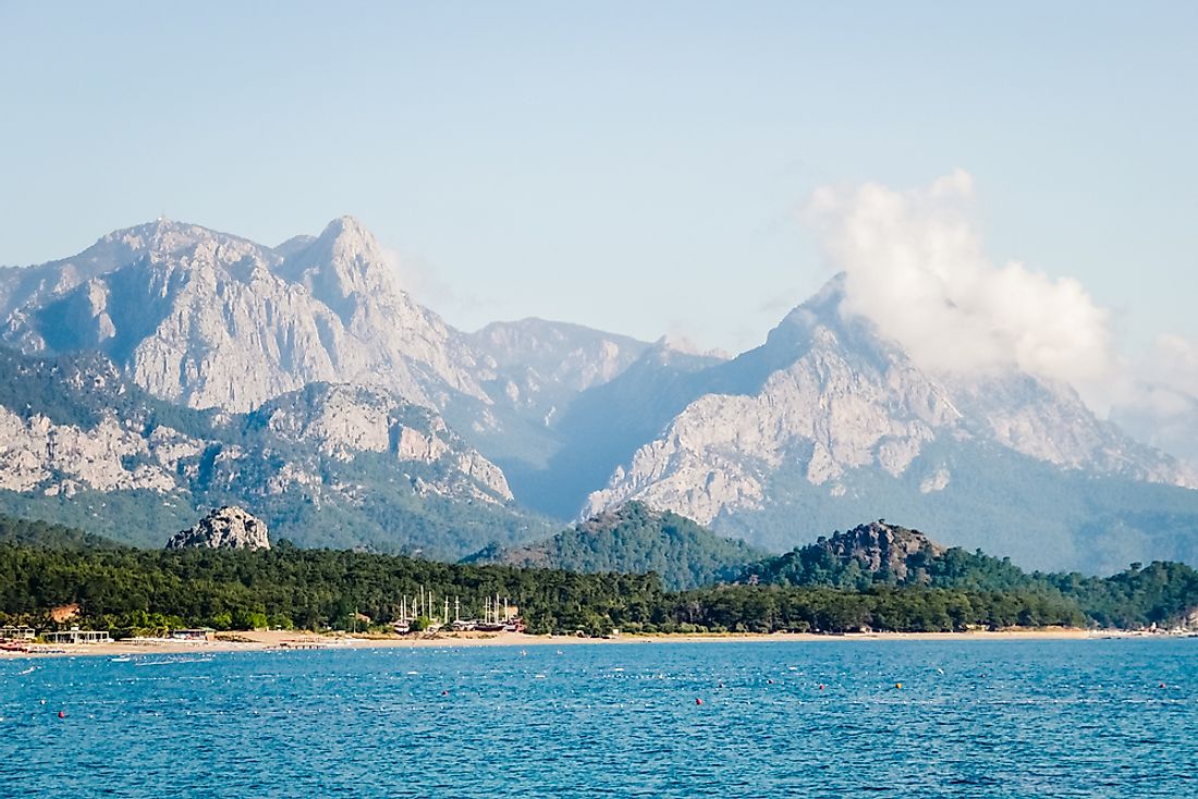
Western Taurus – Bati Toroslar
Western Taurus and the Taurus mountains join to form a curve around the Gulf of Antalya. The Gulf of Antalya is a large Northern Levantine Sea bay. The Goksu River and the East Taseli plateau separate the West from the Central Taurus Mountains. Ranges in Western Taurus include the Beydalgari Mountains, Geyik Mountain, Katrancik Mountain, and Akdaglar Mountain. The southern slopes of the Beydalgari Mountains is the source of the Manavgat River. The highest point is the peak of Mount Kizlarsivrisi at 10,125 feet above sea level.
Central Taurus – Orta Toroslar
Central Taurus includes Bolkar Mountains, Tahtali Mountains, Akcali Mountains, Anti-Taurus Mountains, and Aladaglar Mountain. The peak in Central Taurus is Mount Demirkazik’s summit which is 12,323 feet. Erosion of limestone in the Bolkar and Aladaglar mountains has given rise to underground rivers, waterfalls, and some of the largest caves in Asia. Turkey is home to about 40,000 caves.
South-Eastern Taurus – Guneydogu Toroslar
South-eastern Taurus makes up the Northern boundary of North Mesopotamia and Southeastern Anatolia. This region of the Taurus Mountains is the source of Rivers Tigris and Euphrates. The chain includes the Malatya Mountains, Bitlis Mountains, Nurhak Mountains, Genc Mountains, and Maden Mountains. The highest point in Southeast Taurus is Mount Medetsiz at 11,562 feet tall.
Naming of the Taurus Mountains
A bull always symbolized the Near Eastern storm gods of ancient times. The mountain complex is named Taurus, which is Latin for the bull. The mountains are home to several storm-god temples. The mountains always received heavy rainfall which to the ancient Syrians was a sign that Adad, the storm-god, wanted to make the rivers Tigris and Euphrates to fill up, flood, and to fertilize their lands.
Tourist Attractions at the Complex
Hiking and mountain climbing are the main tourist activities in the mountains, though the complex also has two ski resorts, one at Saklikent and the other at Davras. The Varda Viaduct, a 322 feet railway bridge that was constructed by Germans in the 1910s is also one of the tourist attractions.


