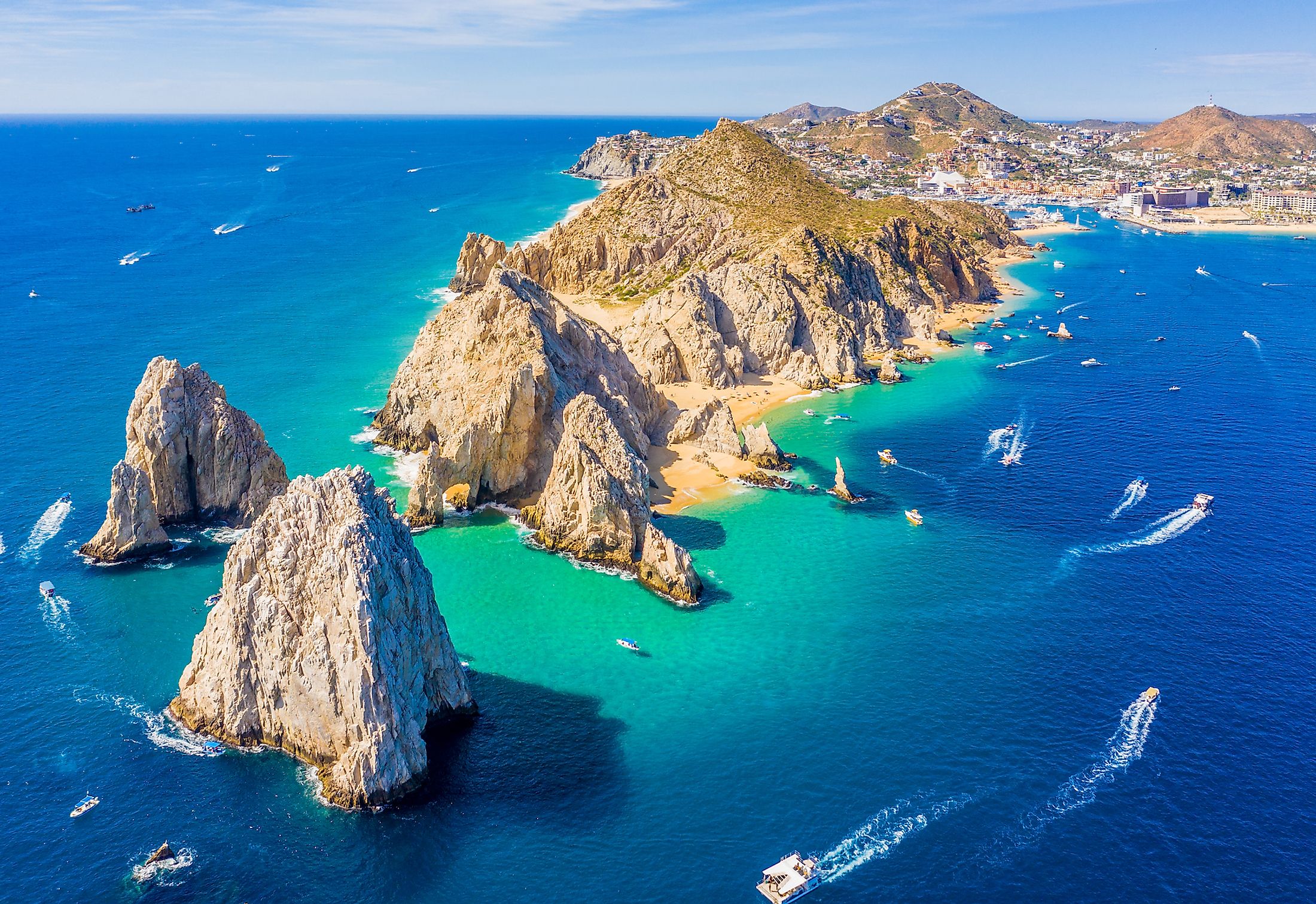
Baja California Peninsula
Baja California Peninsula, also known as Lower California Peninsula, is a peninsula in North America, separating the Gulf of California from the Pacific Ocean. The peninsula is a Mexican territory and bordered to the north by the US. It extends approximately 1,247 kilometers and comprises two Mexican states; Baja California Sur and Baja California. The peninsula is characterized by a unique landscape and rich marine life, making it one of Mexico’s most visited destinations. The region has four desert areas, including the Central Coast Desert, San Felipe Desert, Magdalena Plain Desert, and the Vizcaino Desert.
Contents:
Location

Baja California Peninsula is located in Northwestern Mexico and separated from the mainland by the Gulf of California. It is bordered to the north by the US states of California and Arizona, south and west by the Pacific Ocean, northeast by Sonora, and Southeast by Sinaloa, with the Gulf of California separating the peninsula from the two Mexican states.
Geography

Baja California Peninsula is approximately 1,247 kilometers long from Mexicali in the north to Cabo San Lucas in the South. It is 40 kilometers wide at the narrowest section close to La Paz, Baja California Sur, and 320 kilometers wide at the widest point. Its coastline is approximately 3,000 kilometers long and has about 100 islands, of which 37 are in the Sea of Cortez. The peninsula is separated from Mexico's mainland by around 258 kilometers at the farthest point and shares a land border with the state of Sonora. It covers approximately 143,390 square kilometers.
Geology

Initially, Baja California Peninsula was part of the North American Plate. However, the East Pacific Rise initiated the separation of the plate and the peninsula about 12-15 million years ago. Currently, the peninsula is part of the Pacific Plate and is slowly moving in a northwestward direction, away from the East Pacific Rise.
A fault block, rising from the gulf side and slopping towards the Pacific, is the peninsula’s main geologic feature. The feature comprises a chain of mountain peaks forming the Peninsular Ranges. The Sierra San Pedro Martir contains the highest point on the peninsula, Picacho del Diablo, at 3,096 meters. Other mountain ranges on the peninsula are Sierra de Juarez, Sierra de la Giganta, and Sierra de San Borja. Volcanoes and lava flow dominate the peninsula’s center, including Las Tres Virgenes at 1,996 meters above sea level, last erupted in 1746.
Brief History
European explorers considered the peninsula’s existence as a myth before its discovery. The idea of its existence first appeared in a 1510 novel authored by Garci Rodriguez de Montalvo, as the Island of California. In 1539, while Francisco de Ulloa was exploring Mexico's west coast, he confirmed that California was a peninsula and not an island as earlier thought.
Until 1804, the Peninsula was referred to as Las Californias under Spanish rule. Later, it was divided into two territories; Baja and Alta California. In 1848, Mexico ceded Alta California to the US (admitted to the Union as California in 1850).
Baja California Peninsula was divided into two territories, southern and northern territories, in 1931. The North Territory became Mexico’s 29th state as Baja California, while the South Territory was renamed Baja California Sur.