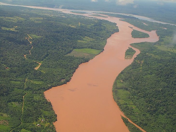
The Ucayali River
5. Description
The Peruvian Ucayali River flows from the merging of two rivers, the Urubamba River and the Tambo River, the main tributary of the Apurimac. It arises from north of Lake Titicaca in the highlands of Peru. Its length is about 907 miles, much of which is navigable by the natives in their small canoes to the city of Cumaria. The river then continues its journey to the Maranon River, and both rivers merge to become the Amazon River in the lowlands. The months of September to March are the river's high water season. The summer allows for easy boat access to many settlements on the river's banks, and many sightseeing opportunities and activities are available at this time.
4. Historical Role
The Ucayali River was first settled as early as 2,000 BCE by the Pano native tribes of Peru. The river has been known by many names in the past, first as the San Miguel, then as the Ucayali, Ucayare, Poro, Apu-Poro, Cocama, and Rio de Cuzco. European exploration of the river was carried out as early as 1806 by Bosquet, and again in 1846 by Francis de Laporte de Castelnau. Then, the Peruvian government commissioned Torres to map it, who initially measured the river at 186 miles. Later, in 1867, another expedition was sent on the small steamer Napo. Its crew claimed to have reached as far upstream as 200 miles north of Cuzco. The Ucayali River lends its name to both the Ucayali Province and Ucayali Region of Peru.
3. Modern Significance
The Ucayali River has been a boon to the Ucayali Region in Peru. It has fed and nourished its people with fish, food, livelihood, and access to the region's forests. Crops are planted in the dry season, and most of the fishing is also done at this time as well. As the water level rises during the rainy season, logging is given priority, as flooding enables transport of logs by canoe and raft. Many communities along the Ucayali River make use of its many natural resources, such as fish, and firewood and timber from its forests. The Ucayali River is also a crucial connection to Iquitos. Mostly, however, it is a historically, and currently, important waterway for the different communities along its riverbanks as a means to access to the outside world.
2. Habitat
There are many tributary rivers and drainage basins that contribute to make up the total flow into the Ucayali River. The major habitat type in the region is Montane freshwater wetlands. The many tributaries can be classified as either white-waters from rain and snow melt or sediment loaded waters near the joining of the upper tributary rivers. The flood season lasts up to 10 months a year, and that time period sees the cyclical inundation of up to 12.5 miles inland of forests. These floods may reach heights of 23 feet in the wet season. Many fish species thrive in these waters, such as catfish and characins. Many endemic fish species also occur in the Ucayali Rivers, meaning they can be found nowhere else in the world. The river is also a habitat for such aquatic mammals as Giant otters, Manatees, and River dolphins.
1. Threats and Disputes
The ecosystems of the Ucayali River serve everything on and well beyond its riverbanks. Annual flooding brings nutrients to the forest, and in turn its forests and jungles give shelter to flora and fauna, as well as to the numerous native communities in the region. The region is now under the Ucayali Forest Information System, which is being implemented by the Peruvian Ministry of Environment. The program is concerned with river and forest resource management within the boundaries of Peruvian jurisdiction. Another intervention and initiative is being carried out by the Valuation of Environmental Services through REDD+ (a United Nations environmental affiliate). This will address the threats that have been observed in the area such as area degradation, over-harvesting of timber and logs, and river waterway contamination.


