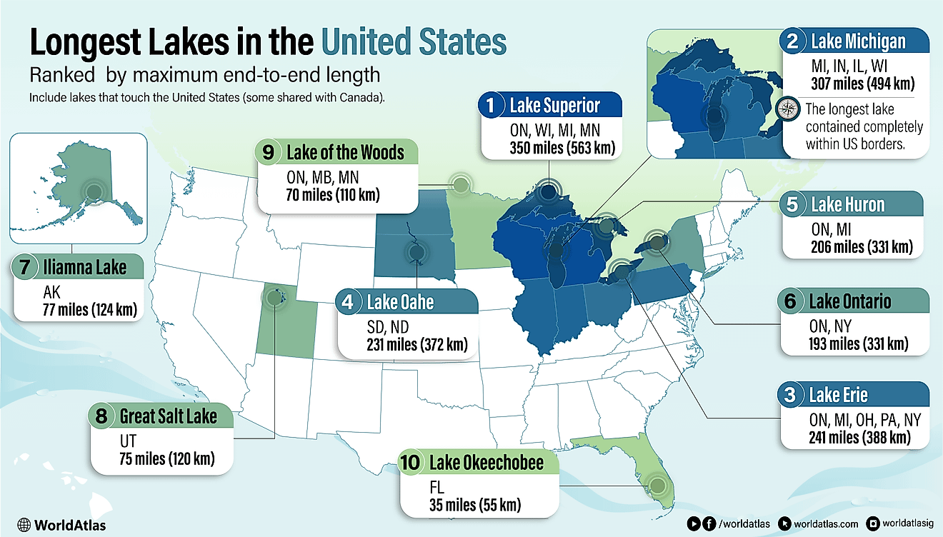
Dniester River
The Dniester River is Ukraine’s second-longest river and Moldova’s major source of drinking water. It rises on the Carpathian Mountains in Western Ukraine and flows for about 1,362 kilometers to its mouth in the Black Sea. It flows through Ukraine and Moldova, where it separates Transnistria (a breakaway state) from the mainland. In Ukraine, the river goes by the name “Dnister,” while Moldovans refer to it as Nistru. The Dniester is divided into three main parts: upper, middle, and lower Dniester, with the middle river as the longest section, flowing 720 kilometers. The Dniester is an important river for transporting logs and also supports hydroelectric power production.

Name
The Dniester River derives its name from “danu nazdya,” a Sarmatian word for “the close river.” The Dnieper River, Ukraine’s longest river, derives its name from the opposite of Dniester that translates to “the river on the far side.” According to other sources, Dniester is a blend of two words from different languages: “danu,” a Scythian word for “river,” and Thracian Ister. Thus, the river was previously known as River Ister.
Major Features

The Dniester River flows southeastwards from Ukraine’s southwestern corner through eastern Moldova and marks part of the Ukraine-Moldova border. With a length of 1,362 kilometers, Dniester is Ukraine’s second-longest river after the Dnieper, which flows further east into the Black Sea. The river is about 100-110 kilometers wide and drains an area of about 68,627 square kilometers. It discharges an average of 310 cubic meters of water per second into the Black Sea.
The Dniester River is divided into the upper, middle, and lower rivers. The upper river is the section from the source to Nizhny (Ukraine), a distance of about 270 kilometers. The middle river flows for about 720 kilometers from Nizhny to Dubasari in Moldovia. The lower river runs from Dubasari to the Black sea, covering 340 kilometers.
Course Of The River

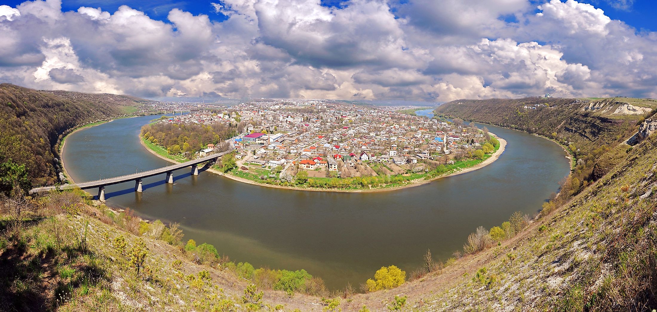
The Dniester River rises on the Ukrainian Carpathians, located in Western Ukraine’s southwestern corner, near the Ukraine-Poland border. For the first 48 kilometers, the river flows southwards through a deep gorge as a rushing stream. The river then flows in a southeastern direction before bending eastwards and briefly running parallel to Moldova’s northern border. The Dniester then bends southeastwards at Mohyliv-Podilskyi and flows briefly on the Ukraine-Moldova border. It leaves the border and continues with the southeastward flow, separating mainland Moldova and the breakaway Transnistria Republic.
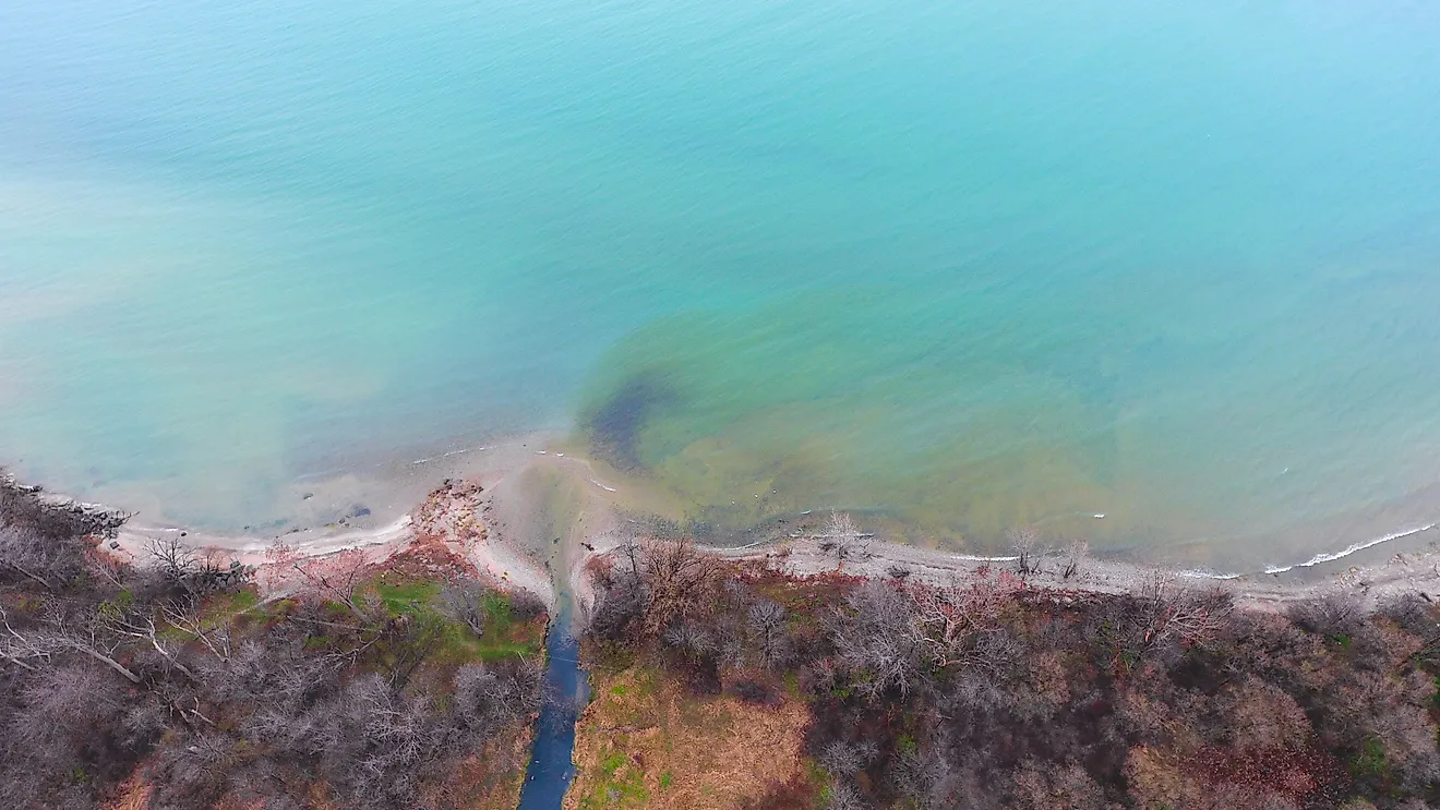
The river exits Moldova at the southeastern corner and flows through Ukraine’s Odesa Oblast into the Black Sea, where the Dniester Estuary forms. Although the Dniester has several tributaries, only 15 are longer than 95 kilometers. The rivers joining from the right side are Stryi, Limnytsia, Svicha, Raut, Bic, Ichel, and Bystrytsia. The left tributaries include Strwiaz, Zolota Lypa, and Strypa.
Settlements
Different communities have inhabited the Dniester basin since the Neolithic period, including the Cucuteni-Trypillian culture and European Sarmatians. Today, the river basin is densely populated, with about 7 million people despite the absence of large towns along the river bank. However, several urban centers lie along the tributaries, including Chisinau in Moldova and Ternopil and Lviv in Ukraine. The high population density and the industries located upstream have contributed to the river’s pollution. Meanwhile, the Republic of Moldova and Odesa (Ukraine) rely almost entirely on the Dniester for drinking water.