What Is The Origin Of The Yenisei River?
The Yenisei River is the largest river that flows into the Arctic Ocean. Also known as the Enisei, Yenisey, Evenk Ioanesi, or Jenisej, the river is among the three major river systems that drain into the Arctic Ocean, the two other rivers being the Lena and the Ob. Draining a huge region of Central Siberia, the Yenisei has a maximum depth of about 80 feet and an average depth of around 45 feet. The river's outflow has a depth of about 106 feet, while its inflow has a depth of around 101 feet. With a length of about 2,136 miles, the Yenisei River is the longest river within the Yenisei-Angara-Selenga-Ider river system.
Course
The Yenisei River flows through two countries: Mongolia and Russia. The source of the river is Mungaragiyn-Gol, which is located at the ridge of Dod-Taygasyn-Noor, Mongolia, and has an elevation of about 10,994 feet. The river then flows north for 2,167 miles along the border between Eastern and Western Siberia, before draining into the ice-cold waters of the Kara Sea. The river drains a total of 996,144 square miles of Central Siberia.
Along its course, the river flows through a number of regions in Mongolia and Russia, including Tuva, Krasnoyarsk Krai, Zabaykalsky Krai, and Irkutsk Oblast. The river also flows through numerous cities, such as Shagonar, Krasnoyarsk, Igarka, Sayanogorsk, Yeniseysk, and Divnogorsk. Some tributaries of the Yenisei River include the Nizhnyaya Tunguska, Podkamennaya Tunguska, Tuba, and Angara (which is fed by the massive Lake Baikal). Eventually, the river reaches its mouth at the Yenisei Gulf, which is part of Russia’s Great Arctic State Nature Reserve.
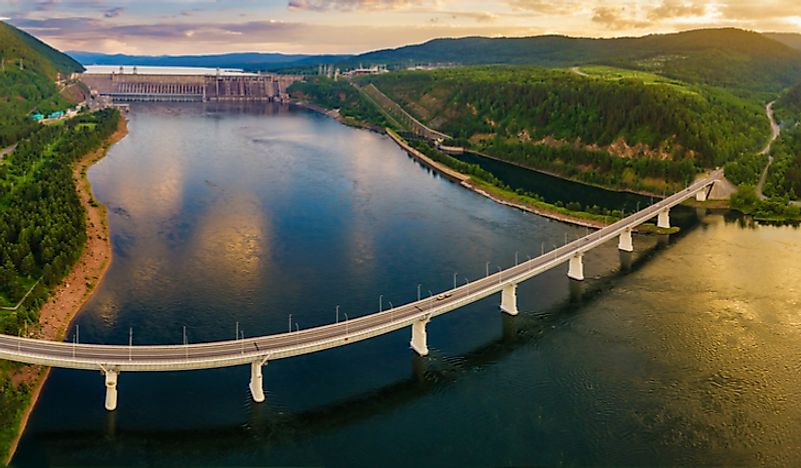
Description and Features
With a north-to-south length of about 2,200 miles and an east-to-west width of about 1,100 miles, the basin of the Yenisei River has extensive and diverse features. Between 6% and 7% of the basin is made up of lowlands. The two main lowlands in the basin are the North Siberian Lowland and a narrow strip of land on the edge of the West Siberian Plain. A significant part of the basin is made up of features in the western and eastern regions of Tuva, Sayan, the Hentiyn and Hangyan mountains, and Sayan. These areas have elevations ranging from 2,300 to 7,200 feet, as well as extensive bowls between mountain ranges and steep valleys. In the Sayans and in the southern area of Tuva, there are even higher peaks, such as Mount Munku-Sardyk, which has a height of about 11,453 feet. Features like the Putorana Mountains (5,580 feet), the Yenisey Ridge (3,622 feet), and the Angara ridge (3,353 feet) border the drainage basin.
The river itself can be divided into three major parts. The first part has a length of about 295 miles, starting from Kyzyl and ending at Oznachennoye on the southern edge of the Minusinsk Basin. The second part has a length of about 544 miles, starting from Oznachennoye and ending at the Angara confluence. The last section flows for about 1,328 miles, starting at the confluence and eventually draining into the Kara Sea.


