Lake Maracaibo
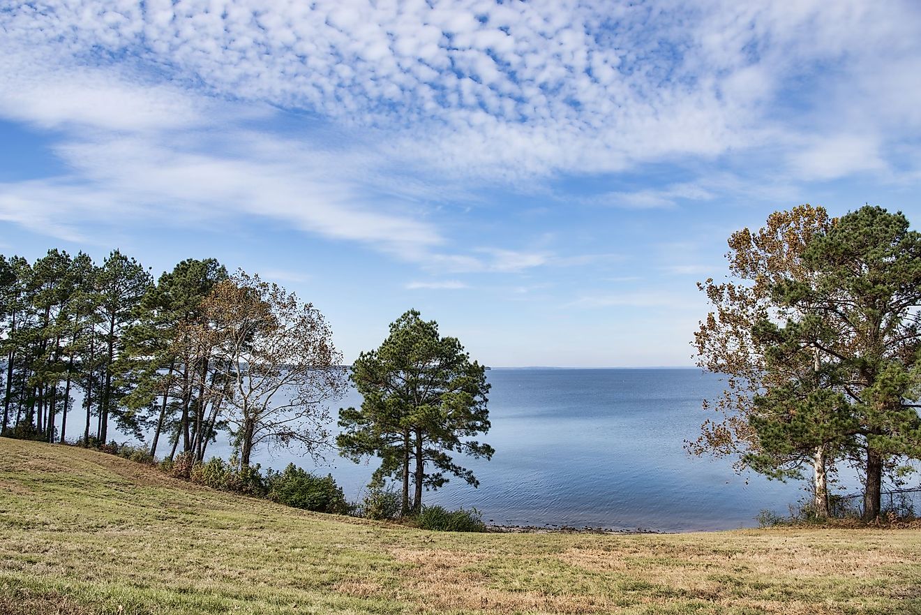
Northwestern Venezuela's Lake Maracaibo is the largest lagoon in South America. Despite its name, it is classified as a lagoon because of the 34-mile strait on its northern shore that connects it to the Gulf of Venezuela. It's also an estimated 36 million years old, making it one of the oldest lagoons on Earth. Its vase shape covers a surface area of 5,217 miles (13,512 square km), 130.5 miles (210km) in length, 75.2 miles (121km) in width, and 67.2 cubic miles (280 cubic km) in volume.
History

The aboriginal Anu people who lived in the area surrounding Lake Maracaibo, including the tribes of Wayuu, Caquetíos, and Quiriquires, referred to the lake and the surrounding northwest Venezuelan area as Coquivacoa. The name Veneziola (Venezuela in Spanish, or "Little Venice") was bestowed on the area in 1499 by Italian navigator Amerigo Vespucci, who equated the stilt houses of the Anu people along the shoreline with the building styles in Venice, Italy.
Lake Maracaibo is also the home of the famous Battle of Lake Maracaibo, or the "Naval Battle of the Lake," between the Republic Admiral José Prudencio and the royalist Captain Ángel Laborde. Fought on July 24th, 1823, the Republican victory marked the end of the Venezuelan War of Independence, and the larger Spanish-American War of Independence.
Hints of Lake Maracaibo's abundance of oil were discovered by Spaniards who used tar seeping from the lake to fill cracks in their ships. After the Maracaibo oil field was officially discovered in 1914, large-scale exploitation began as early as 1922.
Geography

Lake Maracaibo's connection to the Gulf of Venezuela leads some experts to argue that it should be considered an inlet of the Caribbean Sea because of the high proportion of water brought into it from the ocean. Scattered within the lagoon are some artificial islands and many natural islands, including San Carlos Island, Zapara Island, Toas Island, and Providence Island, among others. The surrounding area, known as the Maracaibo lowland, is between the Perija Mountains, the Merida Mountains, and the Eastern Cordillera Mountains of northwestern Venezuela.
It's also home to significant human activity: it borders almost a quarter of Venezuela's population, mostly owing to the influx of farmers from nearby Andes, who propelled population growth from 300,000 in 1936 to an astounding 3.62 million in 2007. Most crops, including bananas, peanuts, cocoa, coconut, sugar cane, and coffee, are grown on the south bank.
Hydrology

Lake Maracaibo's connection to the Caribbean Sea causes some slight salinity, generally between 1.5 and 3.8%, with the northern portion being more brackish, and the southern being more fresh, owing to the many river inflows. These inflows are counted at over 50 river sources, most notably including the Santa Ana River, the Chama River, the Motátan River, the Escalante River, and the largest being the Catatumbo River, which provides 57% of the water entering the lake.
The ocean's influence also provides prevailing winds that circulate the lake water counterclockwise.
Climate

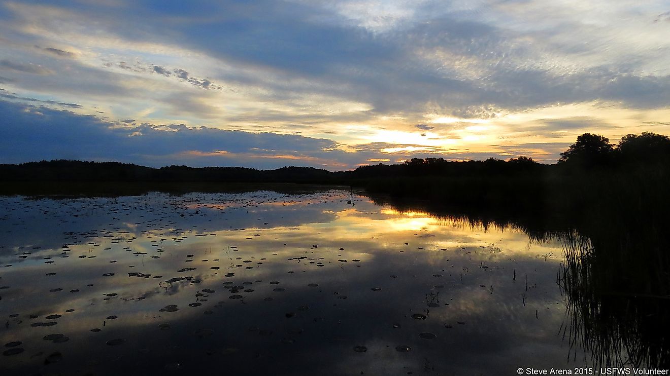
Lake Maracaibo is most renowned for its weather; the lagoon is the place with the most frequent lightning on Earth, recognized as the Catatumbo lightning, characterized by a continuous series of silent lightning. Estimates cite 233 lightning strikes per 0.4 square mile per year on average, equating to a peak of 280 lightning strikes per hour, or 28 lightning strikes per minute in September. This extreme frequency is due to the area's unique combination of moisture, temperature, and topography, which tends to trap storms for long periods of time.
The average annual temperature of the lake area is 82.4 degrees Fahrenheit (28 degrees Celcius), with an average annual rainfall estimated at 1400 mm.
Wildlife

Lake Maracaibo's oxygenated waters make it a vibrant home for wildlife and micro-flora and fauna, like algae.
Animals
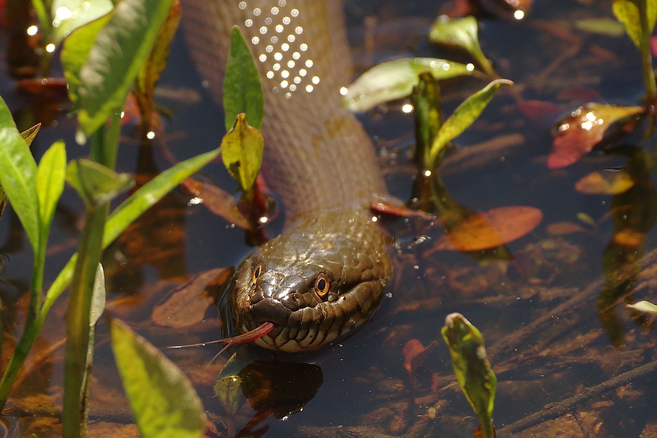
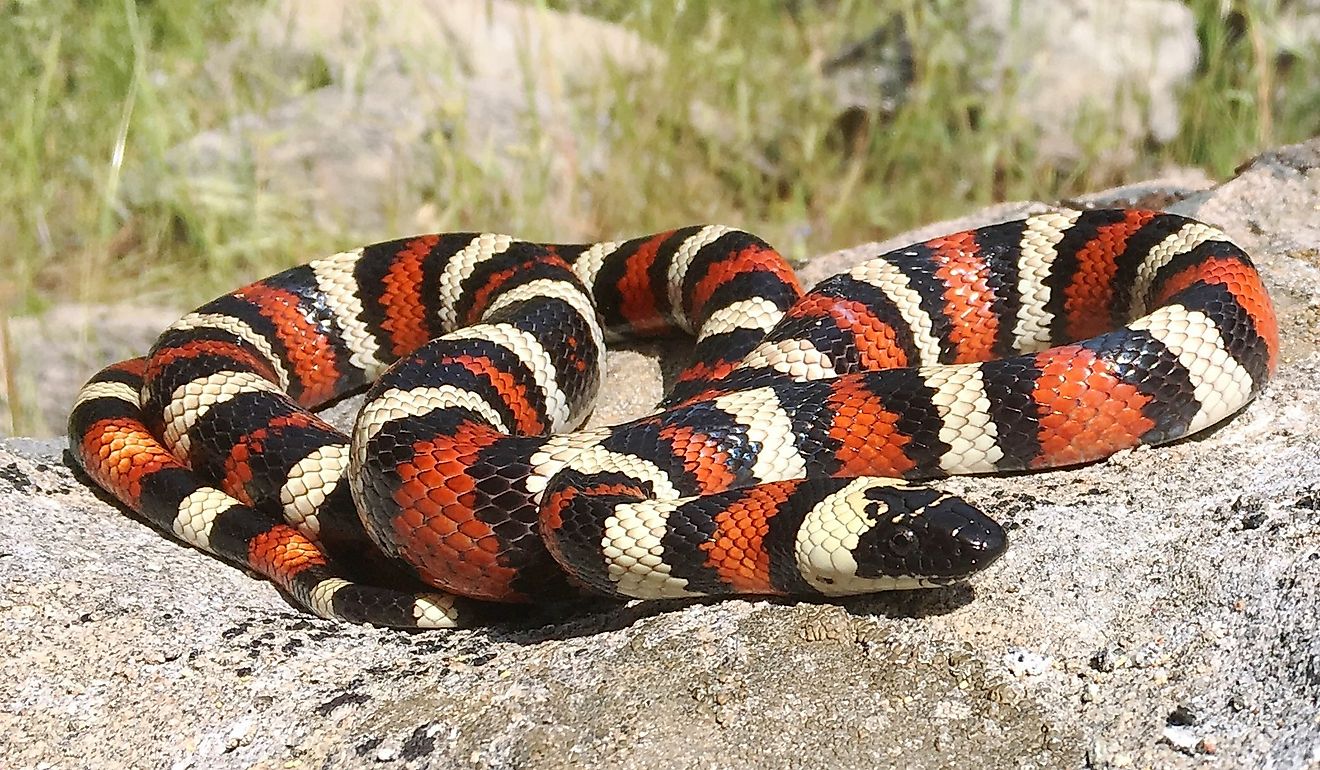
Lake Maracaibo's fishery is based on seafood like blue crabs, clams, and shrimp that populate it. Fish are also abundant and diverse, totaling over 145 species. These include many endemic (only found in Lake Maracaibo) species, including the Maracaibo half-hooked catfish, the Maracaibo hairy catfish, the Maracaibo Lake Lamont catfish, the Lake Maracaibo tetra, and Maracaibo wolf anchovies, all of whom have developed over the lake's 36 million years of age.
Notable large mammals that inhabit the lake include the Amazon River dolphin and the West Indian manatee. Both of these species, unfortunately, are endangered because of the contamination that threatens their food sources and because of habitat fragmentation caused by dams and other manmade features.
Flora and Fauna
Unfortunately, contamination owing to oil spills, pollution, oil pipeline leaks (among the 15,000 miles of pipeline spread across the lake floor), and the indiscriminate discharge of waste has significantly deteriorated the water quality. Aside from causing dangerous levels of contamination for human health, the water quality also limits the flourishing of local flora and fauna.
Eutrophication, or the gradual increase in the concentration of phosphorous, nitrogen, and other plant nutrients in an aging aquatic ecosystem, has combined with the polluting effects to propel massive blooms of duckweed and green algae. Their overwhelming presence blocks the passage of sunlight, deters biological cycles, and prevents the development of native algae and plant species.
Significance Today
Lake Maracaibo is one of Venezuela's significant stores of economic wealth, owing in large part to its supply of oil. The "oil lake" is primarily concentrated in the northern portion, which accounts for 75% of Venezuela's total oil production. Lake Maracaibo's fishery also supports more than 20,000 fishermen, many of whom attract tourist activity with colorful, traditional stilt houses built along the lake coastline.
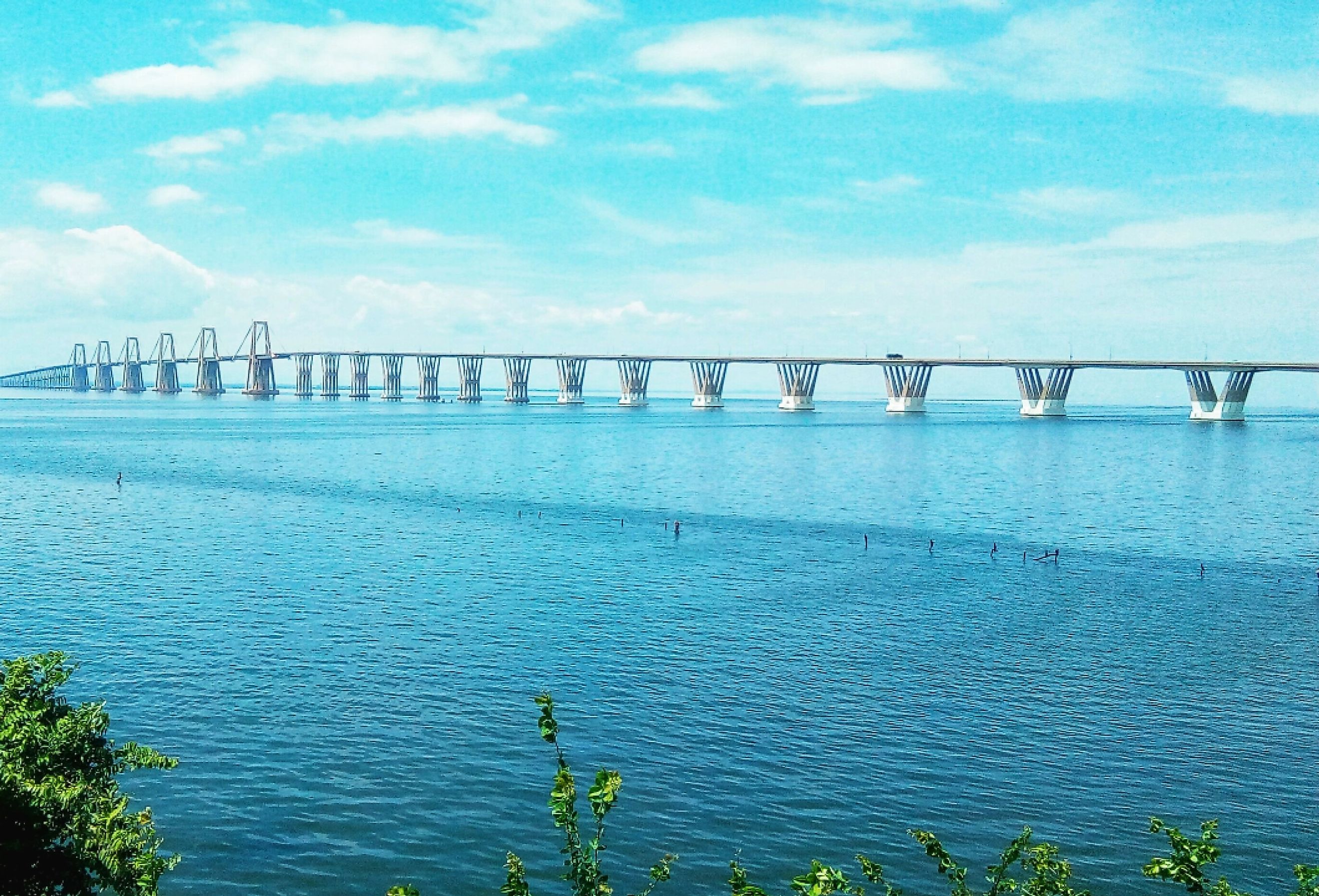
The primary city is Maracaibo — the capital of Zulia State and the second-largest city in Venezuela — which serves as a major exporter of oil and as a transshipment shipment center of coffee produced in the Andes, supported by infrastructure like the 28,471 foot (8,678m) General Rafael Urdaneta Bridge that connects the western and eastern coast of the lake at the northern strait.