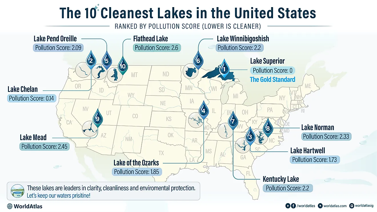
Lake Nicaragua
Covering an area of 8,157 km2, Lake Nicaragua is Central America’s largest freshwater lake, located in the southwestern part of Nicaragua. By area, it is also the world’s 20th largest lake and the tenth-largest lake in the Americas. The Indigenous Nicaraguan people named the lake Lago Cocibolca which means "sweet sea."
Where Is Lake Nicaragua?

Lake Nicaragua is located in the central portion of a tectonic valley, to the east of the Pacific lowlands in the southwestern part of Nicaragua. It is separated from the Pacific Ocean in the southwest by the 20 km-wide Isthmus of Rivas. Along the southeastern shore, the San Juan River drains the lake into the Caribbean Sea. It is also connected with Lake Managua in the northwest by the Tipitapa River.
Geography

This roughly oval-shaped lake measures about 161 km in length and has a maximum width of 71km. The lake has a maximum depth of about 26 m at its deepest point, which is situated southeast of Ometepe Island. Lake Nicaragua is located at an altitude of 32.7 m above sea level. About 40 rivers drain into the lake.
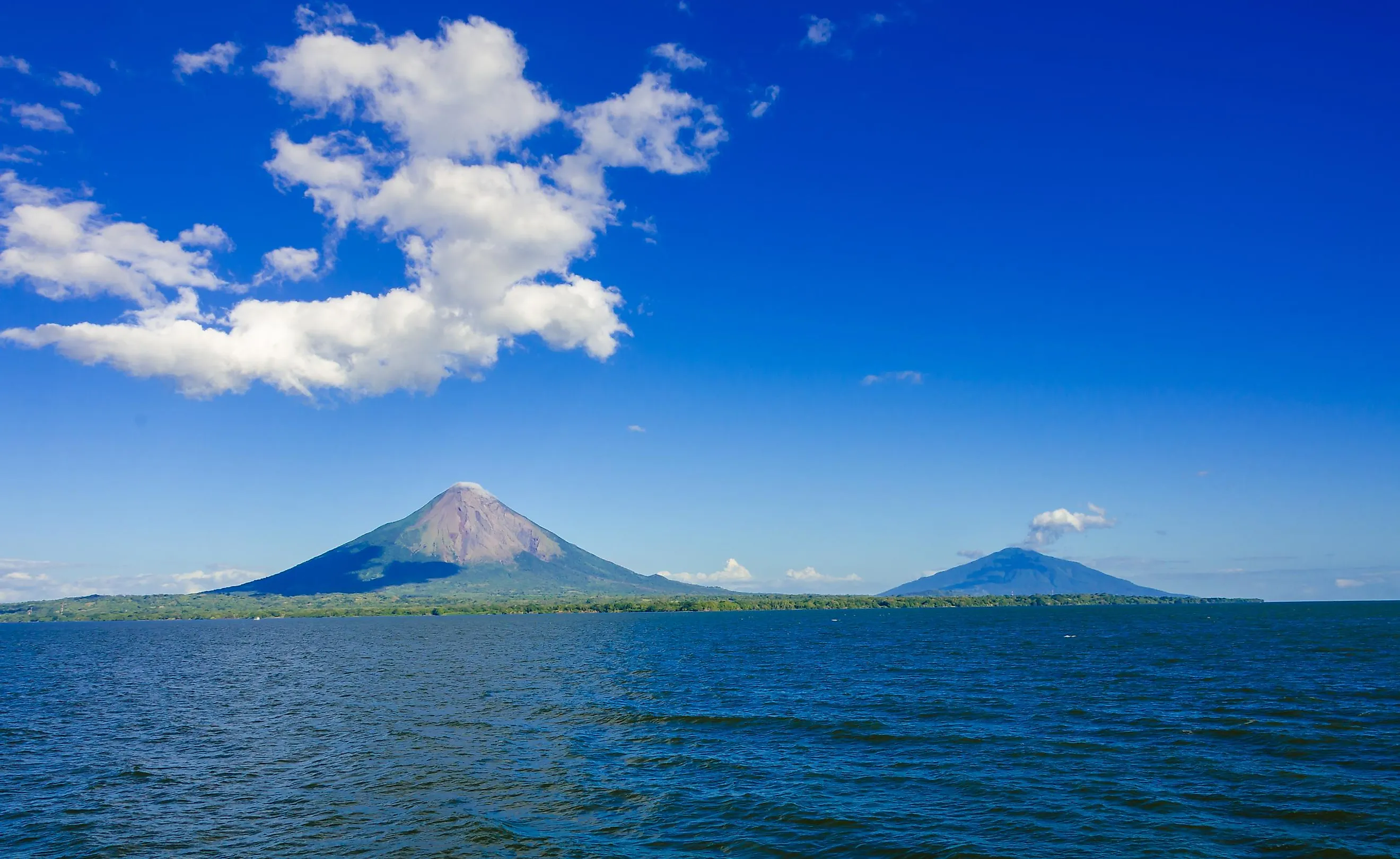
Lake Nicaragua has about 400 islands including the Las Isletas archipelago which contains over 350 small islets. Covering an area of 275 km2, the tropical island of Ometepe is the lake’s largest island, formed by the lava flow from the volcanoes Concepción and Maderas. Concepción is located in the western part of Ometepe Island and is an active volcano, while Maderas in the eastern part is a dormant volcano. Zapatera Island is the remnant of the Zapatera volcano. Situated in the southern part of Lake Nicaragua is the Solentiname archipelago which comprises four large islands and 32 small islands. The four large islands in the archipelago are Mancarrón, San Fernando, Mancarroncito, and La Venada.
Marine Life
Lake Nicaragua is the only freshwater lake that contains several oceanic animal species. This is likely due to the fact that the lake was once an ocean bay, until it was separated by a volcanic eruption, trapping fish in the lake basin where they had to adapt to the water progressively losing its salinity. About 40 species of fish like tarpon, big sawfish, fine-toothed sawfish, gasper, and swordfish along with 16 species of cichlids are found in the lake. Freshwater shark species like the Caribbean bull shark are also found in the lake waters.

Brief History
In 1522, the Spanish conquerors first arrived on the Isthmus of Rivas. The Spanish Captain Gil Gonzáles Dávila visited the lake on the horseback and claimed possession of it for the Spanish Kingdom. Due to the lake’s large size, the Spanish conquerors thought it to be a sea when they first saw it. They named it Mar Dulce, "freshwater sea." The Caribbean Sea exit of the lake was found through the expeditions of Captains Machuca, Calero, and DeSoto. During colonial rule, the lake served as an important link between the Caribbean Sea, San Juan River, and the colonial city of Granada. The lake along with the San Juan River also served as an important navigational waterway through which different important products like gold, indigo, and wood were exported to Spain. On several occasions, Caribbean pirates successfully navigated upstream to attack the rich city and port of Granada, located in the lake’s extreme northwestern part.
Some of the important port cities that are located along the lake’s shorelines include San Carlos, Granada, San Jorge, and San Miguelito.