Irish Sea
After significant expansion at the end of the last Ice Age, the Irish Sea (Irish: Muir Éireann), sometimes called the Manx Sea, now cleanly separates Ireland from Great Britain. This 46,000 square-kilometer (17,800 square-mile) saline body of water links to the North Atlantic Ocean at both its North and South ends, making it an important shipping channel for both the Republic of Ireland and the United Kingdom. It has also fostered multiple energy sources, from oil and gas reserves to wind farms to nuclear power plants (now banned in Ireland but ongoing in the UK). The varied ecosystem harbors an impressive range of flora and fauna, strengthening the area's biodiversity and providing tens of thousands of tonnes of fish and other seafood to the bordering nations. Over fifteen million people live around the Irish Sea, with at least six million living within ten kilometers (six miles) of the coast.
Geography Of The Irish Sea

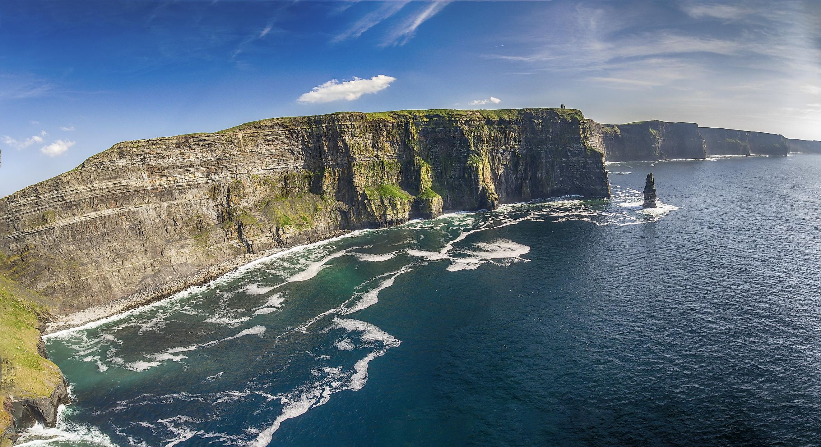
The terrestrial borders of the Irish Sea include Ireland (to the West), Northern Ireland (Northwest), Scotland (North), England (East), and Wales (South). Its waters are defined to the North, where they intersect with the Southern limit of the North Channel and the Inner Seas off the West Coast of Scotland. This transition is marked by Northern Ireland's Ballyquintin Point and Scotland's Mull of Galloway. From there, the North Channel heads Northwest into the North Atlantic Ocean. To the South, the Irish Sea blends with St. George's Channel, where the imaginary tangent between Ireland's Carnsore Point and Wales' St. David's Head can be drawn. St. George's Channel flows into the Celtic Sea and then also the North Atlantic Ocean. The width of the Irish Sea ranges from 75 kilometers to 200 kilometers (120 miles). Its depth generally ranges from 80 to 275 meters (262 - 902 feet), with the shallowest point (i.e., East of the Isle of Man) measuring less than 50 meters (164 feet) and the deepest, about 300 meters (984 feet). The total surface area is between 45,000 and 47,000 square kilometers, stated by some sources as exactly 46,007 square kilometers (17,763 sq mi).

The Irish Sea contains ten islands that are over one square kilometer. The three largest, both in terms of area and population, include the Isle of Anglesey (714 sq km/276 sq mi; 2021 population: 68,900), just off the coast of Northern Wales, Isle of Man (574 sq km/222 sq mi; 2021 population: 84,069), in the middle of the sea's Northern section, and Holy Island (39 sq km/15 sq mi; 2011 population: 13,659), immediately adjacent to Anglesey's West coast.
There are dozens of substantial settlements surrounding the North Sea. The five most populous include Dublin, capital of the Republic of Ireland (2022 urban population: 1,263,219), Northwestern England's Liverpool (2022 urban population: 864,122), Belfast, capital of Northern Ireland (2021 urban population: 345,418), Northwestern England's Blackpool (2020 population: ~145,007), and Southport, a town of about 94,421 residents (as of 2021), also in Northwestern England.
The Formation Of The Irish Sea
Approximately 20 million years ago (i.e., the Neogene geological period), the islands of Ireland and Great Britain settled into their current geographical positions. And while the Atlantic Ocean formed roughly 20 million years prior to that, land bridges and glaciers interrupted the flow that exists today. Between about 18,000 to 14,000 BC, there was a terrestrial crossing from modern-day Cornwall to Southern Ireland. Between roughly 14,000 and 11,000 BC, it is thought that a minor land bridge connected the Isle of Man to Northwestern England. During this era, the Irish Sea is believed to have been a lengthy freshwater lake formed by the remnants of an ice sheet that covered much of Ireland and Britain (with a maximum height of perhaps 600 meters/1,969 feet) until 13,000 years ago. As the ice sheet that covered Northern Ireland began to melt about 10,000 years ago, sea waters encroached, first creating a brackish transition before the complete connections were made, and a fully saline content was established.
Economy And Human Activity

Given the complete lack of international tunnels or bridges, the only points of contact between Ireland/Northern Ireland and Great Britain are accomplished by sea and air. But because of the prodigious costs and limitations of the latter, heavy goods are predominantly shipped across the Irish Sea. Over 10 million tonnes are exchanged between Northern Ireland and the rest of the United Kingdom on an annual basis, while the Republic of Ireland handles in excess of 7.6 million tonnes. Liverpool is the United Kingdom's most substantial port (though far from its only one) – processing in the neighborhood of 32 million tonnes on an annual basis. Additionally, approximately twelve million passengers cross the Irish Sea each year.
Along with commercial goods and transportation, Irish Sea ports also bring in tens of thousands of tons of fish on an annual basis (the majority of which are shellfish). The total suggested economic value put forward for the Irish Sea is equivalent to roughly $9.56 billion (USD) per year. According to the Irish Sea Conservation Zones, there are 17 active oil and gas drilling platforms. Sites have been explored and/or drilled in the Caernarfon Bay Basin, Cardigan Bay Basin, Liverpool Bay, East Irish Sea Basin, and around Dalkey Island.

Because of the strong winds and shallow waters of the Irish Sea, wind farms have proven to be a viable source of renewable energy for both Ireland and the United Kingdom. And while Ireland banned nuclear power in 1999, the United Kingdom chose to forge ahead, using the waters of the Irish Sea to support the demands of some of its reactors and waste management. This initiative has delivered somewhat mixed results. On the one hand, as of 2022, 15% of the nation's electricity comes from this low-carbon source. However, the Sellafield reprocessing plant, located in Seascale, Cumbria, UK, has drawn negative attention for its release of radioactive materials into the ecosystem. Greenpeace has claimed that this discharge of nuclear waste has made the Irish Sea the most radioactively contaminated sea in the world. But the Environmental Protection Agency (EPA) counters this by showing that the amount of increased radiation exposure for marine life, though the largest single source of artificial radioactivity to invade the Irish marine environment, is still very small overall and only accounts for about 0.3% of the total radiation dose received by Irish citizens from all regular sources. In either case, improved waste treatment techniques have greatly reduced the amount of discharges into the Irish Sea since the 1970s (when it was at its peak).
On the lighter side of things, the Irish Sea fosters a joyous range of recreational activities. These include, but are not limited to, diving, wind and kite surfing, paddle sports, boating, sailing, jet-skiing, and angling.
Flora And Fauna Of The Irish Sea

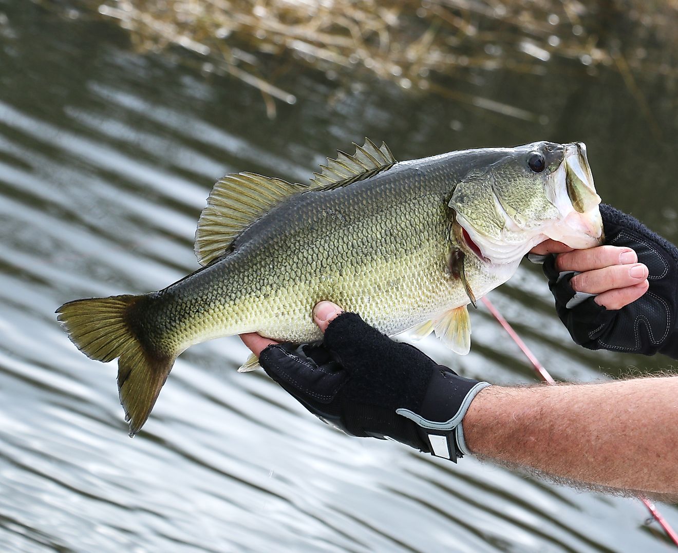
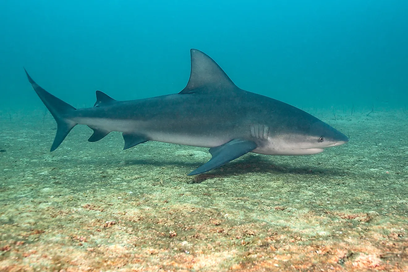
The Irish Sea fosters such habitats as seagrass beds, rocky reefs, honeycomb reefs, muddy beds, cliffs, estuaries, salt marshes, and sand dunes. From this base, sea urchins, plankton, Dublin Bay prawns (aka "scampi"), and other species of shrimp, brittlestars, mussels, tellins, furrow shells, tower shells, scallops, and worms form the lower ranks of the food chain. These, in turn, give rise to schools of fish, such as flatfish, herring, and sea bass, swarms of jellyfish, leatherback turtles, swimming crabs, cuttlefish, and at least thirty species of shark, such as the thresher, blue, mako, porbeagle, and the basking shark (the world's second-largest fish), and even various species of whale, seal, dolphin, and porpoise. Additionally, flocks of seabirds and shorebirds rely on the coastal habitats surrounding the Irish Sea and the abundant food sources found in its open waters. Finally, the endangered pink sea fan (Eunicella verrucosa), a type of coral that can manifest as orange or white, along with the expected pink, is found in the shallower waters of the Irish Sea but nowhere else in the whole of the United Kingdom.

Despite the plethora of biodiversity and the undeniable importance of the Irish Sea as a collective ecosystem and source of livelihood, it lacks conservation initiatives. According to the Wildlife Trusts, as of October 2022, 36% is designated as a Marine Protected Area, but only about 5% of these areas have active management, and a mere 0.01% is fully protected. Current sources of detrimental impact include climate change, fishing and aquaculture, urban development, the robust shipping industry, recreational activity, and the pollution that results from all of these sources, among others.
Whether gazing out from the western shore of England, the eastern shore of Ireland, the northern shore of Wales, or the southern shore of Scotland, the immense Irish Sea looks like an incorrigible fixture of Northwestern Europe. But plate tectonics, glaciation, and climate change are responsible for the divide between Ireland and Great Britain and will continue to give it a gradual but ultimately dramatic makeover. For now, the Irish Sea is the site of frenetic and international human activity and home to a commendable mix of plants and animals, both above and below the brisk waters.