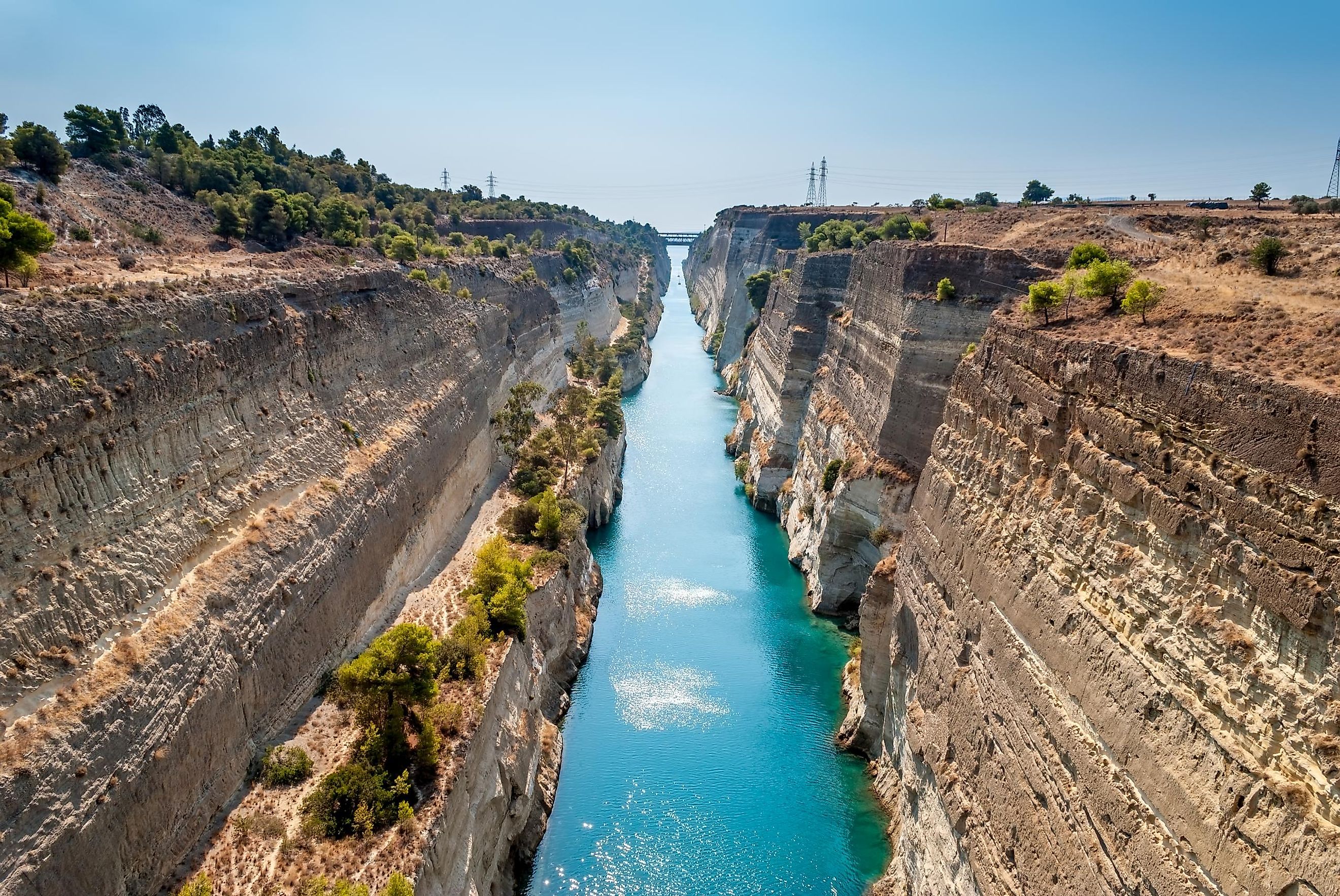
Corinth Canal
The Corinth Canal is an artificial waterway connecting the Ionian Sea’s Gulf of Corinth in the northwest with the Aegean Sea’s Saronic Gulf in the southeast. The canal passes through the narrowest portion of the Isthmus of Corinth separating mainland Greece from the Peninsula of the Peloponnese and effectively converting the peninsula into an island. The Corinth Canal provides a shorter navigational route to the west from Athens and the port of Piraeus.
Construction

It is believed that Periander, the second tyrant of Corinth, was the first to propose the idea of constructing a canal in the 7th century BCE, to connect the Mediterranean Sea (via the Gulf of Corinth) to the Aegean Sea (via the Saronic Gulf). However, the project turned out to be quite expensive and given the limited technical expertise during that time, it was eventually abandoned. Periander, therefore, constructed an overland portage road known as Diolkos through which the ships were transferred from one side of the isthmus to the other.
It is believed the emperors Demetrios Poliorkitis, Julius Caesar, Caligula, and Nero also tried to construct the canal but were not able to successfully execute their plans. After the independence of Greece from the Ottoman Empire in 1830, the newly appointed Greek governor, Ioannis Kapodistrias, was the first to reconsider the construction of the canal. King George I of Greece officially inaugurated the construction of the canal on April 23, 1882. After 11 years of construction work, the canal was completed on July 25, 1893. During the Second World War, the German Nazis used explosives to trigger landslides of its rocky slopes and dumped locomotives and other construction materials to block the canal. The canal was finally cleared in 1947 by the US Army Corps of Engineers and reopened for all ship traffic in September 1948.
Layout And Navigation

The Corinth Canal measures about 6.6 km in length and has a maximum water depth of 8 m. The canal has a maximum width of 24.6 m at sea level and a minimum width of 21.3 m at its bottom. The peculiar composition of its steep limestone walls has resulted in occasional landslides leading to the blocking of the canal for long periods. In 1988, two submersible bridges were constructed in the canal, one at each end, to maintain the connectivity between the Peloponnese Peninsula and the Mainland.
For several decades, the Corinth Canal served as an important navigational route for the ships entering the Aegean Sea. However, due to the narrowness of the canal, it is difficult for the large modern cargo ships to pass through it. The high winds and strong currents also reduced the navigation of ships through the canal. Hence, over the years the canal has lost the significant economic importance it once possessed. The Corinth Canal is now mostly used by tourist cruise ships, yachts, and small recreational boats. It has been estimated that annually about 11,000 ships use the waterway. The 195 m long and 22.5 m wide cruise ship MS Braemar, with more than 900 passengers on board, became the longest and the widest ship to pass through the narrow Corinth Canal on October 9, 2019.