Kara Strait
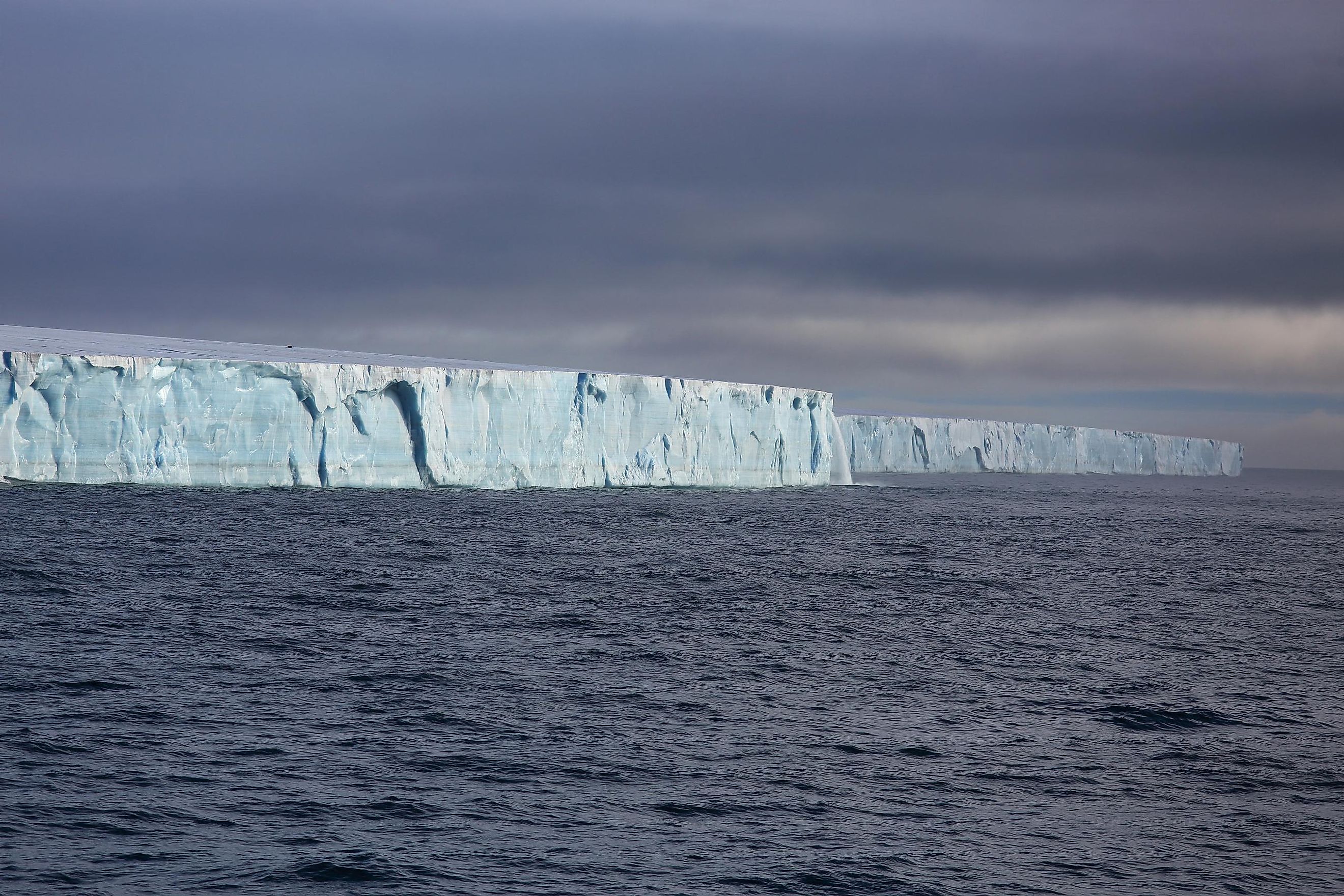
The Kara Strait is a water channel that connects the Kara and Barents Seas in northern Russia. The 35-mile-wide body of water, also known as the Kara Gates, plays a significant role in the Northern Sea Route. It is also the main migration route for polar bears traveling from Vaygach Island to the west coast of Novaya Zemlya.
Where Is The Kara Strait?

Located in the vast Arctic Ocean, the strait lies at the southern end of the sparsely populated Novaya Zemlya archipelago and the northern coast of Russia. The waters form a natural boundary between the Kara Sea and the Barents Sea and contribute to the border between Europe and Asia.
Hydrographical Features
Currents, temperature fluctuations, and salinity all have an effect on the Kara Strait. Researchers also discovered that the strait contains internal gravity waves. This means strong waves move within the water and not on the surface. Scientists have studied these internal waves for at least two decades as scientific interest in the strait intensified. The adjoining Kara Sea is stratified, meaning two distinct layers make up the vertical water column. Furthermore, research papers dissect how freshwater disperses in the Kara Sea and how they can apply regional coupled ice-ocean models to it.
Geological Formation
The geological history of the Kara Strait dates back millions of years. Tectonic shifts and glacial movements carved out the sea basins and Arctic region straits. There is little information on the exact geological formation of the Kara Strait, but scientists believe it formed due to erosion. Deposits by glaciers, sea levels, and tectonic activity also played a role.
Marine Life In The Kara Strait

Despite the harsh, freezing conditions in the strait, the waters provide a home for a range of magnificent marine life. Not only did various fish species adapt to the cold here, but it is an excellent habitat for polar bears and seals. Moreover, the unique ecosystem in the strait is connected to the Arctic Food Chain.
Exploration And Mapping Of The Kara Strait
Early records indicate that Russian explorers were the first to scout the Kara Strait. This is mainly because the strait lies so close to the Russian mainland. As part of an intensive exploration of the Arctic region, the strait was progressively mapped as the centuries went by.
One of the main reasons the strait was explored and mapped was to search for a passage that would provide a shorter route to Asia. Navigators had difficulty finding such a passage because the strait was blocked by ice most of the year. However, the Soviet Union and Russia eventually built a 3,500-mile channel through the most unnavigable part between the Kara and Bering straits and called it the Northern Sea Route.
Brief History Of The Kara Strait
Fast forward to the 19th century, and the strait was now a central waterway for trade. The Russian government planned and built several lighthouses and weather stations in the region to guide the ships traveling between the two seas.
When WWII set the world on fire, German submarines pitched up in the Kara Sea and the strait to surprise attack the Soviets. Since the war's end, the Kara Strait has been a critical factor in oil exploration and shipping. For this reason, the Russian government invested a large chunk of money in developing the Northern Sea Route.
The Effects Of Climate Change On The Kara Strait

Unfortunately, the Kara Strait is not immune to the threat of climate change. Temporal variability and sea ice trends and their connection to local atmospheric forcing are ongoing concerns in the Kara Sea. And, as global warming continues to melt sea ice and raise ocean temperatures, the Kara Strait is changing in ways that could have long-term ecological and navigational consequences.
The Kara Strait Today

Today, the Kara Strait forms an unmissable part of the Northern Sea Route or Northeast Passage. This passage is also becoming easier to navigate because of climate change. As Earth continues to warm, the strait is almost automatically becoming a shortcut between Europe and Asia.
Moreover, the straight lies close to oil and natural gas fields, which makes it a strategic location for Russia and other countries interested in extracting resources. However, even though the sea ice cover isn't quite as thick as in the past, it still poses a risk to vessels. Ongoing studies aim to predict vessel speed to help plan safe maritime operations in the strait and the surrounding seas.
Scientists, on the other hand, are less concerned with maritime activities than they are about the effect ongoing global warming has on the polar bear populations in the Kara Strait. It was reported in 2014 that open water had replaced ice-covered areas in the strait since 2010. This means that instead of walking over the ice during spring, polar bears have to swim for hours on end. And, in 2023, it doesn't seem like anyone has a solution to this problem just yet.