Which Countries Border The Gulf Of Tonkin?
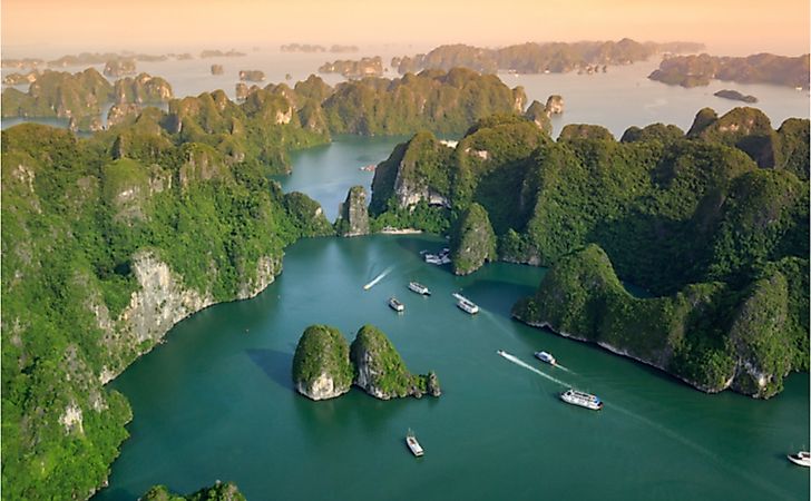
The Gulf of Tonkin is the northern arm of the South China Sea. The Gulf borders the northern coastline of Vietnam and the Chinese territories of Guangxi Province, Hainan Island, and the Leizhou Peninsula. The Gulf of Tonkin is 300 miles long and 150 miles wide. The Red River is the primary source of water while the Vietnamese Port of Haiphong and Chinese Port of Peihai are the main seaports. The gulf is popularly known for the infamous Gulf of Tonkin Incident that led to the escalation of conflict during the Vietnam War after President Lyndon B. Johnson falsely accused Vietnam of attacking American destroyers in the gulf. The gulf witnessed a series of armed conflicts in the 1970s and continues to experience a cold war as China consistently claims islands in the South China Sea.
Economic Importance Of The Gulf Of Tonkin
The Gulf of Tonkin is vital to the bordering states of China and Vietnam as well as other states in the region. Ben Thuy and Haiphong ports in Vietnam and Beihai Port in China enable the two countries to import and export goods through the sea. The Gulf also supports hundreds of species of marine life that are of economic importance to millions of Chinese and Vietnamese. Recently, the Gulf has become a bone of contention between China and Vietnam after the discovery of natural gas and oil beneath the seabed.
It Is Part Of The South China Sea
The Gulf of Tonkin is part of the larger South China Sea, which covers 1.4 million square miles of the Pacific Ocean between the Strait of Taiwan to the Karimata and Malacca Straits. The sea is one of the economically important sea routes in the world. It links the economic giants of the East to those of the West. Each year, the sea moves goods worth $3 trillion, which is nearly a third of the goods shipped across the world. The South China Sea borders China, Vietnam, the Philippines, and the island of Borneo, and Bangka Belitung. However, the maritime boundaries are not clearly defined, and all the neighboring countries contest the islands within the South China Sea. China has laid claim to most of the islands sparking an international outcry from the neighboring states. The United States and China have made several unfriendly encounters in the South China Sea after the latter threatened to militarize the gulf and prevent the freedom of navigation in international waters.
Red River Drains Into The Gulf Of Tonkin
The Red River is also known as Hồng Hà in Vietnam and the Yuan River in China. It rises in the mountainous regions of Yunnan Province in China and flows southeast through Honghe Autonomous Prefecture into northern Vietnam before draining at the Gulf of Tonkin. The Red River forms part of the boundary between Vietnam and China. Its tributaries include Lô River and Black River. The river is known for its notorious and violent floods during the rainy season. It was named “red river” due to its reddish color brought about by silt. The river is one of the major pollutants of the Gulf of Tonkin, delivering thousands of tons of plastics and fertilizers washed downstream from upstream rice paddocks.


