Where Is The Serra de Tramuntana Located?
Serra de Tramuntana is found in Spain’s island of Mallorca, stretching through the northern part of the island. The mountain range sits on an area that encompasses 13 administrative regions known as municipalities with a combined surface area of 320.85 square miles. The largest of these municipalities is Calvia that has a population of about 51,000 people. Due to its towering height, the mountain range influences the climate of the surrounding areas. For instance, the region around the mountain is the wettest in the entire island, with annual precipitation exceeding 59 inches, which is quite high compared to the average annual precipitation of 15 inches recorded in other areas of Mallorca. The Serra de Tramuntana region also experiences relatively cooler temperatures, with the higher regions of the mountain range even experiencing snowfall in winter.
Geography
The highest point of the mountain range is the Puig Major peak, located near the village of Fornalutx. The peak reaches 4,741 feet both in elevation as well as in prominence, and it is also the highest point not only in the island of Majorca but also in the Balearic Islands. However, the peak is not accessible to the public due to the presence of sensitive military installations on the peak. The tallest accessible peak of the mountain range is the Puig de Massenella, which despite being 1,962 feet in prominence, is 4,475 feet in elevation. The Puig de Massenella peak stands near Puig Major. Puig de Massenella is popular site for mountaineering, with hundreds, perhaps thousands of mountaineers scaling it each year. There are well-marked paths up the mountain to assist in the ascent and descent of the mountain. The peak has a special appearance, as it bears a deep crevice, believed to be formed through the dissolution of limestone rock.
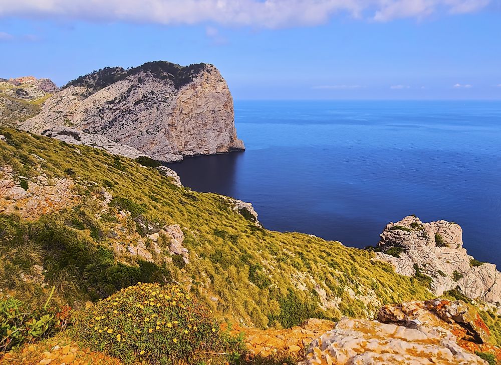
Serra de Na Burguesa
At the southernmost part of the mountain range is the Serra de Na Burguesa, marking the point at which the Serra de Tramuntana touches the Mediterranean Sea. The Bay of Palma marks this point at which the mountain range reaches the sea. This part of the mountain range is situated on the Calvia municipality. Also known as the Sierra de Porto Pi, the mountain is primarily made up of hills and valleys, with an average elevation of 1,300 feet. The highest point of the Sierra de Porto Pi is the Puif d’en Bou with an elevation of 1,650 feet, followed closely by the Puig Gros de Bendinat which stands at 1,594 feet in elevation. As a testament to its name “Sierra de Porto Pi,” which translates to “Port of the Pine Mountain,” the mountain’s ecological composition is primarily made up of pine-tree forests.
Conservation
The mountain range was designated as a UNESCO World Heritage Site in July 2011, due to Serra de Tramuntana’s great cultural and ecological importance. A nature reserve has been established around Serra de Tramuntana aimed at protecting the mountain’s biosphere, made up of many animal and plant species. Despite being located near a region experiencing rapid urbanization, the mountain acts as a haven for some endangered animal species.


