Where is Enewetak Atoll?
Enewetak Atoll refers to a group of islands that is sometimes also known as Eniewetok or may be written as Eniwetok Atoll. This group of islands is located in the Pacific Ocean and has forty islands housing a small population of fewer than 1,000 people. Politically, the region is part of the Ralik Chain (a legislative district) that is part of the larger Marshall Islands. The name was changed to the present name in the year 1974 by the US government. Other islands that are part of the Marshall Islands also had their names changed.
Geography of Enewetak Atoll
In terms of size, the Enewetak Atoll’s total land area does not exceed 2.26 square miles and does not rise beyond 17 feet. At the center of Enewetak Atoll is a lagoon that has a circumference of 50 miles. The formation of Enewetak Atoll occurred on top of a basalt seamount that is about 4,600 feet below the seas level.
Location of Enewetak Atoll
On a map, it can be very difficult to locate Enewetak Atoll. However, the general location of the tiny ribbon of land is in the Pacific Ocean between Hawaii and Australia. To the east of Enewetak Atoll, approximately 190 miles away, is another atoll known as the Bikini Atoll.
History of Enewetak Atoll
Enewetak Atoll has been supporting human life since 1,000 BCE. A Spanish explorer named Alvaro de Saavedra first discovered the island in 1529. Alvaro elected to name the island “Los Jardines" which translates to “The Gardens.”
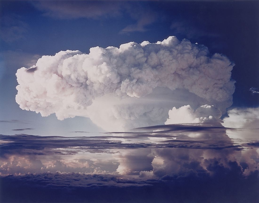
During World War I, the Japanese captured the island but lost their control of the island to the Americans in the early 1940s. The US government saw that the atoll was the perfect place to test the potency of their nuclear weapons. Between the years 1948 and 1958, a total of forty-three nuclear weapons had been tested on the island.
Decontamination of Enewetak Atoll
During the early 1970s, the US military did a survey of the radiological state of the atoll. Later, in 1977, decontamination work of the atoll and other islands used for testing or affected by the testing of nuclear weapons was started. The process took three years to complete and cost around $239 million. The military took at least 111,000 cubic yards of contaminated soil and other substances and mixed it with cement then buried the dried mixture in a crater formed by a blast. The top was covered to form a dome. The mixture was buried at Runit Island. In 1980, the region was declared safe for habitation, and the people returned. The US government agreed to compensate the affected people.
However, even to this day, some parts of Enewetak Atoll cannot be inhabited because they are not fully decontaminated. Projections state that most of the atoll will be safe for human habitation by 2030. These projections may soon not hold ground due to sea-level rise. This will cause the water to seep inside the dome, causing the radioactive substances buried underneath to leak out.