The Finlay River
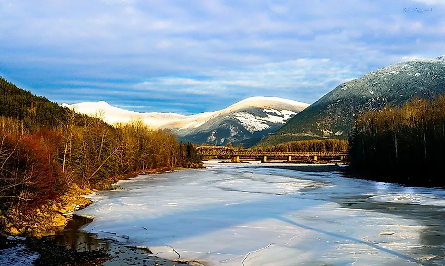
5. Description
The Finlay River is one of the longest rivers flowing in the north-central British Columbia, moving through the northern interiors of the Canadian Province. This river is 402 kilometers (260 miles) long and flows exclusively in this Canadian provincial district. The direction in which the river mainly follows is firstly northern, and then it takes a southern route from Thutade Lake near Omineca Mountain towards Williston Lake, forming impounded waters for the Peace River as well, with the W.A.C. Bennett Dam formed over it. The Finlay River drains an area of around 43,000 square kilometers, and its main tributaries are the Ospika, Ingenika, and Fox.
4. Historical Role
This river was named in honor of the explorer John Finlay, who traveled his way along the river in the year 1797. Samuel Black, who was an explorer and fur trader, was the first European to make the journey to the source of the river, doing so in the year 1824. At the time of naming of this river in the year 1858, it was on the eastern side of the northern boundary of the Colony of British Columbia, while its western half was called the Nass River in the years of 1862 and 1863, and the southern boundary was formed by what were then the Stickeen Territories. This river's current status was adopted on the 6th of March, 1928, and its channels were provided with Sekani language names by the Kaska Tribal Council.
3. Modern Significance
The Finlay River flows down through stunning wilderness areas, and is best known for water sports activities, which can also be enjoyed upon its many tributaries. It flows past the scenic beauty of the Cassiar and Skeena Mountains in northern British Columbia, while on its southern side stands the amazing Stikine Country Parks, and on the south-west area it has the Muskwa-Kechika Management Area. With its free-flowing water and its tributaries, the Finlay itself actually adds charm to the scenic views seen in these neighboring attractions. People also throng this area for fishing and hunting activities. The Finlay River forms a corridor area which stretches for almost 85 kilometers in the famous Finlay-Russel Provincial Park. This corridor area gives tourists here opportunities for hiking and wildlife viewing, and all manner of wintertime recreational activities.
2. Habitat
The area surrounding the Finlay River serves as a home to many wild animals, and the river itself to a number of native aquatic animals. Beyond the river, the area's fauna is mainly found on the mountain slopes and the lake waters of the region. Some of the native animals found in this area are Stone Sheep, Mountain Goats, Grizzly Bears, and Moose. It is also the habitat for many large fish species, which are found in the river's clear waters, and are mostly caught for sporting and recreational purposes by tourists. Though it is not a very populated area, there is small First Nations community at Fort Ware (Kwadacha)), located at the junction point of the Finlay and Warneford Rivers.
1. Threats and Disputes
The area near the Finlay River is recommended to be listed as a “Special Zone” area because of the sprawling mineral wealth found here. The area is being witnessed as a lucrative business area for mining, forestry, and energy development. As such activities proliferate to ever greater degrees, they may pose danger to wildlife, aquatic habitats, and even the First Nation people who reside in this area. The Finlay River area has been designated as an "environmentally sensitive area" by conservationist groups.


