What is Longshore Drift?
Longshore drift is a geological process responsible for transporting sediments such as shingle, silt, clay, and sand along a coast that is aligned to the shoreline, relying on prevailing oblique winds. The prevailing oblique winds send water down the coast generating a water current which in turn advances parallel to the coast. Therefore, longshore drift can be simply defined as sediment transported by the longshore current. The sediment and current movement take place within the surf zone. Numerous sediment sizes are affected by the longshore drift since it works in slightly distinct ways depending on the sediment. For instance, there is a difference in longshore drift between sediments from a shingle beach and those from a sandy beach. Since shingle beaches tend to be much steeper than sandy beaches, a longshore drift is likely to form plunging breakers. In this case, since shingle beaches lack an extended surf zone, a majority of longshore movement will take place in the swash zone. On the other hand, movement of sand sediments on sandy beaches tend to move down the beach in a zigzag manner.
Formulas Used in Calculating Longshore Drift
There are about six formulas that are used in calculating the factors that are considered to cause longshore drift. All of the formulas give a different view into the procedures involved in generating longshore drift. Some of the usual factors considered by these formulas include: breaking and non-breaking waves, bed load and suspended transport, and the flow associated with waves.
Natural Features
There are several features of longshore drift that form along the coast where the process occurs naturally, and they include:
- Tidal inlets: Many of the tidal inlets formed on the shores of a longshore drift gather sediments in ebb shoals and floods. While flood deltas are likely to expand the availability of space in a lagoon system or bay, ebb-deltas are most likely to become stunted when in smaller spaces or highly exposed shores.
- Barriers: These are systems connected to the land at the distal and proximal end, and they happen to be the widest at the down-drift end. Such barriers may surround a lagoon system or an estuary, a good example of such is Lake Ellesmere which is encompassed by the Kaitorete Spit. Another example is the hapua forming at the river-coast interface, for instance, at the mouth of River Rakala.
- Spits: These are created when longshore drift moves beyond a re-entrant or river mouth point where dominant drift direction and the shoreline do not turn in the same direction. Spits, just like dominant direction are heavily influenced by wave angle, the height of prevailing waves and the strength of the wave-driven current.
Human Influence
Just like natural features, there are human influences that result in long drift features. In some cases, such features are constructed to increase the consequences of longshore drift along the shoreline. Here are a few examples:
- Harbors and the ports: The worldwide creation of ports and harbors can have a serious effect on the natural trajectory of longshore drift. Both ports and harbors pose a short-term threat to longshore drift. Similarly, they are also a threat to shoreline evolution. Change of sedimentation patterns is one of the key impacts caused by the creation of harbors and ports on a shoreline drift. Such changes may result in the erosion of a coastal system or beach.
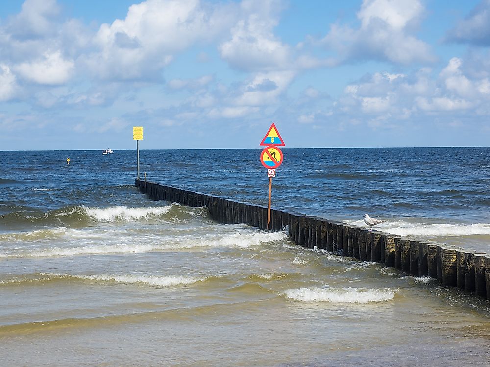
- Groynes: These are structures built along the coastline to cross the intertidal zone and stop coastal erosion, and they are placed at an equal interval. Groynes are mostly used on shorelines that have high annual and low net longshore drift. The structures hold on to sediments lost during heavy storms.