What Is A Yazoo Stream?
In hydrological or geological terms, a yazoo stream is a tributary stream that lies within a single floodplain with a larger river and runs parallel to the river for a long distance and eventually joins it downstream. A natural or man-made levee between the stream and the bigger river usually blocks the two from joining. In most cases, the yazoo stream and the major river run on an almost equal elevation before joining at a "deferred junction" or a "belated confluence." Originally, the name yazoo referred to an almost extinct Native American Yazoo Indians, although in the Native America Choctaw language found in Mississippi the word translates to "the River of Death.” However, the universal name yazoo stream comes from the Yazoo River that runs parallel to the Mississippi River.
Formation of Yazoo Streams
A yazoo stream can form in two natural ways; these are through natural levees or through glacial processes. In addition, human activities and safety needs within floodplains usually lead to people building levees to protect them from floods.
Natural Levees: Usually, natural levees form on a mature floodplain of an old river or stream. When the river floods, water fills the floodplain which creates two distinct water velocities; the fastest velocity in the river channel and a slower velocity on the floodplain. The floodplain, therefore, has a lower load carrying capacity than the river channel and, consequently, alluvial sediments settle on the river banks and the floodplain. After flood subsides, the deposits block the tributary’s original route. Continuously, the sediments rise and form a natural levee which is strong enough and can withstand forces from smaller streams and tributaries. Additional floods widen the levee and separate a tributary from entering the main river at a particular point and distance. This long levee makes the tributaries that want to enter the river to instead run parallel (or in small meanders) to it downstream until where the levee disappears.
Glacial Processes: Glacial movements, like the Mendenhall Glacier, carve out a wide area leaving a flat floodplain or a floodplain with a dome at the center. Tectonic forces lift create high valley wall and glacial outwash (natural levee) create two rivers running parallel to each other.
Man-Made: People also build levees within flood plans to protect their homes and properties from floods. This process happened in 1927 in parts of the Yazoo Basin.
Examples of Yazoo Streams
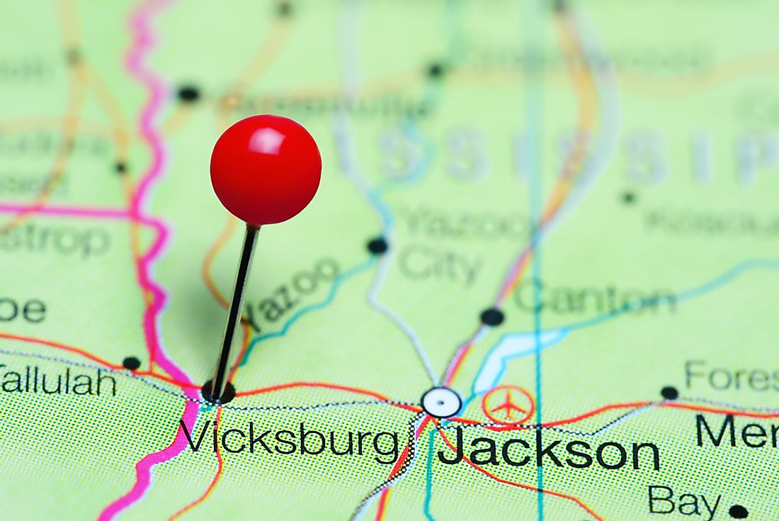
Yazoo River, a confluence of the Yalobusha and Tallahatchie rivers, meanders for 170 miles almost parallel to the Mississippi River. In 1886, residents added a system of man-made levees to stop larger streams’ headwater flooding of their cotton farms. Today, 200 miles of levees extends from the southern Memphis before joining the Mississippi River at Vicksburg. Along this distance, there are several natural and man-made levees. During the recent Little Ice Age, glacial processes formed the Montana creek which, together with the Jordan creek on both sides of the Mendenhall River, run parallel to it within the Mendenhall floodplain for several miles due to the two natural levees separating them from joining the Mendenhall River. Other examples include several tributaries of the Wakarusa River in eastern Kansas.