What Is A Submerged Continent?
A submerged continent is a continent or a large landmass that is predominantly under water. There are two known submerged continents, the Kerguelen Plateau and Zealandia. The rising levels of the sea are thought to have caused the sinking of the submerged lands.
The Kerguelen Plateau
The Kerguelen Plateau is a submerged continent located in the southern part of the Indian Ocean. The plateau is one of the Large Ingenious provinces of the world with an area of approximately 480,000 square miles. It is raised above the adjacent oceanic basins. The plateau is said to have originated from the Kerguelen hotspot either before or after the split of Gondwana. The plateau is believed to have once been a part of a continent 100 million years ago before it broke off and sunk. The landmass is thought to have submerged around 20 million years ago and now is at 3,300 feet to 6,600 feet below sea level. Some parts of the plateau are above sea level, and they are the Heard and McDonald Islands and the Kerguelen Islands. During the southern summer season, the southern part of the Kerguelen Plateau becomes home to several whale species that migrate to the area.
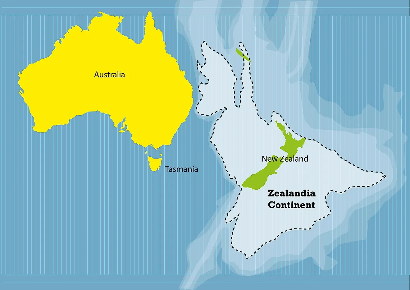
Zealandia
Zealandia is a continental crust that broke off from Australia about 85 million years ago and is partially beneath the Pacific Ocean. Bruce Luyendyk came up with the theory and name of Zealandia in 1995. The landmass is thought to have once been completely submerged about 23 million years ago, but today around 93% of the land surface is below sea level. Zealandia has an area of about 1,900,000 square miles and is thought to be the biggest existing micro-continent. In 2017 scientists argued that Zealandia has the characteristics of a continent and should be considered as such rather than a micro-continent. The total land area of Zealandia above water is 110,678 square miles, New Zealand and several neighboring islands make up 93% of the land area with an area of 103,471 square miles. New Caledonia and its surrounding islands make up 7% of the continent's land area at 7,172 square miles; the remainder of the area is made up of Elizabeth and Middleton reefs, Norfolk Island, and Lord Howe Island. The Zealandia population is estimated at five million.
The Search for Lemuria
Lemuria was once, in the 1930s, theorized as a lost continent located either in the Pacific or Indian Oceans. This theory portrayed Lemuria as a land bridge, but this has been invalidated. When the theories of plate tectonics and continental drift gained acceptance by scientists, the theory about Lemuria was refuted. Some of the lands thought to have existed before getting submerged and lost include Sundaland, Dvaraka, Beringia, Maui Nui, Doggerland, Part of Malta, Strand, New Moore Island, Jordsand, Verdronken Land van Reimerswaal, Sarah Ann Island, Dunwich, Ferdinandea, and Ravenser Odd.


