What Is A Lahar?
A lahar is a violent and dangerous debris flow or mudflow composed of a slurry of rocky debris, pyroclastic material, and water. Typically, the materials flow from a volcano down along a river valley. The word lahar is derived from the Javanese language, namely from the word wlahar.
Lahars can be very destructive depending on their size and speed. Small lahars can be a few feet wide and several feet deep, flowing at a few feet per second, while large lahars can be hundreds of feet wide and tens of feet deep, and can flow at speeds of up to 22 mph. Large lahars can be up to 460 feet deep, covering up to 190 miles, and reaching speeds of up to 60 mph. With such enormous flow and speed, they are capable of destroying anything in their path. Examples of lahars include those experienced at Nevado del Ruiz and Mount Pinatubo. Approximately 5,600 years ago, an immense lahar was produced by Mount Rainier in the US state of Washington, which covered an area of 130 sq mi and had a volume of about 0.55 cu mi.
Causes of Lahars
Several factors can trigger lahars. Although usually associated with volcanic activity, lahars can occur without volcanic activity if the necessary conditions trigger the collapse and flow of mud from existing deposits of volcanic ash. Therefore, glaciers and snow can melt during hot weather can cause lahars. Similarly, earthquakes that occur near a volcano can also cause materials to become loose and collapse, resulting in a lahar avalanche. Heavy rainfall also has the potential to cause lahars, especially on unconsolidated pyroclastic deposits.
Places That Experience Lahars
Numerous mountain areas around the world are likely to experience lahars. Certain areas have been noted to have the highest potential, including Mount Ruapehu (New Zealand), Mount Rainier (United States), and Galunggung and Merapi (Indonesia). Various urban area, such as those in the Puyallup River valley in the US state of Washington, including Orting, Sumner, and Tacoma, are situated on lahar deposits estimated to be about 500 years old. It is estimated that lahars flow through the valley every 500 to 1000 years, and therefore cities like Tacoma, Fife, Puyallup, Summer, and Orting are at a considerable risk of lahars.
Warning Measures
Lahar warning sirens have been established by the United States Geological Survey (USGS) in Pierce County, Washington, to notify people of imminent debris flows from Mount Rainier in case of eruption. Similarly, lahar warning systems have been created near Mount Ruapehu by the New Zealand Department of Conservation (DOC). In March 2007, officials were praised for alerting the public of an impending lahar. Warning systems have also been installed near Mount Pinatubo, which have been active since 1991 to monitor and warn against lahars.
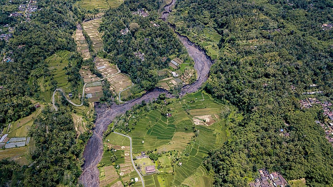
Mount Pinatubo
Mount Pinatubo in the Philippines erupted in 1991, causing a significant lahar. When it first erupted, the volcano killed six people, but the lahar that followed resulted in approximately 1,500 deaths. Typhoon Yunya went over Mount Pinatubo when it erupted, and the rain caused by the typhoon triggered a flow of volcanic ash down the river valleys surrounding the mountain. The lahar from the volcano flowed through the Abacan River and Sapang Balen Creek, causing destruction in Pampanga, Angeles City, as well as neighboring towns. The mudflow was about 20 ft high.