What Causes A Weather Front?
Description
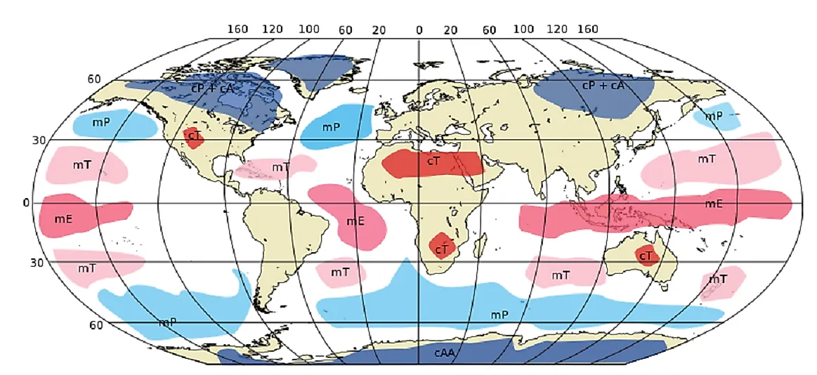
When there are two air masses which are characteristically different, their collision is often also the cause strong meteorological phenomena. When the two air masses of distinct moisture levels collide, then they usually give rise to a higher moisture level. According to the reports given by major weather analysts, it is said that when these weather fronts pass over a certain area, then it causes a change in weather and gives rise to such events as thunderstorms, tornadoes, and gusty winds. These air masses included in the weather front have features like humidity or the temperature, and their direction is guided by the wind in the form of "Jet streams, and even underlying mountains and other geological features can influence their paths as well.
Types of Weather Fronts
Following are the types of weather fronts which are formed by the characterized features of two air masses, and are categorized as:
- Cold Fronts: These are caused by drops in temperature, and normally lie within a sharp surface trough. They produce sharper change in the weather and move up to two times more powerfully than the warm fronts in the air, causing rapidly developing thunderstorms. They come in association with the low-pressure area, and form a line of showers if enough moisture is present in the front.
- Warm Fronts: The warm fronts especially lie within the broader troughs of low pressure than the cold fronts, though these move more slowly upwards in the area. Their locations are often also marked on meteorological maps with semicircular red lines in the direction of travel.
- Occluded Front: When the cold front in the air takes over the warm front, this causes the dominance of the cooler air in the air mass. As it takes over the warm front, it gives rise to two forms of "occlusions" in the air, and these characterize the mature forms of the storm systems.
- Stationary Front: This is actually a non-moving kind of boundary between two different air masses, and remains in the same area for most of the time. A wide variety of weather is found along this area, and is visible in the form of clouds or precipitation. When these fronts are formed into smaller zones, they come to be known as "shear lines".
Movements of Weather Fronts
The movement of weather fronts is guided by the winds moving them aloft, within which can be noticed the fact that usually the cold and occluded fronts move into the northwest to southeast direction, while warm fronts move from the southwest to the northeast direction in the Northern Hemisphere. Usually, however, this is effectively the opposite in the Southern hemisphere. The weather fronts' movement is generally caused by the gradient front, or through the Coriolis Effect.
Effect of Fronts on Weather
These weather fronts impose a significant level of control on the weather conditions when they advance forward towards each other and, in some cases, will collide and then form violent storm conditions as a result. It is seen that these thunderstorms are most unusual, as the cold front makes the warm air pushed upwards. If there is any moisture present in the air, then it leads to the formation of the clouds.

