Mountain And Glacial Landforms: What Is A Cirque?
What Are Glacial Landforms?
Glacial landforms are created by the action of the glacier through the movement of a large ice sheet. The glacial landforms can either be erosional or depositional depending on the action of the glacier. When glaciers retreat leaving behind crashed rocks and debris they create depositional landforms, but if the glaciers expand as a result of their accumulating weight crushing in the process and abrade scoured surface rock or bedrock, then it will lead to the formation of erosional landforms. Depositional landforms include eskers, kame, and Moraine while erosional landforms include Cirque, glacial horns, and arête. Apart from landforms, glaciers may also be striking features including lakes and ponds, particularly in the Polar Regions.
What Is A Cirque?
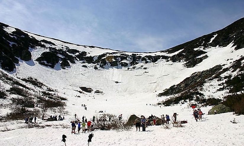
A cirque, or Corrie, is an amphitheater-like valley created by glacial erosion. The glacial cirque is opened on the downhill side while the cupped section is steep. The cliffs on the sides slope down and combine and converge from three or more higher sides. The floor of the cirque is bowl-shaped because of the convergence zones of combining ice flows from a different direction and the debris accompanying them. A Cirque experiences greater erosion because of the accompanying rock burdens which may also over deepen the level of a cirque. Cirques subjected to seasonal melting often form small lakes called tarns behind the Moraine.
Formation Of Cirque
Cirque can be formed through glacial erosion or fluvial erosion. Cirque formed through glacial erosion is called a glacial cirque while fluvial cirque is formed by fluvial erosion. Glacial cirques are found in mountain ranges across the world and are typically about one kilometer long and one kilometer wide. Glacial cirques are situated high on mountainsides near the firn line and are surrounded on three sides by a cliff. For glacial cirques to be formed the slopes must be protected from sun’s energy and prevailing wind. The sheltered side encourages the accumulation of snow which turns into glacial ice. A hollow on the slope is then enlarged by ice segregation and glacial erosion. The ice segregation erodes the rock causing it to disintegrate resulting in avalanche bringing down more snow and rock to the already growing polar ice. The hollow becomes bigger allowing for more glacial erosion leading to the formation of a bowl shape on the side of the mountain with a weathered headwall. The bowl becomes deeper with the increased ice erosion creating a glacial cirque. An arête, which is also a glacial landform, will be formed if two adjacent cirques erode toward one another. Cirques formed from fluvial erosion are less common compared to glacial cirque. For fluvial-erosion cirques to be formed there must be a terrain which includes an erosion resistant upper structures which are overlying the easily eroded material. Some erosional cirques were formed by the river flow cutting through limestone and chalks.
Location Of Cirques Around The World
An example of Cirque formed through fluvial erosion is found on the Reunion Island and include the tallest volcanic structure in the Indian Ocean. The cirques in Europe include Circo de Gredos in Spain and Cirque de Garvanie in France, Summit Lake and Great Gulf in the US, and Chandra Taal in India. Cirques are famous tourist destinations because of their striking features. They are also major small lakes which feed smaller streams around the mountains.


