Mount Mayon: Facts and History
Location and Geography
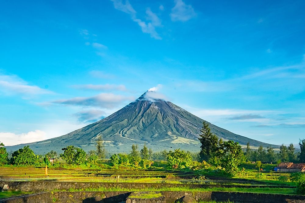
Mount Mayon is an active volcanic mountain located in the Philippines. More specifically, it is in Albay province of the island of Luzon roughly 205 miles southeast of Manila. Mayon, as it is commonly called, is the main and highest marker of the entire Albay province. The mountain has an astounding height of 807 feet above the beaches of the Albay Gulf. Eight cities and municipalities share the mountain’s geographical location. These cities are Legazpi, Ligao, Guinobatan, Santo Domingo, Malilipot, Daraga, Tabaco, and Camalig. All these cities surround Mayon. If viewed from above, the cities’ boundaries appear to divide the mountain as a pie would be divided.
Mount Mayon is a stratovolcano, that is, it is made out of alternating strata of lava and ash and is part of the Ring of Fire in the Pacific Ocean. At the summit, there is a crater. The cone-shaped mountain is deemed as one of the most perfectly formed mountains because of the symmetry it possesses. Towards the top, Mayon is steeper with the slopes angling between 35 and 40 degrees.
History of Eruptions
The past half the millennium has seen Mayon erupting more than 50 times. The first recorded eruption was back in the 18th century in July 1766.
The worst eruption was on February 1, 1814. The eruption completely buried the town of Cagsawa and caused massive destruction of lives and property. The ash accumulated to a height of nine feet which killed 2,200 people.
Further eruptions occurred late in the century between July 1881 and August 1882. An account by a geologist, Professor Samuel Kneeland, says that the volcanic action went on for five months continuously. A decade passed and there was more eruption again in June 1897.
Three eruptions occurred in the 20th century in 1984, 1993, and then again in 1999. Thankfully, in this period, the damage and loss of life were minimal. Further eruption happened in 2006, 2008, 2009–2010, 2013, 2014, and now in 2018.
Current Eruption Facts
On January 13, 2018, there was another explosion containing steams, ash, and lava pouring. One day later, the threat level was raised to 3 and more than 3,000 villagers forced to abandon the nearby places and give Mayon a seven miles buffer. Level 3 alter means that there is a higher potential for a hazardous eruption.
Two days later, on January 16, 2018, a state of calamity was declared by the authorities because the seven miles buffer was not enough as lava flows reached its edges. January 16, 2018, again saw another raise in the threat level from 3 to 4. Most activities including schools were suspended. On the mountaintop, lava showers, and explosions of magma could be observed accompanied by emissions of ash. In addition, rockfalls and fire bombs could be seen and heard.
A day later, the lava fountains had increased in size to between 900 and 1,700 feet in height with columns of ash. Even more ash columns were spewed a day later, on January 24, 2018, further increasing fears and keeping the mountain active.


