10 Important Facts Related To The Beaufort Sea
The Beaufort Sea is named after Sir Francis Beaufort, a hydrographer. The sea is a marginal sea of the Arctic Ocean. It is situated on the northern side of the Northwest Territories of Yukon and Alaska. The sea has a number of features and characteristics that are quite interesting. Some of the most notable facts related to the Beaufort Sea include the following.
1. Extremely Cold Temperatures
The Beaufort Sea is usually frozen most of the year. For this reason, plant and animal life in the sea is limited. The months of August and September are the only slightly warm months compared to the other ten months when the sea is frozen. However, after 2000, there have been tremendous climatic changes in the Arctic. Some of the areas that were normally covered with ice are now ice-free. Thawing in the channels of the Mackenzie River usually occurs from as early as late May to early June. The shores experience Southwesterly and westerly winds which are mostly caused by the water currents that form the clockwise-directed Beaufort Gyre.
2. Distinct Water Layers of the Beaufort Sea
The water of Beaufort Sea is usually divided into four separate layers. The topmost layer, which is referred to as “surface water” is usually around 100 meters deep. The temperature of the surface water is usually approximately −1.4 °C during the summer period and −1.7 °C in winter. The second layer is as a result of waters from the Pacific Ocean and the Bering Strait. The waters are channeled into Beaufort Sea by the Bering Strait. The Atlantic layer, which is the third layer, is the warmest. Temperatures of the third layer are usually between 0 and 1 °C. The bottommost layer usually has temperatures varying between −0.4 and −0.8 °C
3. Rich Natural Resources of the Beaufort Sea
There are a number of natural resources found in the Beaufort Sea. Petroleum and natural gas are the most notable resources with the largest reserves in the sea. Exploitation of petroleum and natural gas began in the 1950s. Offshore drilling of petroleum and natural gas was first undertaken in 1972. From then, over 200 wells were constructed by the year 2000 to facilitate the process of drilling. Amauligak Field, which is the largest oil reserve in the Beaufort Sea, was discovered in 1984. Taglu Gas Field is the major gas field in the sea. It was discovered in 1971. Some of the petroleum and gas reserves have not been exploited to date because of their remote location. Mackenzie River brings in over 14 million tons of sediments rich in dolomites and calcium carbonate.
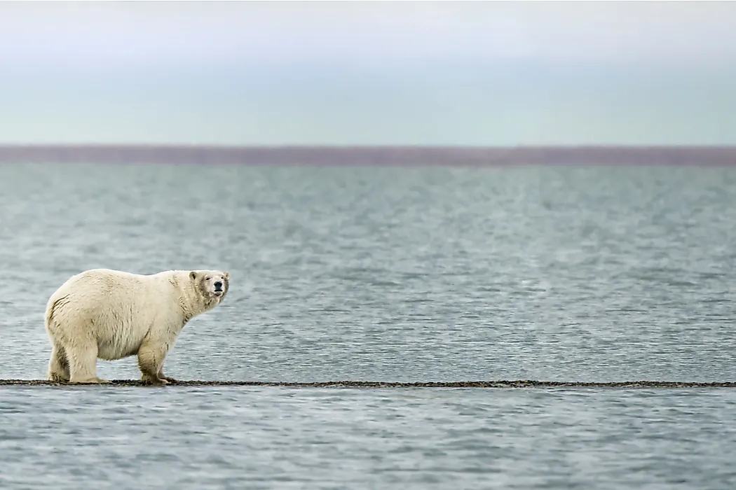
4. Diverse Flora and Fauna of the Beaufort Sea
The flora and fauna of the Beaufort Sea is very diverse. In fact some of the species are endangered yet endemic to the sea. The Mackenzie River makes a perfect habitat for whales, seabirds, and muskrat. The eastern side of the sea is inhabited by a large number of Beluga whales. In fact, the population of the Beluga whales is stable and increasing gradually. The whales migrate to the coastal areas of the Mackenzie River Delta during the summer. In the summer, the region is not covered by ice. Polar bears are also seen along the shores of the Beaufort Sea. There are over 70 species of zooplanktons and 60 species of phytoplanktons inhabiting the Beaufort Sea. There hundreds of species of mollusks and crustaceans inhabiting the sea.
5. Declining Population of Most Marine Life
The Beaufort Sea has experienced a steady decline in the marine life over the years. Bowhead Whales were among the most hunted species in the Beaufort Sea, especially between 1888 and 1914. However, due to the rapid decline in their population, the hunting had to be restricted. The governments regulated the fishing in the sea to help protect the rapidly declining population of the marine creatures in the sea. The regulations have helped to protect some of the threatened species in the sea.
6. Mouth of Many Rivers
Several rivers flow into the Beaufort Sea. The most notable of the rivers is the Mackenzie River that flows from Canada. Mackenzie River is the longest river in Canada which empties its waters into the Canadian part of the Beaufort Sea. Other notable rivers that empty into the sea are Kongakut River in Alaska and the Firth River in Yukon.
7. A Source of Border Disputes Between the United States and Canada
The Beaufort Sea is a major source of border dispute between the US and Canada. There is a wedge-shaped area in the Beaufort Sea that is being claimed by the US state of Alaska and the Canadian state of Yukon. The 21,000 square kilometer area which is disputed by the two countries is viable for oil, shipping, and fishing ventures. The dispute dates back to several years. Both countries have different arguments on why the area of the sea should belong to them and not the other. Canada’s ownership dates back to St Petersburg Treaty of 1825. The United States, on the other hand, argues that the area overlying their country should rightfully belong to them.
8. Growing Pollution in the Beaufort Sea
The sea has experienced pollution due to several factors that affect different parts of the sea. The key cause of pollution in the sea is oil spill during shipping and oil drilling processes. Some of the rivers emptying into the Beaufort Sea carry along different chemicals and refuse which pollutes the waters. The pollution affects marine life in the sea.
9. The Beaufort Sea Has Artificial Islands
There are several islands situated in the Beaufort Sea. Some of them are natural and others are artificial. Artificial islands in the sea include Endicott and the Northstar Islands. The two artificial islands were set up to facilitate effective oil drilling. Endicott was set up in 1987 whereas Northstar was set up in 2001.
10. Settlements near the Beaufort Sea
There are several human settlements in the sea. Key among them includes the Tuktoyaktuk in Canada which had a population of 900 in 2009. The Prudhoe Bay in Alaska is permanently inhabited by thousands of people. People living in the bay are mostly mine workers in the oil drilling companies and fishermen. Most contract workers in Prudhoe are employed in the Prudhoe Bay Oil Field. Prudhoe Bay Oil Field is located in the coastal lowland on the Northern Slope.


