Maps of Peru

Peru, located on the western side of South America, shares its borders with five countries: Ecuador and Colombia to the north, Brazil to the east, Bolivia to the southeast, and Chile to the south. Its western border lies along the Pacific Ocean. Covering a total area of approximately 496,224 square miles (1,285,216 square kilometers), Peru presents a diverse and complex geographic structure divided primarily into three distinct regions: the Costa (coastal region), the Sierra (highland region), and the Selva (jungle region).
The Costa, representing a narrow strip of desert plain that stretches from the northern tip of the country to the southern border, makes up around 12% of the total area of Peru. This region extends nearly 2,414 miles (3,885 kilometers) along the Pacific Ocean and has an average width of about 30 to 60 miles (50 to 100 kilometers). Despite its predominantly desert landscape, the Costa contains numerous river valleys that support substantial agricultural activity.
Parallel to the Costa, the Sierra, also known as the Andean highlands, runs from the north to the south of the country. This region includes the towering peaks of the Andes Mountains, among them Huascarán, the highest peak in Peru, standing at 22,205 feet (6,768 meters). The Sierra accounts for about 28% of the country's total area. It is characterized by high plateaus and deep valleys, often leading to contrasting climate conditions. This region is also home to Lake Titicaca, which Peru shares with Bolivia. Known as the world's highest navigable lake, Lake Titicaca is situated at an altitude of 12,507 feet (3,812 meters) above sea level.
East of the Sierra, the Selva, the largest of the three regions, spans over 60% of the country. It encompasses the vast Amazon Rainforest, featuring numerous rivers, the most significant of which is the Amazon River. Originating from the Andes, the Amazon River traverses the country from west to east before emptying into the Atlantic Ocean after flowing through multiple countries. The Selva's landscape consists of dense rainforests, expansive wetlands, and towering river cliffs. It is a region of immense biodiversity and hosts a significant portion of the world's species.
Regarding islands, Peru has a number of coastal and lake islands. The largest and most important coastal islands include the Ballestas Islands, known for their rich marine life, and San Lorenzo Island, the largest island of Peru, located off the coast of Callao. In Lake Titicaca, the Uros Islands, which are man-made from reeds, and Taquile Island are of particular note.
Regions of Peru Map

Peru (officially, the Republic of Peru) is divided into 25 regions (regiones, singular - region) and 1 province (provincia). In alphabetical order, the regions are: Amazonas, Ancash, Apurimac, Arequipa, Ayacucho, Cajamarca, Callao, Cusco, Huancavelica, Huanuco, Ica, Junin, La Libertad, Lambayeque, Lima, Loreto, Madre de Dios, Moquegua, Pasco, Piura, Puno, San Martin, Tacna, Tumbes and Ucayali. Lima is the province in Peru. The regions are further subdivided into a total of 196 provinces (provincies) and 1,869 districts (distritos). [Note: Callao, the largest port in Peru, is also referred to as a constitutional province, the only province of the Callao region].
Covering an area of 1,285,216 sq.km , Peru is South America's 3rd largest country and the 19th largest country in the world. Located on the coast of the Pacific Ocean is, Lima - the capital, the largest and the most populous city of Peru. Lima is also the 4th largest city in South America and the 2nd largest city in the Americas. It is the administrative, cultural, educational, commercial and economic hub of the nation.
Where is Peru?

Peru is a nation located on the western coast of South America. It is situated just to the south of the Equator and is geographically positioned both in the western and southern hemispheres of the Earth. Peru is bordered by Colombia and Ecuador to the north; by Brazil to the east; by Bolivia to the southeast and by Chile to the south. It is also bounded by the South Pacific Ocean to the west.
Peru Bordering Countries: Bolivia, Ecuador, Chile, Brazil, Colombia.
Regional Maps: Map of South America
Outline Map of Peru

The above blank map represents Peru - a country located in Western South America. The above map can be downloaded, printed and used for geography education purposes like map-pointing and coloring activities.

The above outline map represents Peru, a country located in Western South America. Peru is known for its diverse landscapes and wildlife.
Key Facts
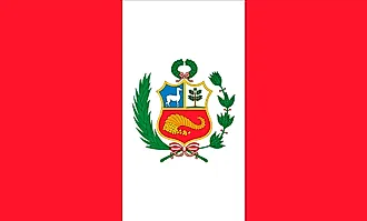
| Legal Name | Republic of Peru |
|---|---|
| Flag |
|
| Capital City | Lima |
| 12 03 S, 77 03 W | |
| Total Area | 1,285,216.00 km2 |
| Land Area | 1,279,996.00 km2 |
| Water Area | 5,220.00 km2 |
| Population | 32,510,453 |
| Major Cities |
|
| Currency | Nuevo sol (PEN) |
| GDP | $226.85 Billion |
| GDP Per Capita | $6,977.70 |
This page was last updated on June 27, 2023