Maps of Australia
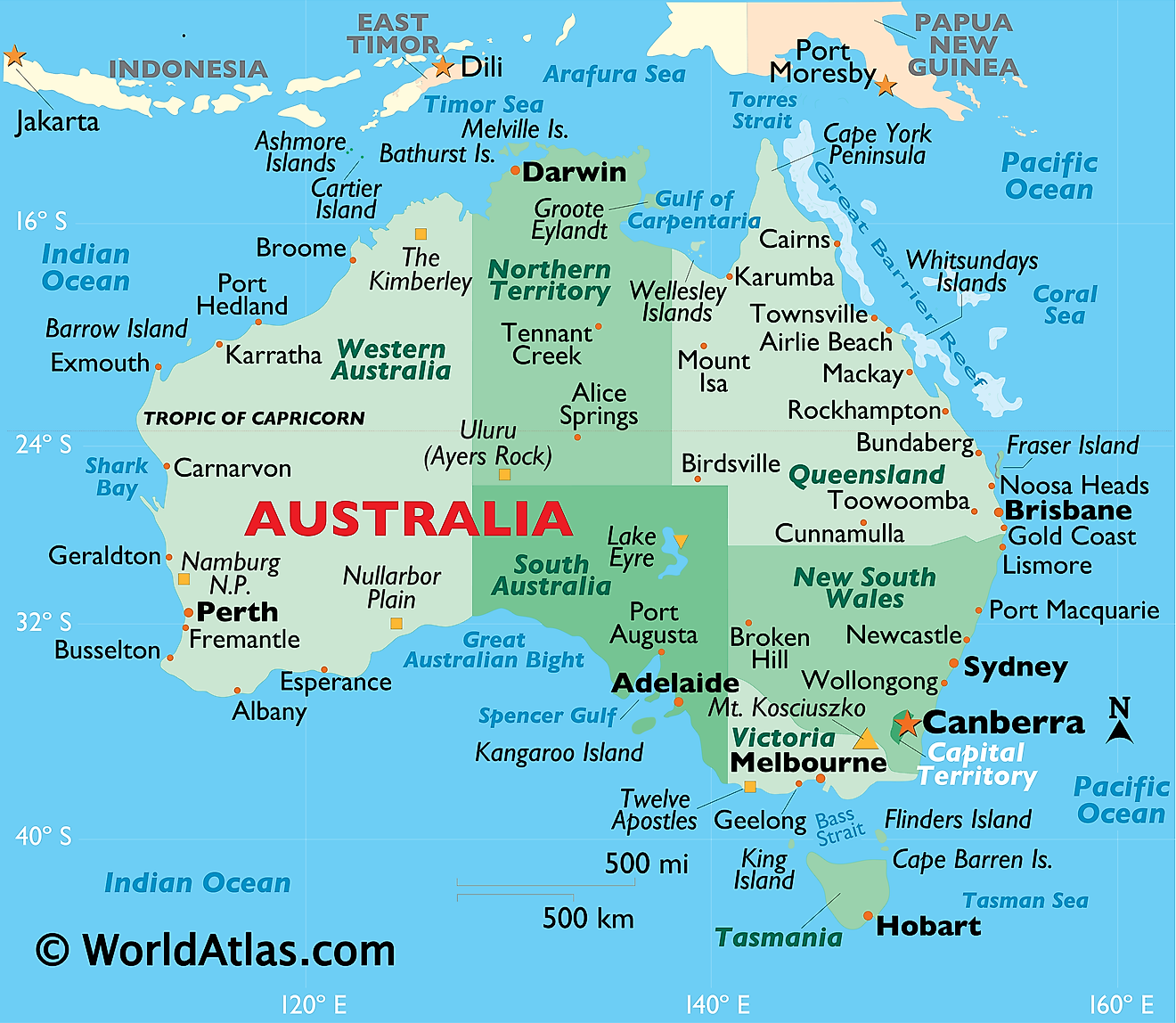
Australia, officially known as the Commonwealth of Australia, is located in the Southern Hemisphere between the Indian Ocean to the west and the South Pacific Ocean to the east. It is the sixth-largest country worldwide, spanning approximately 7,741,220 square kilometers (2.99 million square miles), and is unique as a single nation that also encompasses an entire continent. With a population of around 26.6 million, its government is centered in the purpose-built capital, Canberra. Most Australians reside in coastal cities like Sydney and Melbourne. The country consists of six states—New South Wales, Queensland, South Australia, Tasmania, Victoria, and Western Australia—and two mainland territories: the Australian Capital Territory and the Northern Territory.
Australia has no land borders. Its closest neighbors are Indonesia, East Timor, and Papua New Guinea to the north; the Solomon Islands, Vanuatu, and New Caledonia (a French territory) to the east; and New Zealand to the southeast. The mainland is divided into three main physiographic regions: the Eastern Highlands, the Central Lowlands, and the Western Plateau.
The Eastern Highlands

The Eastern Highlands, better known as the Great Dividing Range, run parallel to the east coast from the northeastern tip of Queensland through New South Wales and into central Victoria. It is Australia's longest mountain range and the third-longest land-based range in the world. Australia's highest point, Mount Kosciuszko, reaches 2,228 m (7,310 ft) in the range's Snowy Mountains. The fertile coastal strip on the seaward side of the range holds most of the country's population and its largest cities.
The Central Lowlands
The Central Lowlands, situated between the highlands and the Western Plateau, encompass the Murray-Darling Basin—Australia's key agricultural region—and the expansive Great Artesian Basin, one of the world's largest underground freshwater reserves. The Murray River, at 2,508 km (1,558 mi), is Australia's longest river and flows through this area, with the Murray-Darling system being the country's longest waterway overall. Additionally, the lowlands host Lake Eyre, a typically dry salt lake approximately 15 meters below sea level, making it the lowest point in Australia.
The Western Plateau
The Western Plateau spans nearly 70% of Australia, forming a vast area of ancient, flat, low terrain. It contains major deserts such as the Great Victoria, Gibson, and Simpson Deserts, as well as Uluru, a prominent red monolith near the center of the continent. Its rocky surface conceals some of the world's most valuable mineral deposits, particularly the extensive iron-ore reserves in the Pilbara and notable gold deposits.
Islands
Australia's territory encompasses over 8,000 islands. The largest is Tasmania, a mountainous region about 240 km (149 miles) south of the mainland, covering approximately 68,401 sq km (26,410 sq miles). Other significant islands include K'gari (previously Fraser Island), the world's largest sand island, and Kangaroo Island, known for its diverse wildlife.
The Great Barrier Reef

Off the northeast coast of Queensland lies the Great Barrier Reef, the world's largest coral reef system and a UNESCO World Heritage site. Extending over 2,300 km (1,429 miles), it comprises thousands of reefs and hundreds of islands, so expansive that it is visible from space. The reef provides habitat for countless marine species, including fish, whales, dolphins, and six of the seven marine turtle species worldwide.
Political Map of Australia
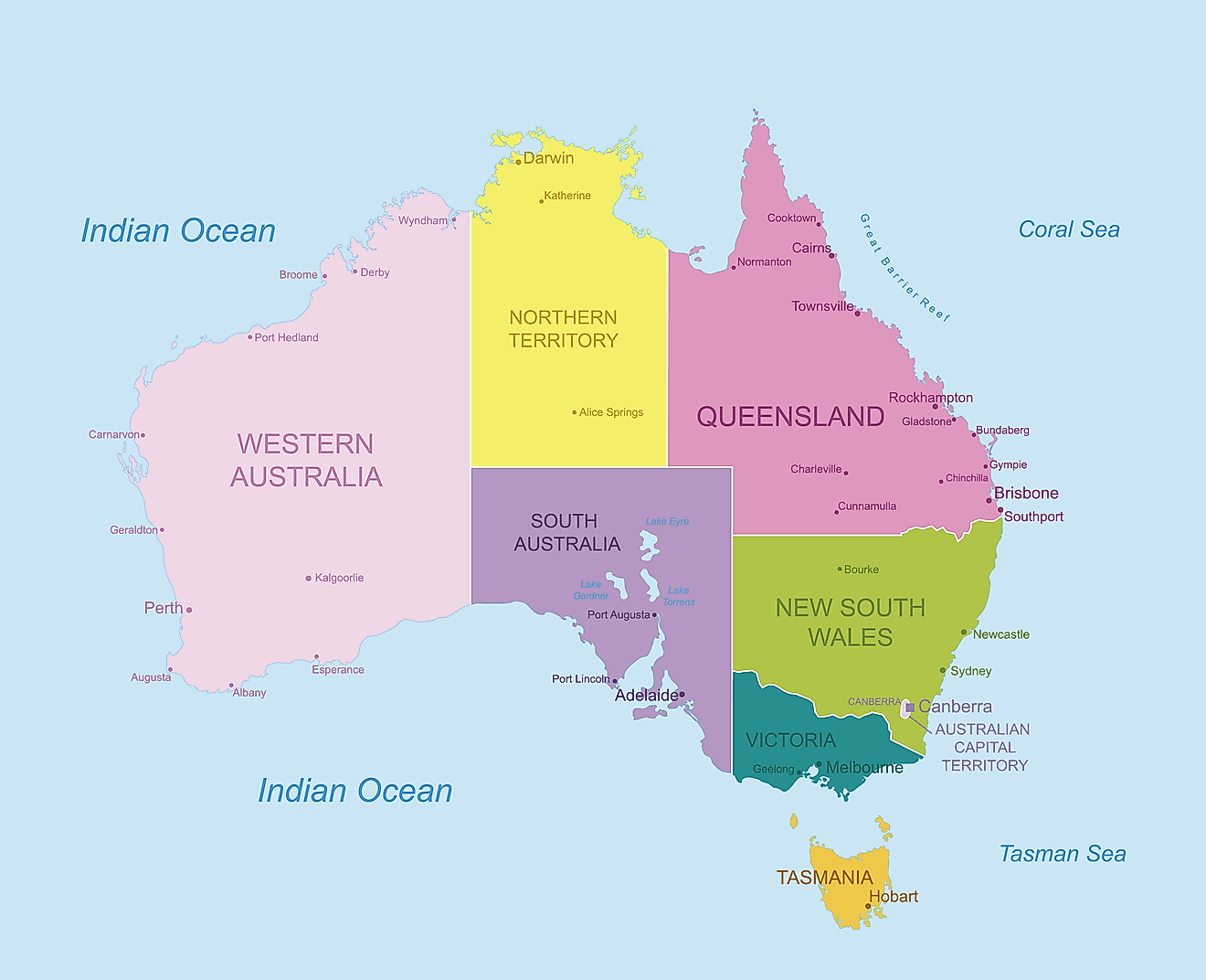
Australia (officially, the Commonwealth of Australia) is divided into 6 states and 2 major mainland territories. In alphabetical order, the states are: New South Wales, Queensland, South Australia, Tasmania, Victoria and Western Australia. The two major mainland territories are: Australian Capital Territory and Northern Territory. In addition to these, there are seven external territories – Ashmore and Cartier Islands, the Australian Antarctic Territory, Christmas Island, the Cocos (Keeling) Islands, the Coral Sea Islands, Heard Island and McDonald Islands and Norfolk Islands.
Located in the northern edge of the Australian Capital Territory, in the southeastern part of the country is, Canberra – the capital of the Federation of Australia. It is also the country’s largest inland city and serves as the central administrative center of the federation. Situated on the country’s southeastern coast is, Sydney – the largest and the most populous city of Australia and Oceania. Its strategic location and magnificent harbor, makes it one of the chief ports in South Pacific. Melbourne is Australia’s 2nd largest city.
Where is Australia?
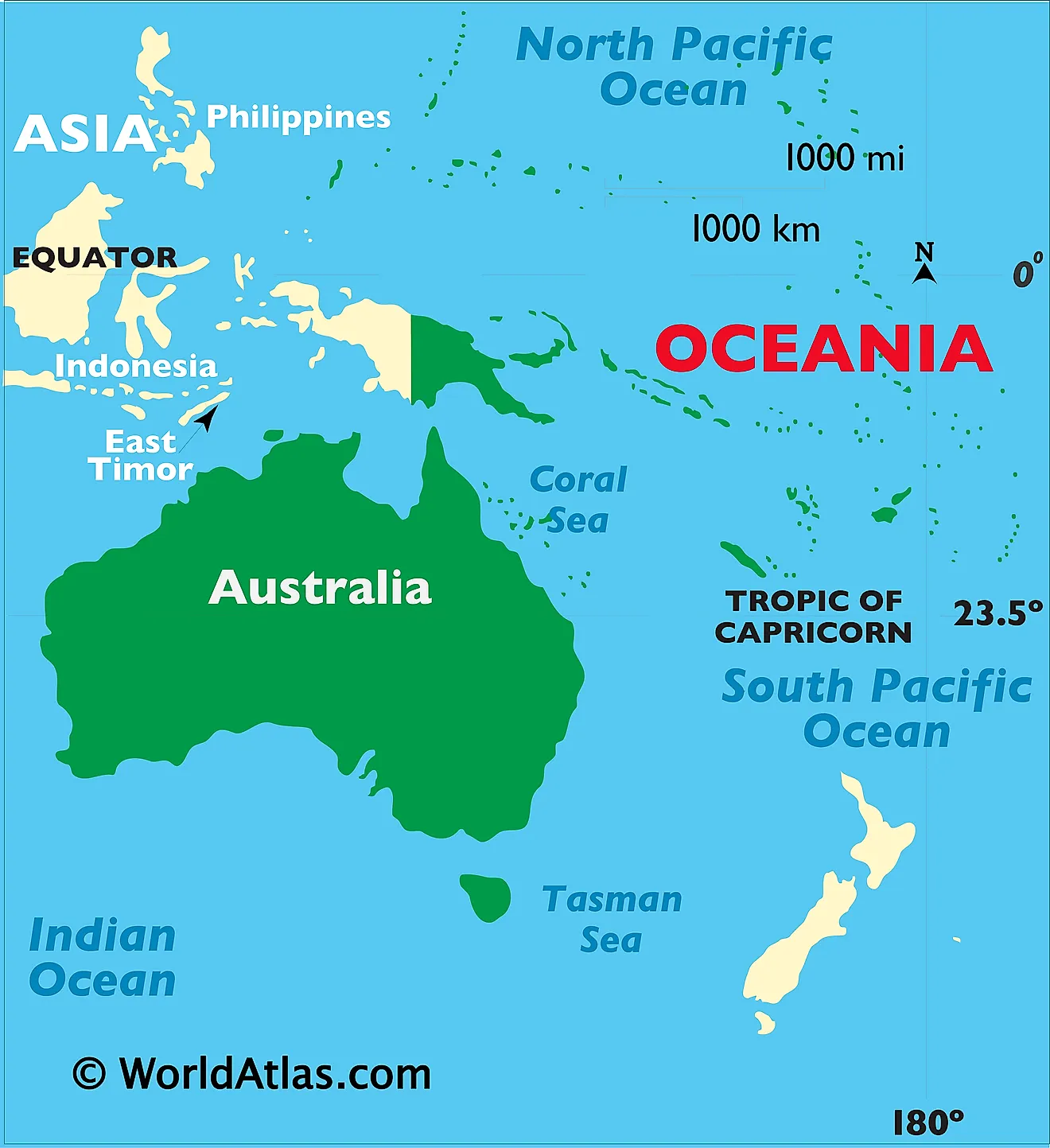
Australia is the smallest continent and the largest country in Oceania located between the Indian Ocean and Pacific Ocean in the Southern hemisphere. Australia is geographically positioned both in the Southern and Eastern hemispheres of the Earth. It is completely surrounded by the Indian and Pacific Oceans and a series of bays, gulfs, seas and straits and is situated to the south of Maritime Southeast Asia and to the north of the Antactic. Australia is separated from Papua New Guinea by the Coral Sea and Torres Strait to the northeast; from Indonesia by the Timor and Arafura seas to the northwest; from Coral Sea Islands Territory by the Great Barrier Reef; from New Zealand by Tasman Sea to the southeast; and from Antarctica by Indian Ocean to the south.
Regional Maps: Map of Oceania
Outline Map of Australia
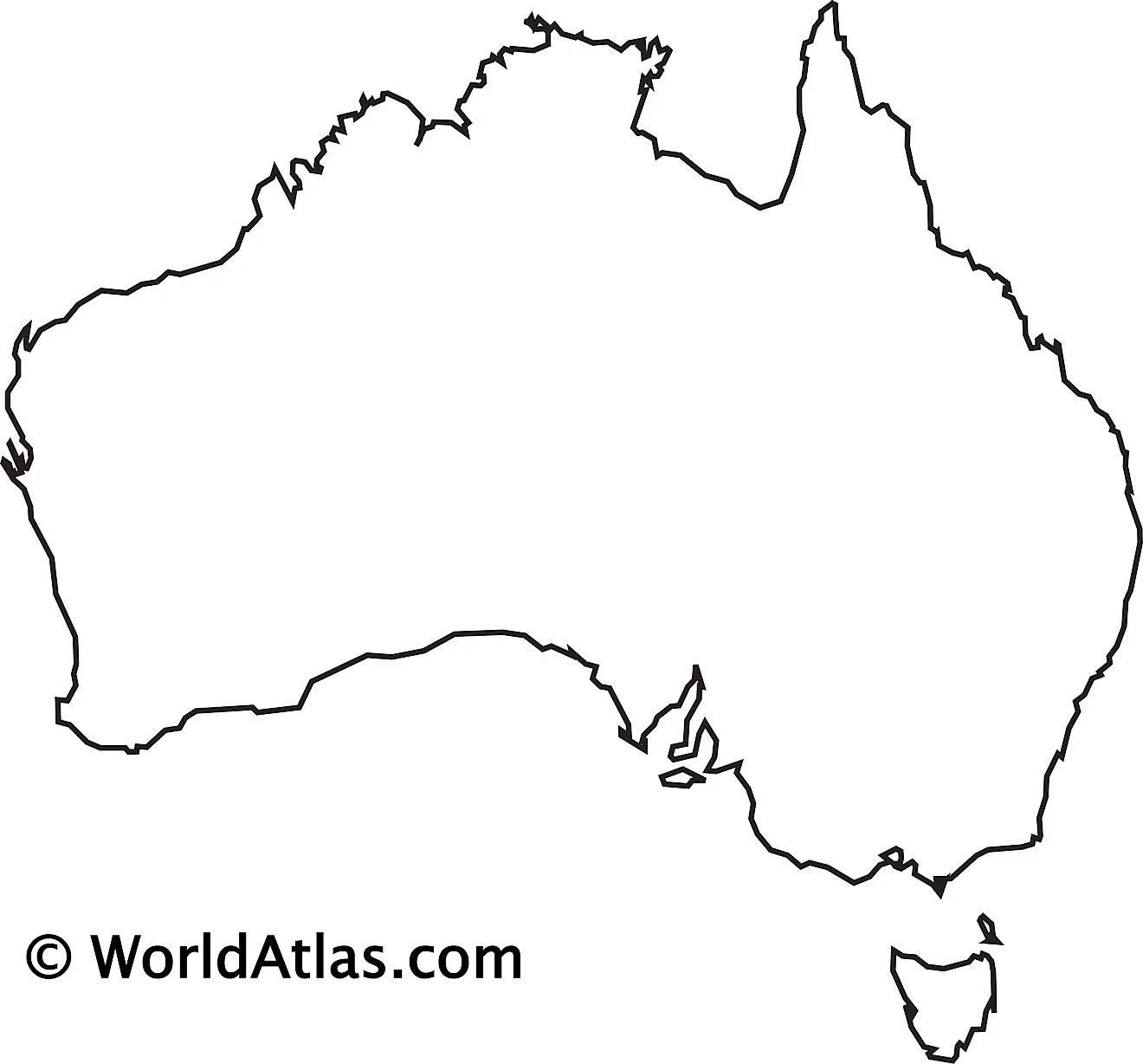
The above blank map represents Australia - the world's smallest continent and the 6th largest country located between the Indian Ocean and Pacific Ocean in the Southern hemisphere. The above map can be downloaded, printed and used for geography education purposes like map-pointing and coloring activities.
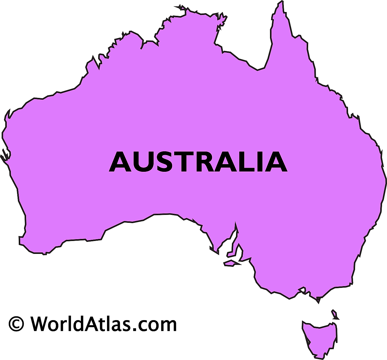
The above outline map represents Australia - the world's smallest continent and the 6th largest country located between the Indian Ocean and Pacific Ocean in the Southern hemisphere.
Key Facts
| Legal Name | Commonwealth of Australia |
|---|---|
| Flag |
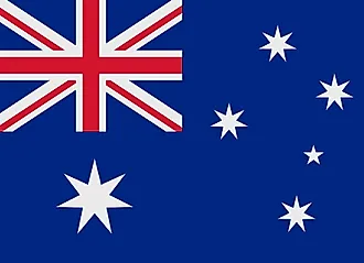
|
| Capital City | Canberra |
| 35 16 S, 149 08 E | |
| Total Area | 7,741,220.00 km2 |
| Land Area | 7,682,300.00 km2 |
| Water Area | 58,920.00 km2 |
| Population | 27,490,921 |
| Major Cities |
|
| Currency | Australian dollars (AUD) |
| GDP | $1.75 Trillion |
| GDP Per Capita | $63,730.13 |
This page was last updated on August 21, 2026