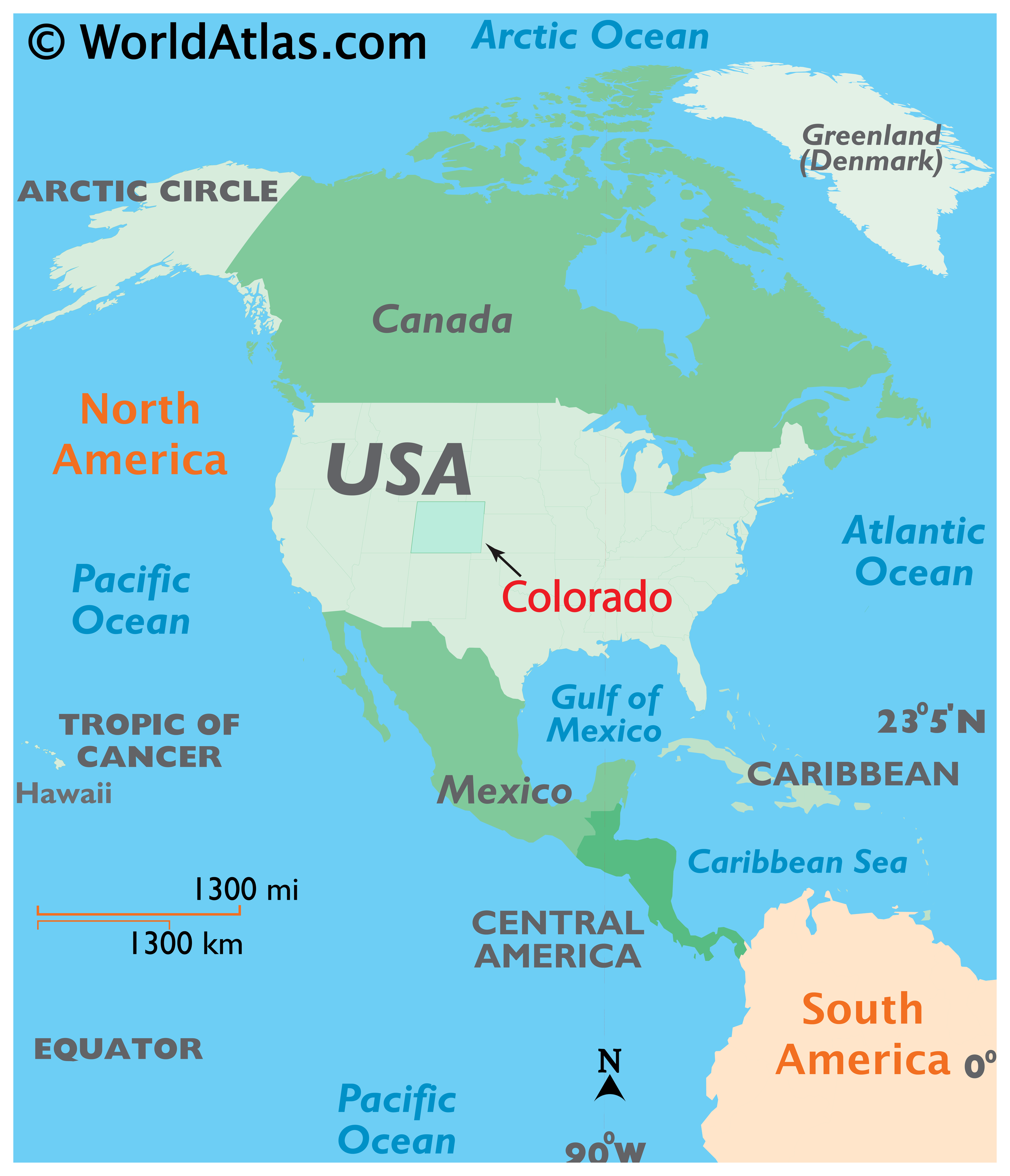
Where is Boulder, CO?
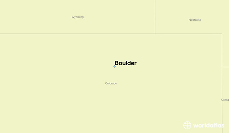
Boulder is a city found in Colorado, The United States Of America. It is located 40.01 latitude and -105.27 longitude and it is situated at elevation 1630 meters above sea level.
Boulder has a population of 97,385 making it the 11th biggest city in Colorado. It operates on the MDT time zone, which means that it follows the same time zone as Denver.
Quick facts
| Country | The United States Of America |
| State | Colorado |
| Population | 97,385 |
| Elevation | 1,630 m over sea level |
| Time Zone | MDT |
| Longitude | -105.270550 |
| Latitude | 40.014990 |

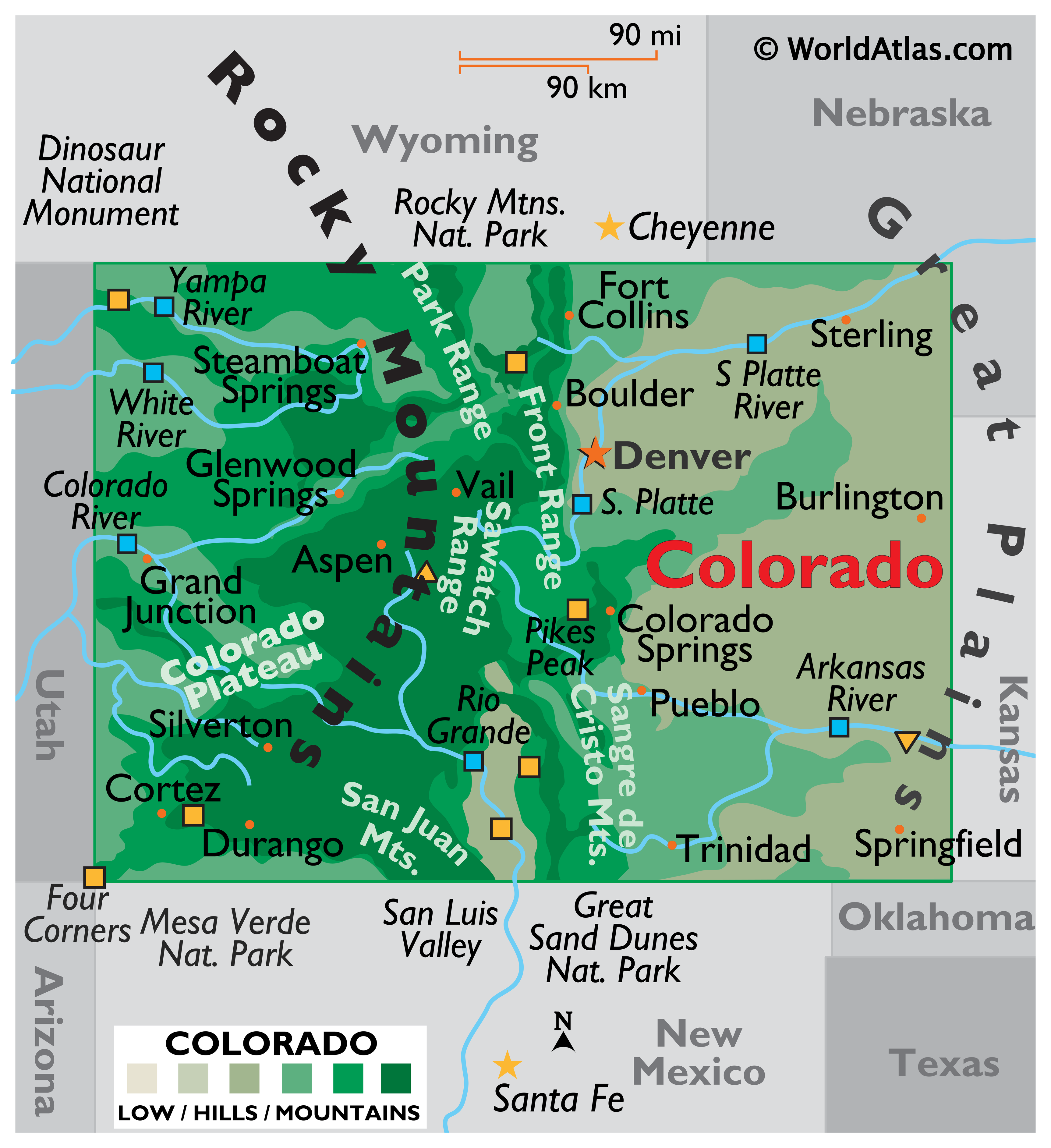
The Rocky Mountain city of Boulder, Colorado is located twenty-five miles northwest of Denver and is home to some of the most breathtaking natural beauty in the United States. Boulder sits at 5,430 feet above sea level and, like much of Colorado, is a haven for ski enthusiasts and outdoor adventurers from around the world.
The area was first settled when prospectors came with dreams of riches to Red Rocks at the mouth of Boulder Canyon. The city was founded in 1859 and officially named the 'Boulder City Town Company'.
Boulder's population lives an active and healthy lifestyle. A survey conducted by the CDC found that Colorado has a high rate of people who exercise regularly and fewer overweight people per capita than any other state in the U.S.
Boulder is a bike crazy city, with seven out of ten Boulderites owning bikes and an almost 1 to 1 ratio of bicycles to people. In fact, in the winter months, the city frequently plows the Boulder Creek bicycle path before they plow the streets!

- Boulder is home to the Boulder Dushanbe Teahouse, the only authentic handcrafted Persian teahouse in the Western Hemisphere.
- Robert Redford was a janitor at The Sink (a notorious University of Colorado student hangout) before becoming famous!
- Baseline Road is a significant east-west route for both residents and map makers; this Boulder throughway marks the 40th parallel of latitude on world maps.
- Boulder is the site of the earliest recorded rock climbing for sport in Colorado

The City of Boulder is rich in natural wonders, culture and learning, offering museums, art galleries, the main campus of the University of Colorado, and the renowned National Center for Atmospheric Research. Check out the Boulder map and read on to discover some of the best things to do and see in this great Colorado vacation destination.
- Boulder Flatirons
The Boulder Flatirons are three massive towers of rock dominating the backdrop of the city. The Flatirons are basically huge, flat, and steeply angled slabs of stone that experienced climbers love to tackle. Over 650 established 5th class rock climbing routes have been mapped offering a nearly inexhaustible variety of climbing challenges. Many offer extreme difficulty ratings and plenty of great rappelling opportunities. The Third Flatiron is the tallest at 1,400 feet high. This Boulder behemoth has been climbed in roller skates, in the nude in 8 minutes flat without using hands…all by different climbers, of course! The Boulder Flatirons are accessible from historic Chataqua Park and are surrounded by scenic picnic and hiking spots for the less extreme Colorado visitor. Other great climbing sites include nearby Flagstaff Mountain and Boulder Canyon. - Boulder Falls
Cascading Boulder Falls is located 11 miles to the west of the city and is a wonderful place to spend the afternoon enjoying the natural wonders of the Colorado landscape. The Falls were donated to the City of Boulder along with five acres of mining claims by Charles G. Buckingham to save them from the then encroaching tungsten boom. The Falls are formed as the North Boulder Creek plunges 70 feet down into Middle Boulder Creek to flow merrily on its way. Picture Rock is a favorite Boulder photo spot, with a round hole eroded right through the middle making it the perfect frame for smiling faces!
- Celestial Seasonings Tea Tour
Free tours are offered every day at the Celestial Seasonings Tea factory which is located in a mostly residential area on the outskirts of Boulder. Explore the tea plant and find out all about the creation of Celestial Seasonings organic offerings. Learn how flavors are chosen and how ingredients are selected from some of the most exotic locals in Asia, Oceania and Africa. Sample the latest savory tastes in teas and stop at the eclectic Tea Shop on the way out for a souvenir. Visitors also enjoy a vast collection of original artwork on display in the company gallery and in the Celestial Café.
Maps
Boulder has a population of around 103919, of which 53753 (51%) are male and 50166 (48%) are female. The average age of the inhabitants of Boulder is 34.35, meaning that the average person is below the national median age of 37. For every male, there are approximately 0.93 females, meaning that the population is relatively evenly distributed between males and female(s).
Of Boulder's 103919 residents, around 100590 (96.80%) identify as having a single race. The majority of the population is white, which consists of 88.50% of the population. Of the remaining population, 1036 are black/African Americans (1.00%), 262 are native Americans (0.30%), 5240 are asians (5.00%), 75 are pacific islanders (0.10%), 2016 are other (1.90%).
The median income of households in Boulder is $58484.00, meaning that most of the households are above the poverty threshold for families of three. Of the total population, 10.70% of households reported an annual income of less than $10,000.
Boulder, CO Zipcodes
The city of Boulder has 8 zipcodes recognized by the United States Census Bureau: 80025, 80301, 80302, 80303, 80304, 80305, 80310, 80503.