Maps of Central African Republic

The Central African Republic is located in the heart of Africa where it occupies an area of 622,984 sq. km. It is a landlocked nation and borders the neighboring countries of Cameroon, Congo, the Democratic Republic of the Congo, South Sudan, Sudan, and Chad.
As observed on the physical map of the country above, a large part of it is covered by a flat or rolling plateau with an average elevation of about 500 m above sea level.
The Ubangi and Sangha Rivers, which both flow south into the Congo River contain some of the densest stretches of tropical rainforest in the region. Characterized by its heavy rainfall, humidity, and abundance of exotic wildlife, this part of the nation has some of the highest population densities in the country.
The Fertit Hills lie to the northeast. This part of the CAR is quite dry and arid especially when compared to the western side of the nation. It has little in the way of rainfall and shares the characteristics of a desert rather than a lush jungle. The hills mark the border with both Sudan and South Sudan with the highest point of these hills reaching 4200 feet (1280.16 m)
The Karre Mountains can be found in the northwest of the nation. Also referred to as Yade Massif, these mountains are largely made up of granite plateaus with an altitude of 3,750 feet (1,143 m). As marked on the map by an upright triangle, the highest point in the country, the 1,410 m high Mount Ngaoui is located in this region.
More than 30 Rivers flow through of begin in the CAR. This geographic marvel has gifted this small nation with over 3,600 unique species of plants and vegetation. It is speculated that there are around another 1,400 species that have not been found yet.
The Dzanga-Sangha National Park is located in the southwest corner of the country and is home to the most rare forms of wildlife in all of Africa such as the Bongo Antelope.
Prefecture and Communes Map of Central African Republic

The Central African Republic is divided into 16 prefectures and an autonomous commune. The prefectures are subdivided into 71 sub-prefectures.
The 16 prefectures are Bamingui-Bangoran, Basse-Kotto, Haute-Kotto, Haut-Mbomou, Kemo, Lobaye, Mambere-Kadei, Mbomou, Nana-Grebizi, Nana-Mambere, Ombella-Mpoko, Ouaka, Ouham, Ouham-Pende, Sangha-Mbaere, and Vakaga. Each prefecture tends to get its name from a river (or rivers) that runs through its territory.
Two of the 16 prefectures, Nana-Grebizi and Sangha-Mbaere are also designated as economic prefectures. These two regions minster and facilitate economic activity for the entire nation. The autonomous commune is Bangui which is the national capital of the country.
With an area of 86,650 sq. km, Haute-Kotto is the largest prefecture by area and Bangui is the most populous administrative division.
Where is Central African Republic?

The Central African Republic or CAR is located in Central Africa in the Northern and Eastern Hemispheres of the Earth. Six countries border CAR. These are Chad, Sudan, and South Sudan to the north, northeast, and southeast respectively. The DRC, the Republic of the Congo, and Cameroon bound CAR to the south, southwest, and west respectively.
Central African Republic Bordering Countries: The Congo, South Sudan, The Sudan, Cameroon, The Democratic Republic Of The Congo, Chad.
Regional Maps: Map of Africa
Outline Map of Central African Republic

This outline map shows the entire country of the Central African Republic. It is located in the heart of Africa and is surrounded by six countries.
Key Facts
| Legal Name | Central African Republic |
|---|---|
| Flag |
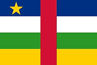
|
| Capital City | Bangui |
| 4 22 N, 18 35 E | |
| Total Area | 622,984.00 km2 |
| Land Area | 622,984.00 km2 |
| Water Area | N/A |
| Population | 4,745,185 |
| Largest City |
Bangui (958,335) |
| Currency | Cooperation Financiere en Afrique Centrale francs (XAF) |
| GDP | $2.22 Billion |
| GDP Per Capita | $467.91 |
This page was last updated on December 5, 2023