Where is Jefferson County, Washington?
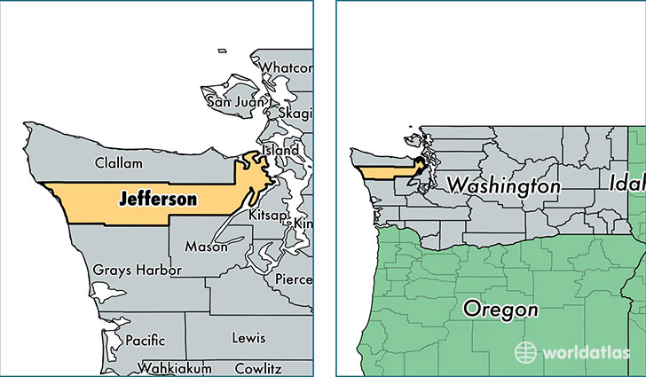
Jefferson County is a county equivalent area found in Washington, USA. The county government of Jefferson is found in the county seat of Port Townsend.
With a total 5,654.25 sq. km of land and water area, Jefferson County, Washington is the 285th largest county equivalent area in the United States. Home to 30,228 people, Jefferson County has a total 17820 households earning 46320 on average per year.
Jefferson County, Washington offers the following attraction to visitors: Olympic NP
Jefferson County, Washington - Quick Facts
| FIPS Code | 53031 |
| Area Codes | 360 |
| Time Zone | PST |
| Major Cities | Port Townsend (population: 14,715), Port Ludlow (population: 4,525), Port Hadlock (population: 3,323), Quilcene (population: 1,996), Chimacum (population: 1,846), Brinnon (population: 1,249), Nordland (population: 896) |
| Land Area | 11,671 sq miles |
| Water Area | 1,803 sq miles |
| Household Income | $46,320 |
| Housing Units | 17,820 |
| Median Home Value | $284,100 |
| High School Grads | 95% of population |
| Holders of Bachelors Degrees | 37% of population |
| Retail Spending | $7,204 per capita |
| Food & Accomodation Sales | $48,744 per capita |
This page was last updated on June 30, 2016.