Where is Erie County, Pennsylvania?
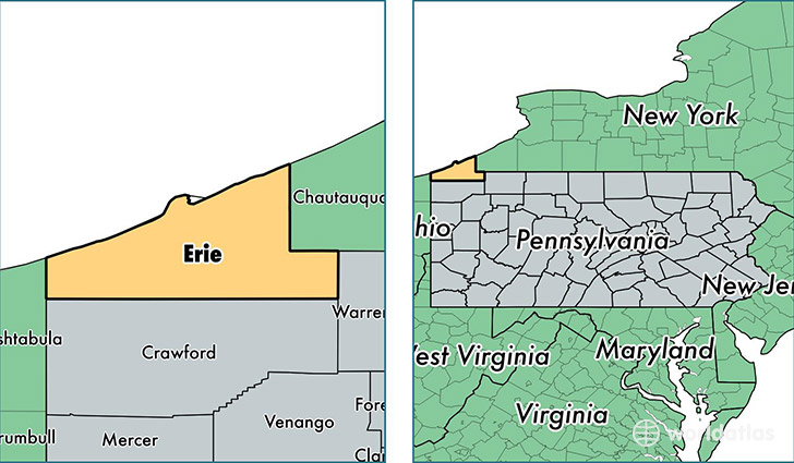
Erie County is a county equivalent area found in Pennsylvania, USA. The county government of Erie is found in the county seat of Erie.
With a total 4,035.8 sq. km of land and water area, Erie County, Pennsylvania is the 429th largest county equivalent area in the United States. Home to 278,443 people, Erie County has a total 119241 households earning 45202 on average per year.
Erie County, Pennsylvania - Quick Facts
| FIPS Code | 42049 |
| Area Codes | 814 |
| Time Zone | EST |
| Major Cities | Erie (population: 187,544), North East (population: 12,481), Edinboro (population: 12,191), Corry (population: 11,296), Waterford (population: 10,136), Fairview (population: 8,918), Girard (population: 8,331), Albion (population: 6,581), Lake City (population: 4,451), McKean (population: 3,731) |
| Land Area | 107,507 sq miles |
| Water Area | 799 sq miles |
| Household Income | $45,202 |
| Housing Units | 119,241 |
| Median Home Value | $115,100 |
| High School Grads | 90% of population |
| Holders of Bachelors Degrees | 25% of population |
| Retail Spending | $12,253 per capita |
| Food & Accomodation Sales | $428,110 per capita |
This page was last updated on June 30, 2016.