Where is Douglas County, Oregon?
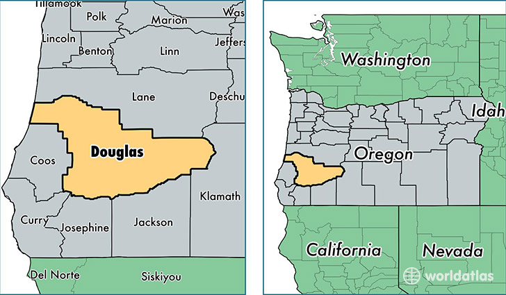
Douglas County is a county equivalent area found in Oregon, USA. The county government of Douglas is found in the county seat of Roseburg.
With a total 13,296.4 sq. km of land and water area, Douglas County, Oregon is the 79th largest county equivalent area in the United States. Home to 106,972 people, Douglas County has a total 48662 households earning 40524 on average per year.
Douglas County, Oregon - Quick Facts
| FIPS Code | 41019 |
| Area Codes | 541 |
| Time Zone | PST |
| Major Cities | Roseburg (population: 48,855), Myrtle Creek (population: 10,160), Sutherlin (population: 9,460), Winston (population: 7,598), Reedsport (population: 5,314), Oakland (population: 3,919), Riddle (population: 2,583), Canyonville (population: 2,427), Drain (population: 2,338), Glendale (population: 2,221) |
| Land Area | 41,302 sq miles |
| Water Area | 5,036 sq miles |
| Household Income | $40,524 |
| Housing Units | 48,662 |
| Median Home Value | $171,300 |
| High School Grads | 88% of population |
| Holders of Bachelors Degrees | 16% of population |
| Retail Spending | $11,276 per capita |
| Food & Accomodation Sales | $228,371 per capita |
This page was last updated on June 30, 2016.