Where is Huron County, Ohio?
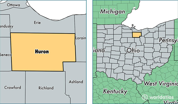
Huron County is a county equivalent area found in Ohio, USA. The county government of Huron is found in the county seat of Norwalk.
With a total 1,281.58 sq. km of land and water area, Huron County, Ohio is the 2203rd largest county equivalent area in the United States. Home to 58,714 people, Huron County has a total 25009 households earning 49404 on average per year.
Huron County, Ohio - Quick Facts
| FIPS Code | 39077 |
| Area Codes | 419,440 |
| Time Zone | EST |
| Major Cities | Norwalk (population: 23,665), Willard (population: 11,097), Wakeman (population: 6,663), New London (population: 5,280), Greenwich (population: 4,480), Monroeville (population: 3,714), Collins (population: 1,676), North Fairfield (population: 1,263), New Haven (population: 147) |
| Land Area | 22,670 sq miles |
| Water Area | 492 sq miles |
| Household Income | $49,404 |
| Housing Units | 25,009 |
| Median Home Value | $118,800 |
| High School Grads | 88% of population |
| Holders of Bachelors Degrees | 13% of population |
| Retail Spending | $9,166 per capita |
| Food & Accomodation Sales | $51,687 per capita |
This page was last updated on June 30, 2016.