Which River Forms The Border Between The United States And Mexico?
The Mexico–United States (US) border is an international border in North America that separates the United States of America to the north and Mexico to the south. The border has a total length of 3,145 km (1,954 mi) and stretches from the Pacific Ocean in the west to the Gulf of Mexico in the east. The border passes through a wide variety of terrains, ranging bustling cities to vast, uninhabited deserts. The Rio Grande, also called the Río Bravo del Norte, forms part of the Mexico–US Border.
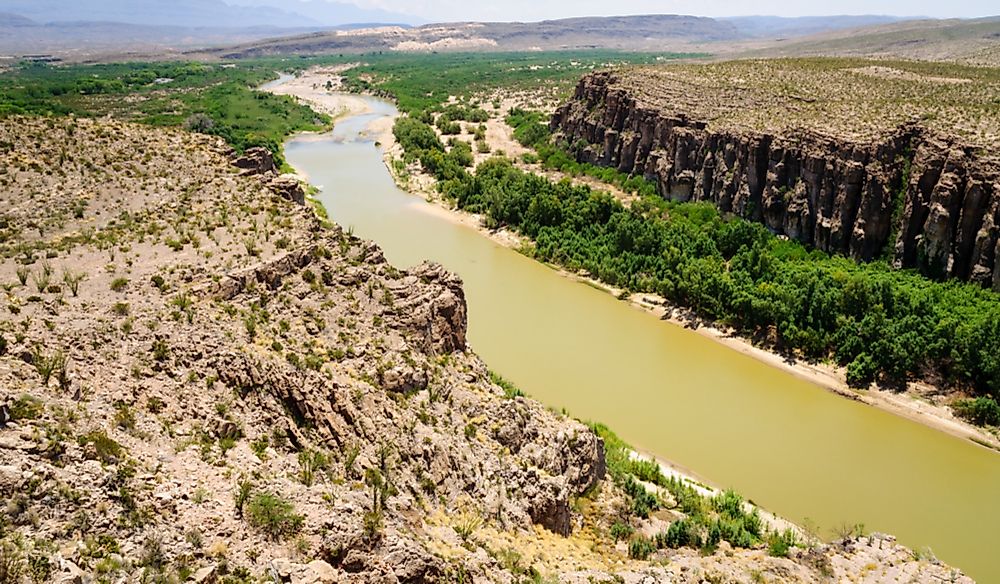
Rio Grande at the US-Mexico Border
The section of the border between Mexico and the US that is formed by the Rio Grande has an estimated length that ranges between 1,431 km and 2,008 km, depending on how the river is measured. Several tributaries, including the Rio Conchos, Pecos, and Devils rivers, enter the Rio Grande at points along the border.
Course of the Rio Grande
The Rio Grande rises in the Rio Grande National Forest in the US state of Colorado and is formed by the joining of several streams at the base of Canby Mountain, which is part of the San Juan Mountains. The river flows into New Mexico, then follows a southerly route through desert cities such as Las Cruces and Albuquerque. The river meets the US-Mexico boundary at the border crossing between El Paso, Texas, US, and Ciudad Juárez, Chihuahua, Mexico. The river forms the natural boundary between Texas and the Mexican states of Tamaulipas, Nuevo León, Coahuila, and Chihuahua. Next, the river flows east through deserts and then forms a small, sandy delta as it drains into the Gulf of Mexico.
Border Crossings on the Rio Grande
The segment of the border formed by the Rio Grande has several crossings, in the form of international bridges, that allow the movement of people and goods between the US and Mexico. These include the Texas-Tamaulipas, Texas-Coahuila, Texas-Nuevo León, and Texas-Chihuahua crossings.
Sharing the Rio Grande
The US and Mexico share the waters of the Rio Grande, which is defined through a series of agreements between the two countries. Additionally, the International Boundary and Water Commission (IBWC), created in 1889, administers the agreements and allocates the river’s waters between the US and Mexico.
Unfortunately, overuse of the waters of the Rio Grande has greatly decreased its volume. Recently, a part of the river downstream of El Paso, Texas was nicknamed "The Forgotten River" by conservationists who wanted to draw attention to the dire state of the river.