Where is Oldham County, Kentucky?
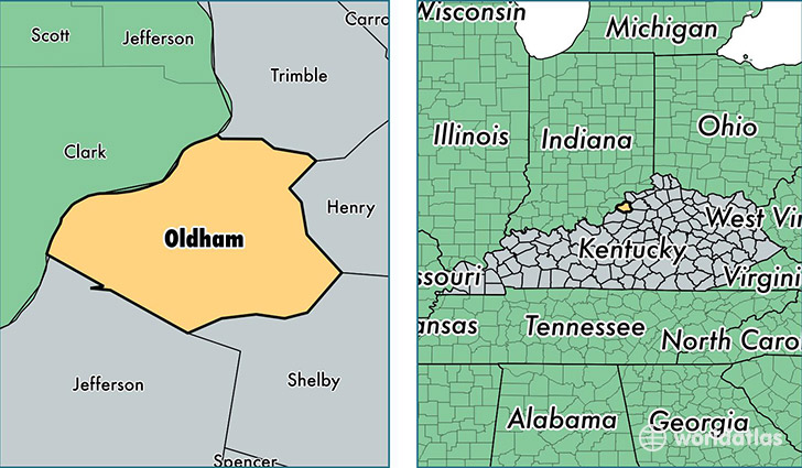
Oldham County is a county equivalent area found in Kentucky, USA. The county government of Oldham is found in the county seat of La Grange.
With a total 508.76 sq. km of land and water area, Oldham County, Kentucky is the 3029th largest county equivalent area in the United States. Home to 63,490 people, Oldham County has a total 20990 households earning 83391 on average per year.
Oldham County, Kentucky - Quick Facts
| FIPS Code | 21185 |
| Area Codes | 502 |
| Time Zone | EST |
| Major Cities | La Grange (population: 23,258), Crestwood (population: 20,349), Goshen (population: 5,557), Pewee Valley (population: 3,322), Buckner (population: 597), Westport (population: 574) |
| Land Area | 24,514 sq miles |
| Water Area | 187 sq miles |
| Household Income | $83,391 |
| Housing Units | 20,990 |
| Median Home Value | $245,700 |
| High School Grads | 92% of population |
| Holders of Bachelors Degrees | 40% of population |
| Retail Spending | $6,621 per capita |
| Food & Accomodation Sales | $47,130 per capita |
This page was last updated on June 30, 2016.