Lake County, IL, USA
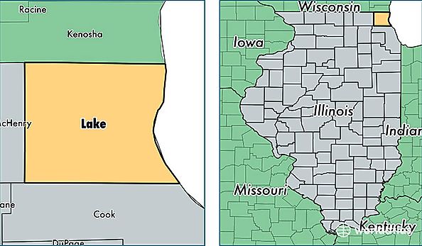
Lake County is a county equivalent area found in Illinois, USA. The county government of Lake is found in the county seat of Waukegan.
With a total 3,544.11 sq. km of land and water area, Lake County, Illinois is the 494th largest county equivalent area in the United States. Home to 705,186 people, Lake County has a total 260550 households earning 77469 on average per year.
Lake County, Illinois offers the following attraction to visitors: Six Flags Great America
Lake County, Illinois - Quick Facts
| FIPS Code | 17097 |
| Area Codes | 847 |
| Time Zone | CST |
| Major Cities | Waukegan (population: 98,503), Round Lake (population: 59,887), Barrington (population: 44,188), Lake Zurich (population: 41,589), Buffalo Grove (population: 41,576), Gurnee (population: 37,874), Mundelein (population: 37,118), Grayslake (population: 35,987), Lake Villa (population: 35,044), Zion (population: 31,044) |
| Land Area | 272,274 sq miles |
| Water Area | 444 sq miles |
| Household Income | $77,469 |
| Housing Units | 260,550 |
| Median Home Value | $254,800 |
| High School Grads | 89% of population |
| Holders of Bachelors Degrees | 42% of population |
| Retail Spending | $28,949 per capita |
| Food & Accomodation Sales | $1,299,296 per capita |
| Universities and Colleges | Lake Forest College |