Maps of Uruguay

Uruguay, officially known as the Oriental Republic of Uruguay, covers an area of approximately 69,898 square miles (181,034 square kilometers). It is nestled in the southeastern region of South America, bordered to the east by the South Atlantic Ocean, to the south by the Rio de la Plata, to the west by Argentina, and to the north and northeast by Brazil.
The geographical landscape of Uruguay can be divided into four main regions: the Atlantic Coast, the Cuchilla Grande hills, the Central Lowland, and the Northern Upland. In general, these regions possess rolling plains, low plateaus, and fertile coastal lowlands.
The Atlantic Coast of Uruguay, extending from the Brazilian border to Montevideo, presents numerous sandy beaches and dunes. This region includes important seaside resort cities such as Punta del Este and Piriapolis, which serve as focal points for tourism. Furthermore, there are a few bays and lagoons such as Laguna Merin and Laguna Negra, and they serve as habitats for local wildlife.
The Cuchilla Grande, the most significant range in Uruguay, traverses the country from northeast to southwest. The system comprises several ranges and highlands, such as the Cuchilla de Haedo and the Cuchilla Grande proper, the latter reaching an elevation of 1,685 feet (514 meters) at the Cerro Catedral, the country's highest point.
The Central Lowland, often referred to as the Uruguayan Pampas, represents the southernmost extension of the Pampas grasslands of Argentina and Brazil. This region comprises gently rolling plains with few hills, making it an agriculturally productive area.
The Northern Upland, which merges into the Brazilian highlands, is characterized by ranges of low mountains and highlands, providing a stark contrast to the country's prevalent flat terrain.
Uruguay hosts several important bodies of water. The Rio de la Plata, forming part of the country's southern border, is one of the most important. This wide estuary results from the confluence of the Uruguay River and the Parana River. The Uruguay River, which demarcates the country's western border, is another significant waterway. Other notable rivers include the Negro River, the country's largest river entirely within its territory, and the Yí and Santa Lucia rivers.
Uruguay is also home to a number of noteworthy islands. The largest, Isla de Lobos, sits off the coast of Punta del Este in the Atlantic Ocean. This island hosts the largest sea-lion colony in the western hemisphere. Other islands include Gorriti Island, also near Punta del Este, and Martín García Island, located in the Rio de la Plata.
Regarding climate, Uruguay's geography plays a critical role in its weather, which is characterized as a humid subtropical climate. The country experiences mild winters and warm summers, with relatively uniform rainfall throughout the year.
Departments of Uruguay Map

Uruguay (officially, the Oriental Republic of Uruguay) is divided into 19 departments (departamentos, singular - departamento). In alphabetical order, the departments are: Artigas, Canelones, Cerro Largo, Colonia, Durazno, Flores, Florida, Lavalleja, Maldonado, Montevideo, Paysandu, Rio Negro, Rivera, Rocha, Salto, San Jose, Soriano, Tacuarembo and Treinta y Tres. These departments are further subdivided into a total of 112 municipalities.
Covering an area of 176,000 sq.km, Uruguay is South America's 2nd smallest nation. Located in the southern part of the country, on the northeastern shore of the Rio de la Plata estuary is, Montevideo - the capital, the largest and the most populous city of Uruguay. Montevideo is the southernmost capital city in the Americas and the chief port as well as the cultural, educational, commercial and financial center of Uruguay.
Where is Uruguay?

Uruguay is a country located on the southeastern coast of South America. It is geographically positioned in the Southern and Western hemispheres of the Earth; being the only South American nation to be situated entirely south of the Tropic of Capricorn. Uruguay is bordered by Argentina to the west and southwest; by Brazil to the north and east; by the Rio de la Plata to the south and by the South Atlantic Ocean to the southeast.
Uruguay Bordering Countries: Argentina, Brazil.
Regional Maps: Map of South America
Outline Map of Uruguay

The above blank map represents Uruguay - a country in Southern South America. The map can be downloaded, printed and used for geography education purpose like map-pointing and coloring activities.

The above outline map represents Uruguay, a country in Southern South America. Uruguay is a wedge-shaped nation.
Key Facts
| Legal Name | Oriental Republic of Uruguay |
|---|---|
| Flag |
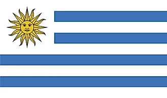
|
| Capital City | Montevideo |
| 34 51 S, 56 10 W | |
| Total Area | 176,215.00 km2 |
| Land Area | 175,015.00 km2 |
| Water Area | 1,200.00 km2 |
| Population | 3,461,734 |
| Largest City |
Montevideo (1,774,396) |
| Currency | Uruguayan pesos (UYU) |
| GDP | $56.05 Billion |
| GDP Per Capita | $16,190.13 |
This page was last updated on June 28, 2023