Maps of Alaska

Alaska, the largest state in the United States, is located in the extreme northwest corner of North America. It spans over 663,268 square miles and boasts a diverse geography that includes mountains, glaciers, forests, tundra, and coastline.
The state is bordered by Canada to the east and shares maritime borders with Russia to the west. Its northernmost point lies within the Arctic Circle and experiences polar climates. Furthermore, the southern regions are characterized by a milder coastal climate due to the influence of the Pacific Ocean.
The state also boasts numerous glaciers, including Hubbard Glacier, Mendenhall Glacier, and Columbia Glacier. These glaciers have shaped much of Alaska's landscape through erosion and deposition of sediments.
In addition to its mountains and glaciers, Alaska has vast areas of tundra, which are treeless plains characterized by permafrost - permanently frozen soil that prevents trees from growing deep roots. The largest national park in the United States - Wrangell-St. Elias National Park - is found in Alaska's eastern region and contains many examples of this unique ecosystem.
Moreover, this massive state is divisible into five distinct geographic regions: the Arctic Coastal Plain, Brooks Range, Interior Plains and Plateaus, Alaska Range, and the Aleutian Islands.
The Arctic Coastal Plain sits on the northern coast of Alaska, a recognizably flat landscape with few trees. It is home to many essential oil fields and is an important breeding ground for migratory birds.
The Brooks Range runs through central Alaska from east to west and is known for its rugged peaks and deep valleys. This region is sparsely populated and is home to many wild animals, such as grizzly bears, wolves, and caribou.
The Interior Plains and Plateaus are south of the Brooks Range, and dynamic hills covered in grasses coat the region. The Yukon River runs through this region, serving as a vital transportation route for locals.
The Alaska Range runs along the southern coast of Alaska and includes several notable peaks, including Denali (formerly known as Mt. McKinley), the highest peak in North America at 20,310 feet. This region also contains glaciers that flow down into surrounding valleys. Other noteworthy ranges include the Brooks and Aleutian Ranges.
Finally, the Aleutian Islands are located southwest of mainland Alaska and have a volcanic island chain stretching over 1,000 miles toward Russia's Kamchatka Peninsula. These islands are known for their unique wildlife, such as sea otters, seals, whales, and puffins.
Finally, Alaska has an extensive coastline stretching over 6,640 miles along the Pacific and Arctic oceans. This coastline is home to many fjords - narrow inlets with steep sides created by glacial activity - and islands like Kodiak Island and Prince of Wales Island.
Counties Map
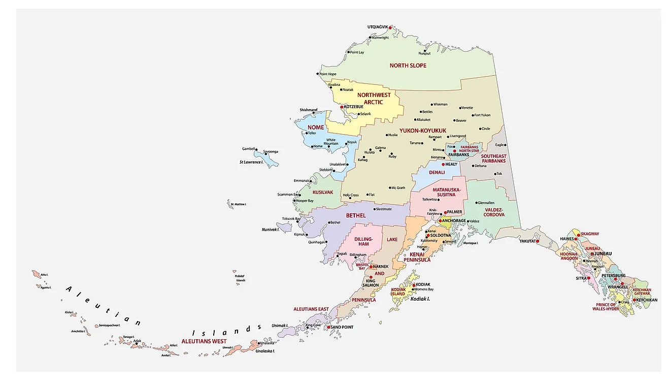
The State of Alaska is divided into 29 counties. In alphabetical order, these counties are: Aleutians East, Aleutians West, Anchorage, Bethel, Bristol Bay, Denali, Dillingham, Fairbanks North Star, Haines, Hoonah Angoon, Juneau, Kenai Peninsula, Ketchikan Gateway, Kodiak Island, Lake and Peninsula, Matanuska Susitna, Nome, North Slope, Northwest Arctic, Petersburg, Prince of Wales Hyder, Sitka, Skagway, Southeast Fairbanks, Valdez Cordova, Wade Hampton, Wrangell, Yakutat, and Yukon Koyukuk.
With an area of 1,717,856 sq. km, Alaska is the largest and the 3rd least populous state in the USA. Located in the extreme southeastern part of the state, at the base of Mount Juneau on the Gastineau Channel is Juneau – the capital city of Alaska. Government services, tourism, and the fishing industry are some of the main contributors to the economy of the capital city. Situated on a peninsula in the south-central part of the state is Anchorage – the largest and the most populous city in Alaska. It also serves as the major commercial and economic center of the state.
Where is Alaska?

The State of Alaska is located in the far northwestern corner of the continent of North America. Alaska is bordered by the Beaufort Sea and the Arctic Ocean in the north; by the Canadian province of British Columbia and the Yukon territory in the east and southeast; by the Gulf of Alaska and the Pacific Ocean in the south and southwest; by Russia (Chukotka Autonomous Okrug), the Bering Sea and Bering Strait in the west and by the Chukchi Sea in the northwest.
Regional Maps: Map of North America
Outline Map of Alaska
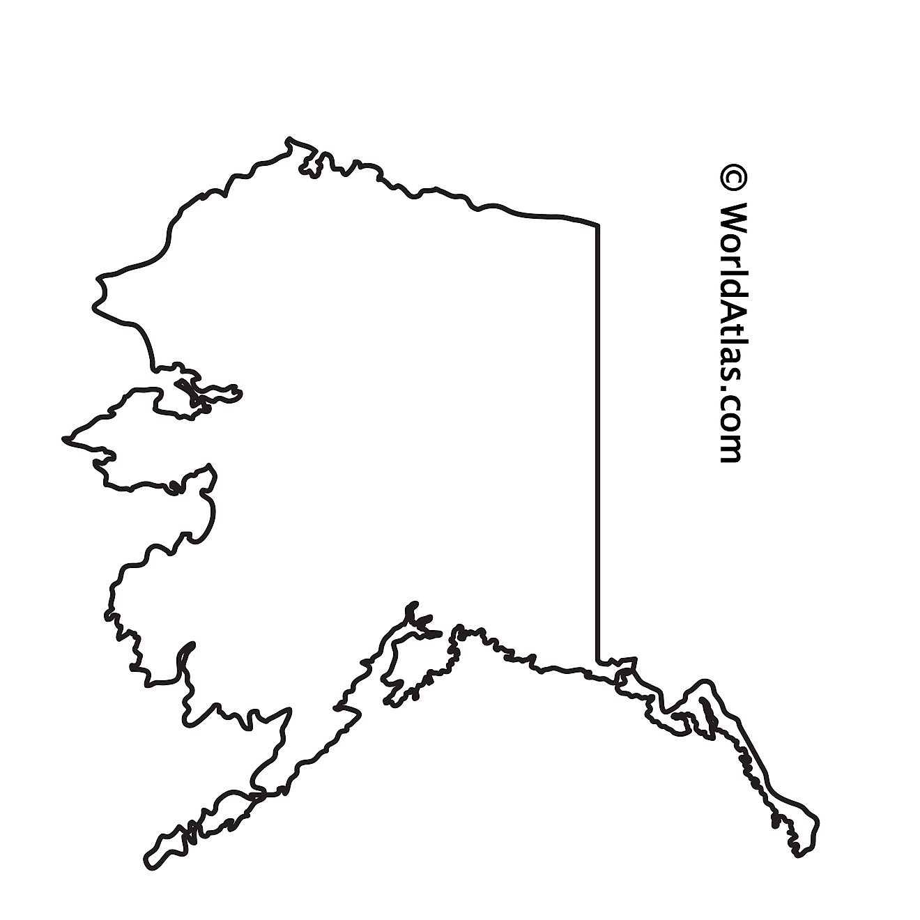
The above blank map represents the State of Alaska, located in the far northwestern corner of the continent of North America. The above map can be downloaded, printed and used for geography education purposes like map-pointing and coloring activities.

The above outline map represents the State of Alaska, located in the far northwestern corner of the continent of North America.
Key Facts
| Legal Name | State of Alaska |
|---|---|
| ISO 3166 Code | US-AK |
| Capital City | Juneau |
This page was last updated on March 7, 2023
