Maps of Costa Rica
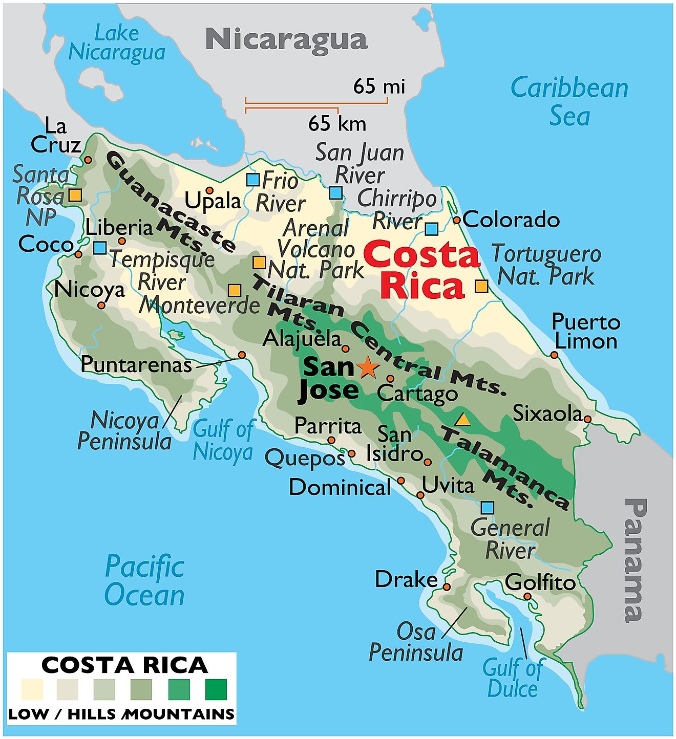
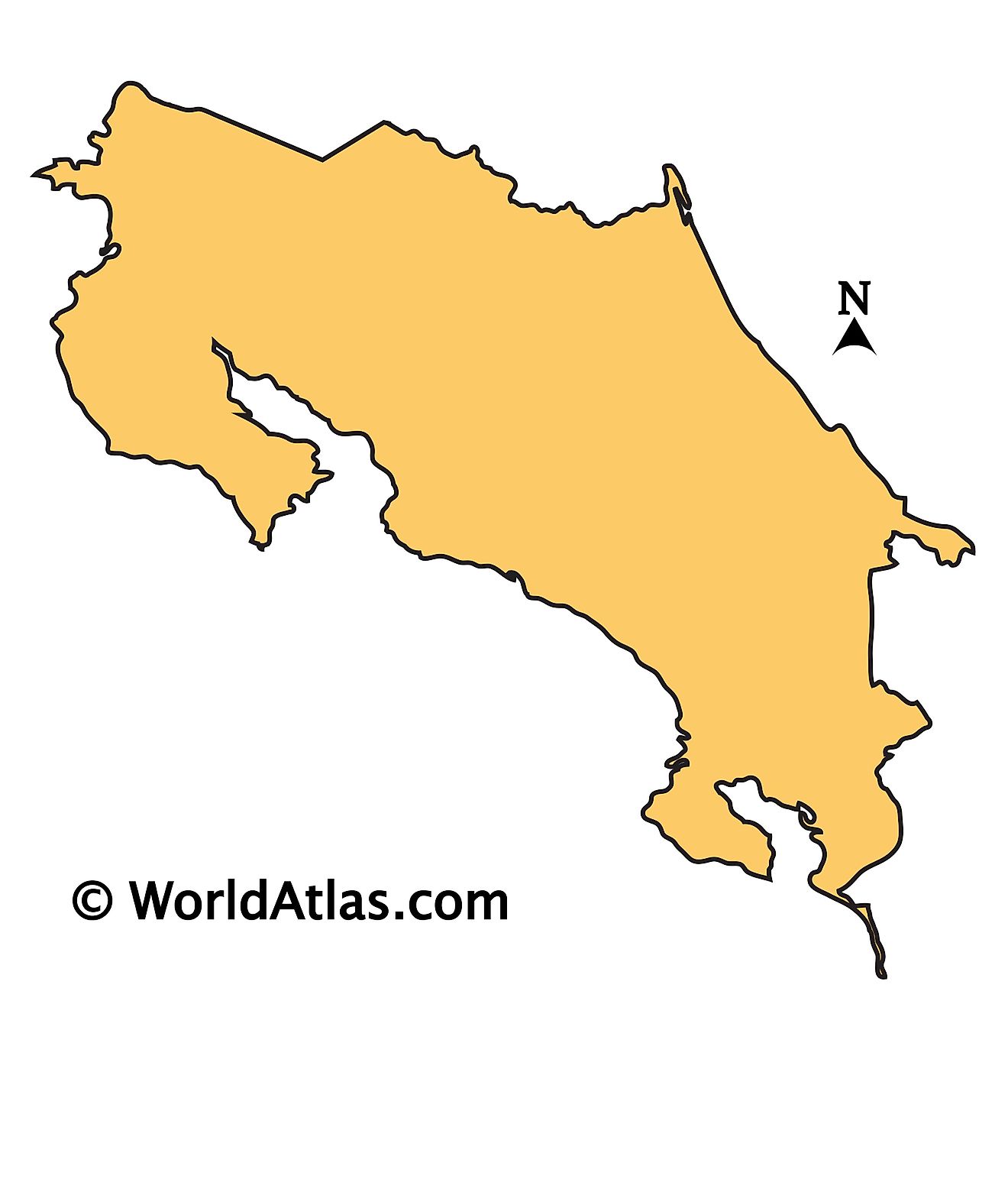
In the heart of Central America, Costa Rica is flanked by Nicaragua to the north and Panama to the south. To the west, it meets the Pacific Ocean, and to the east lies the Caribbean Sea. This tropical country boasts an area of 19,710 square miles (51,060 square kilometers), which is ample space for its population of 5,264,000 people to call home.
The country's landscape mainly consists of four geographical regions: the Central Valley, the coastal plains, the mountain ranges, and the wetlands.
The Central Valley, Costa Rica's most populated region, stretches in a wide arc from east to west. Here, the land takes on a gentler aspect, sculpted by rolling hills and fertile plains. Among these verdant landscapes nestle the bustling cities of San Jose, Heredia, Alajuela, and Cartago. These urban areas, interspersed with coffee plantations and farms, paint a picture of a vibrant blend of urban and rural life.
Straddling the Central Valley are the impressive mountain ranges, which include the Cordillera Volcanica to the north and the Cordillera de Talamanca to the south. These mountain ranges form the country's natural backbone and house several active and dormant volcanoes, such as the Arenal Volcano, the Poás Volcano, and the Irazú Volcano. The country's highest point, Mount Chirripó, lies in the Cordillera de Talamanca and reaches a staggering height of 12,536 feet (3,821 meters).
Two coastal plains - the Caribbean and the Pacific - flank these central mountains. The Pacific coastal plain, also known as the Guanacaste Plain, is drier and more agriculturally oriented, supporting vast cattle ranches and fields of sugarcane, while the Caribbean coastal plain, often referred to as the Limón coastal plain, is marked by lush rainforests and extensive banana plantations. The Nicoya Peninsula and the Osa Peninsula further enhance the scenic beauty of the Pacific coast.
The wetlands, which include the Tortuguero and Caño Negro wildlife refuges, are other vital geographical features. These areas, comprising mangrove swamps, lagoons, and marshes, support a wide variety of wildlife and are important habitats for migratory bird species.
Costa Rica hosts several major bodies of water. Lake Arenal, the country's largest lake, sprawls across the northern highlands. It's both a critical hydroelectric power source and a popular spot for water sports. Other significant lakes include Lake Cote and Lake Bonilla.
The country also boasts a network of rivers that snake their way across the landscape, feeding its diverse ecosystems. The Reventazón River, one of Costa Rica's most prominent rivers, meanders through the country's central region before pouring its waters into the Caribbean Sea. Other major rivers include the Tempisque, the Sierpe, and the San Juan, which form a natural border with Nicaragua.
Provinces of Costa Rica Map
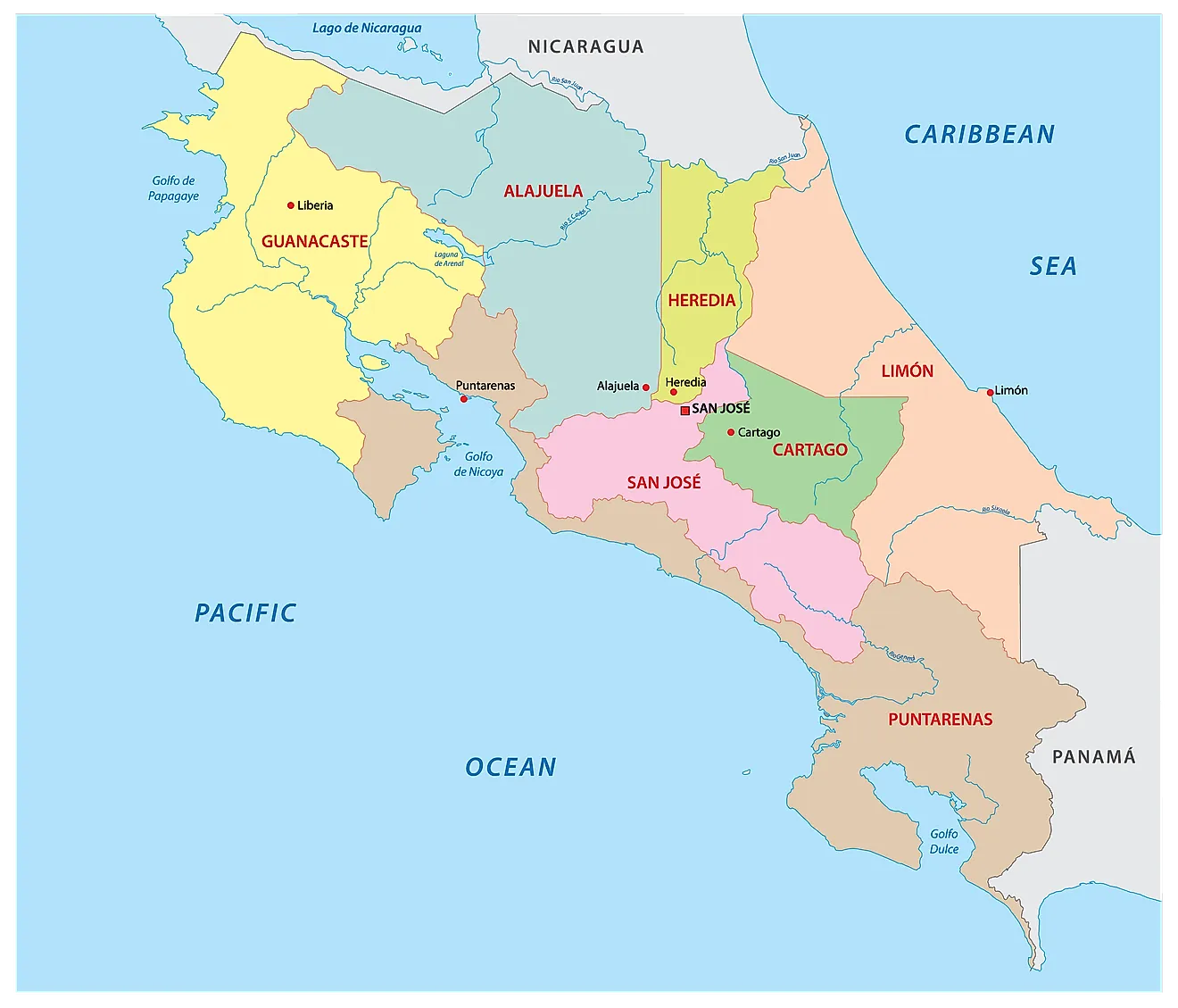
Costa Rica (officially, the Republic of Costa Rica) is divided into 7 administrative provinces (provincias, singular - provincia).
In alphabetical order, the provinces are: Alajuela, Cartago, Guanacaste, Heredia, Limon, Puntarenas, and San Jose. These provinces are divided into 82 cantons, which are further subdivided into 473 districts.
Located in Costa Rica’s western province in the Central Valley is San Jose – the capital, the largest and the most populous city of Costa Rica. It is also the administrative, economic and transportation hub of the country.
Where is Costa Rica?
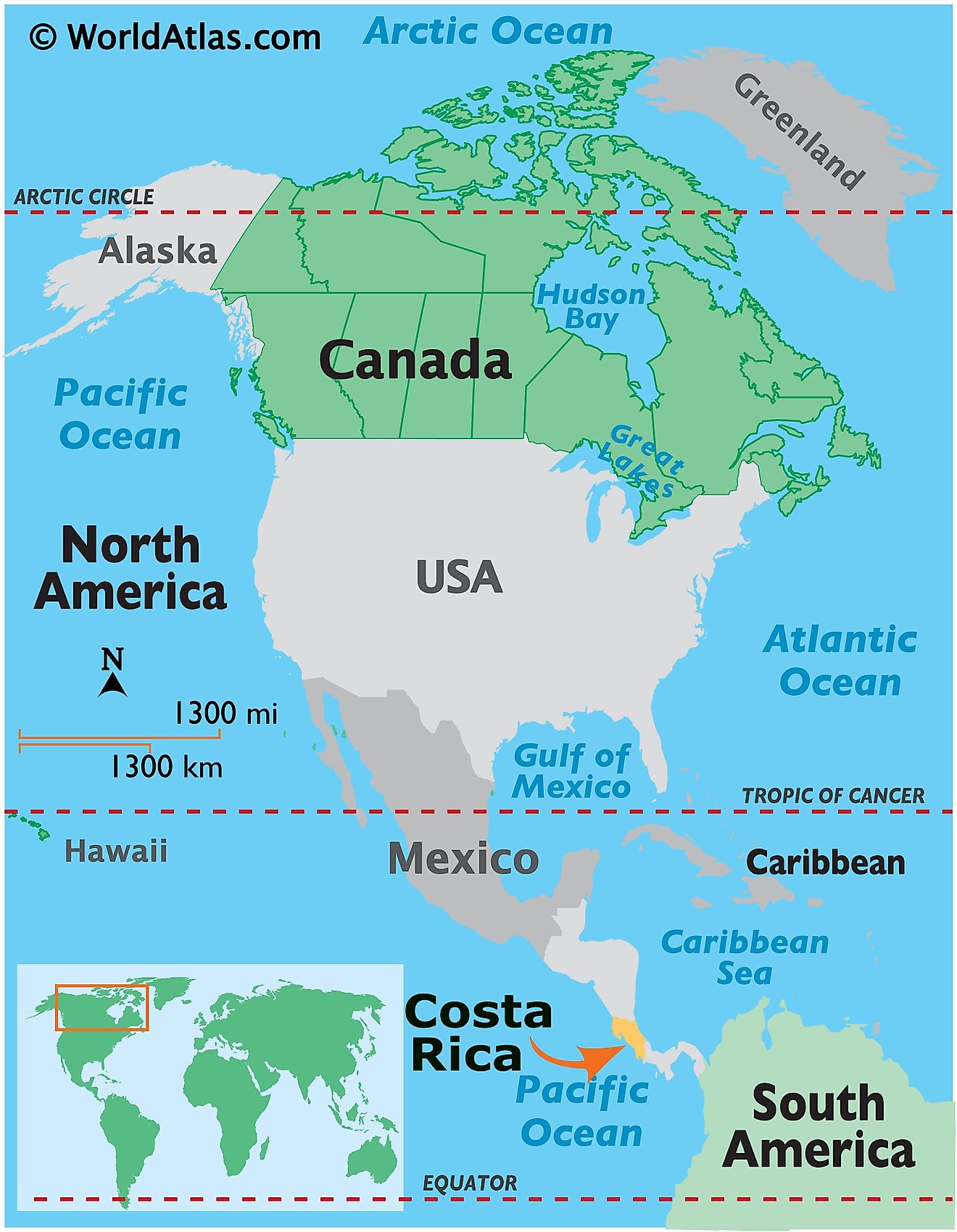
Costa Rica is a small country located in Central America. It is positioned in the Northern and Western hemispheres of the Earth. Costa Rica is bordered by Nicaragua to the north; by the Caribbean Sea to the northeast, by Panama to the southeast and by the Pacific Ocean to the southwest.
Costa Rica Bordering Countries: Panama, Nicaragua.
Regional Maps: Map of North America
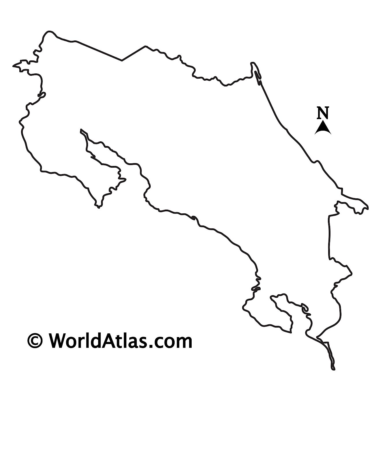
Outline Map of Costa Rica
Key Facts
| Legal Name | Republic of Costa Rica |
|---|---|
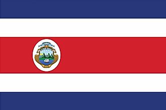
| Flag |
|
| Capital City | San Jose |
| 9 56 N, 84 05 W | |
| Total Area | 51,100.00 km2 |
| Land Area | 51,060.00 km2 |
| Water Area | 40.00 km2 |
| Population | 5,047,561 |
| Major Cities |
|
| Currency | Costa Rican colones (CRC) |
| GDP | $61.77 Billion |
| GDP Per Capita | $12,238.37 |
This page was last updated on June 15, 2023
