Maps of Portugal
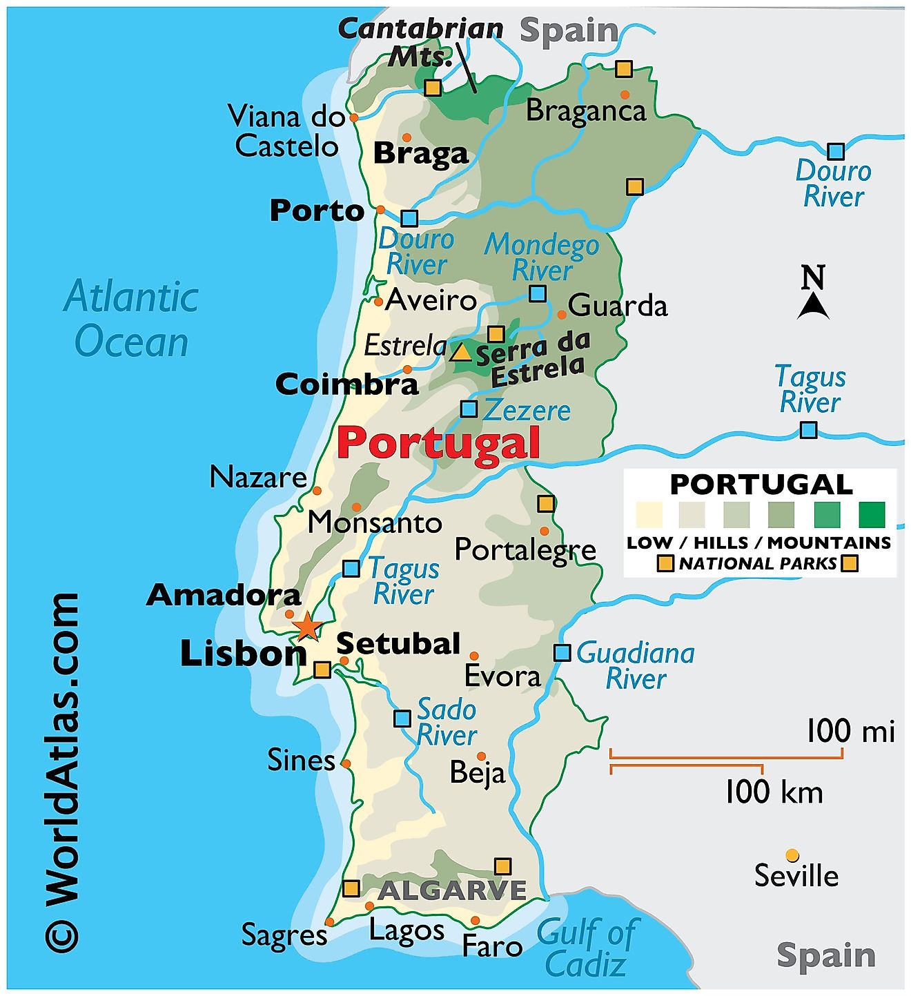
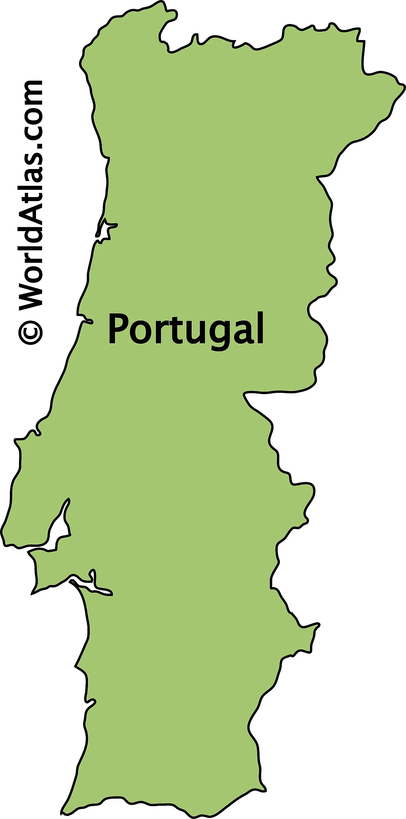
Portugal occupies the western edge of the Iberian Peninsula in southwestern Europe and is the westernmost country on the European mainland. It covers about 92,212 sq km (35,603 sq mi) and shares a land border with only one country, Spain, along its northern and eastern sides, while the Atlantic Ocean forms its entire western and southern coast. Home to roughly 10.3 million people and centered on its capital, Lisbon, Portugal also includes two Atlantic island regions, the Azores and Madeira. Cabo da Roca, on the coast just west of Lisbon, marks the westernmost point of continental Europe.
Mountains And The Interior
Portugal is sharply divided by the Tagus River valley. To the north, the land is high and rugged, ascending through the mountains of Tras-os-Montes and the granite highlands of Peneda-Geres, which is Portugal's only national park. The most significant mountain range is the Serra da Estrela, part of the Sistema Central, extending east into Spain. Its peak, Torre, is the highest point on the Portuguese mainland at 1,993 meters (6,539 feet) and hosts the country's only ski resort. South of the Tagus, the landscape levels out into the rolling plains of the Alentejo, a warm, dry area dominated by wheat fields and expansive cork-oak groves, making Portugal the world's leading cork producer.
Rivers And Lakes

Most of Portugal's major rivers originate in Spain and flow westward into the Atlantic Ocean. The Tagus (Tejo), the longest river on the Iberian Peninsula, crosses Portugal and broadens into an estuary at Lisbon. To the north, the Douro cuts through steep, terraced hillsides that produce grapes for Port wine, a renowned fortified wine. The Guadiana forms part of the southern border with Spain, while the Mondego is Portugal's longest entirely within the country. Portugal lacks significant natural lakes; instead, its largest inland waters are reservoirs, such as the Alqueva, one of Western Europe's biggest artificial lakes.
The Coast And The Algarve

The Portuguese mainland features about 940 km (585 miles) of Atlantic coastline, from extensive sandy beaches to dramatic cliffs like those at Nazare. The Algarve, in the south, is the most renowned part, known for its sunlit cliffs, secluded coves, and sea caves such as Benagil, formed from soft limestone by the ocean. Behind these beaches, the Ria Formosa lagoon protects a series of evolving barrier islands and is one of Portugal’s key wetlands for migrant birds.
The Azores And Madeira

Portugal's two autonomous regions are located far out in the Atlantic. The Azores consist of nine volcanic islands situated about 1,400 km west of the mainland, characterized by lush greenery, rugged terrain, crater lakes, hot springs, and Mount Pico, which stands at 2,351 m (7,713 ft) as Portugal's highest peak. Madeira, closer to the African coast, boasts a mild, subtropical climate year-round. Its capital, Funchal, is nestled on steep hillsides, and the island's ancient Laurisilva laurel forest is recognized as a UNESCO World Heritage site. Collectively, these two archipelagos extend Portugal's influence deep into the Atlantic.
Districts of Portugal Map
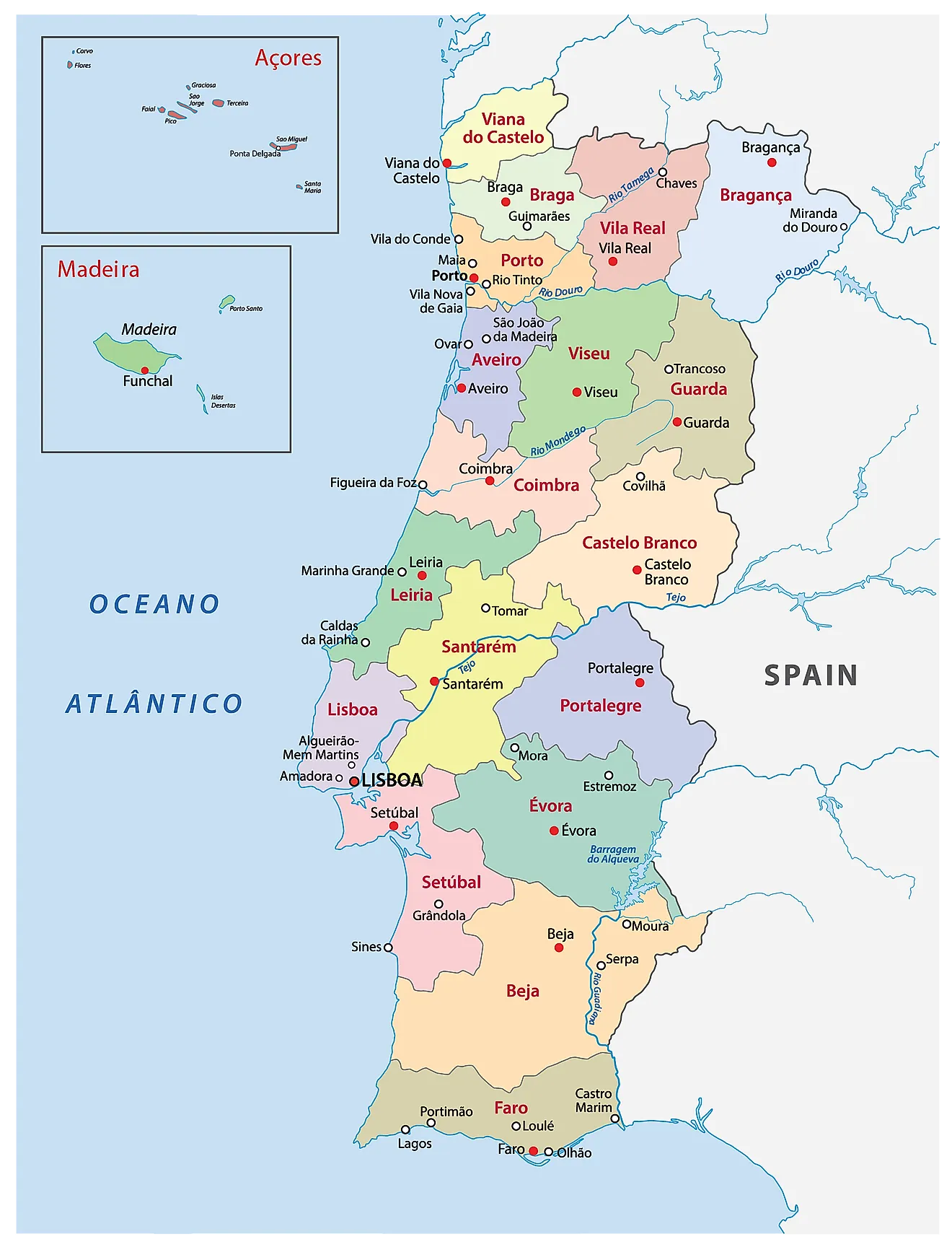
Portugal (officially, the Portuguese Republic) is divided into: 18 districts (distritos, sing. distrito) and 2 autonomous regions (regioes autonomas, sing. regiao autonoma). In alphabetical order, the districts are: Aveiro, Beja, Braga, Braganḉa, Castelo Branco, Coimbra, Evora, Faro, Guarda, Leiria, Lisboa (Lisbon), Portalegre, Porto, Santarem, Setubal, Viana do Castelo, Vila Real, and Viseu. The two autonomous regions are – Acores (Azores) and Madeira.
Located at the mouth of the Tabus River, along the coast of the Atlantic Ocean is, Lisbon – the capital and the largest city of Portugal. Lisbon is the westernmost capital city of the European mainland. It is also the administrative, cultural, economic and commercial center of Portugal. Lisbon also serves as Portugal’s chief port.
Where is Portugal?
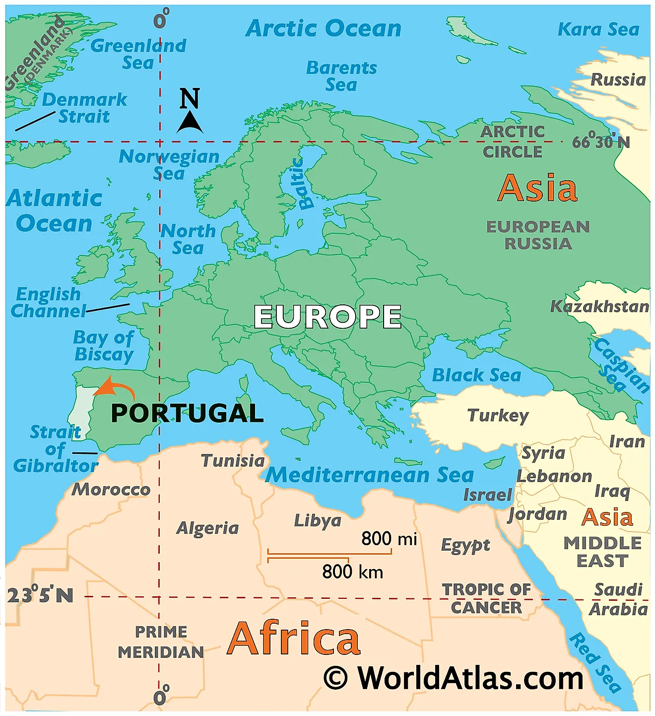
Portugal is located on the Iberian Peninsula, in South Western Europe. Portugal is geographically positioned in the Northern and Western hemispheres of the Earth. Situated in the westernmost part of Europe, Portugal is bordered by Spain in the north and east; and by Atlantic Ocean in the south and west. The small archipelagos of Azores and Madeira are in the south and southwest of Portugal in the Atlantic Ocean. Portugal shares its maritime borders with Morocco.
Portugal Bordering Countries: Spain.
Regional Maps: Map of Europe
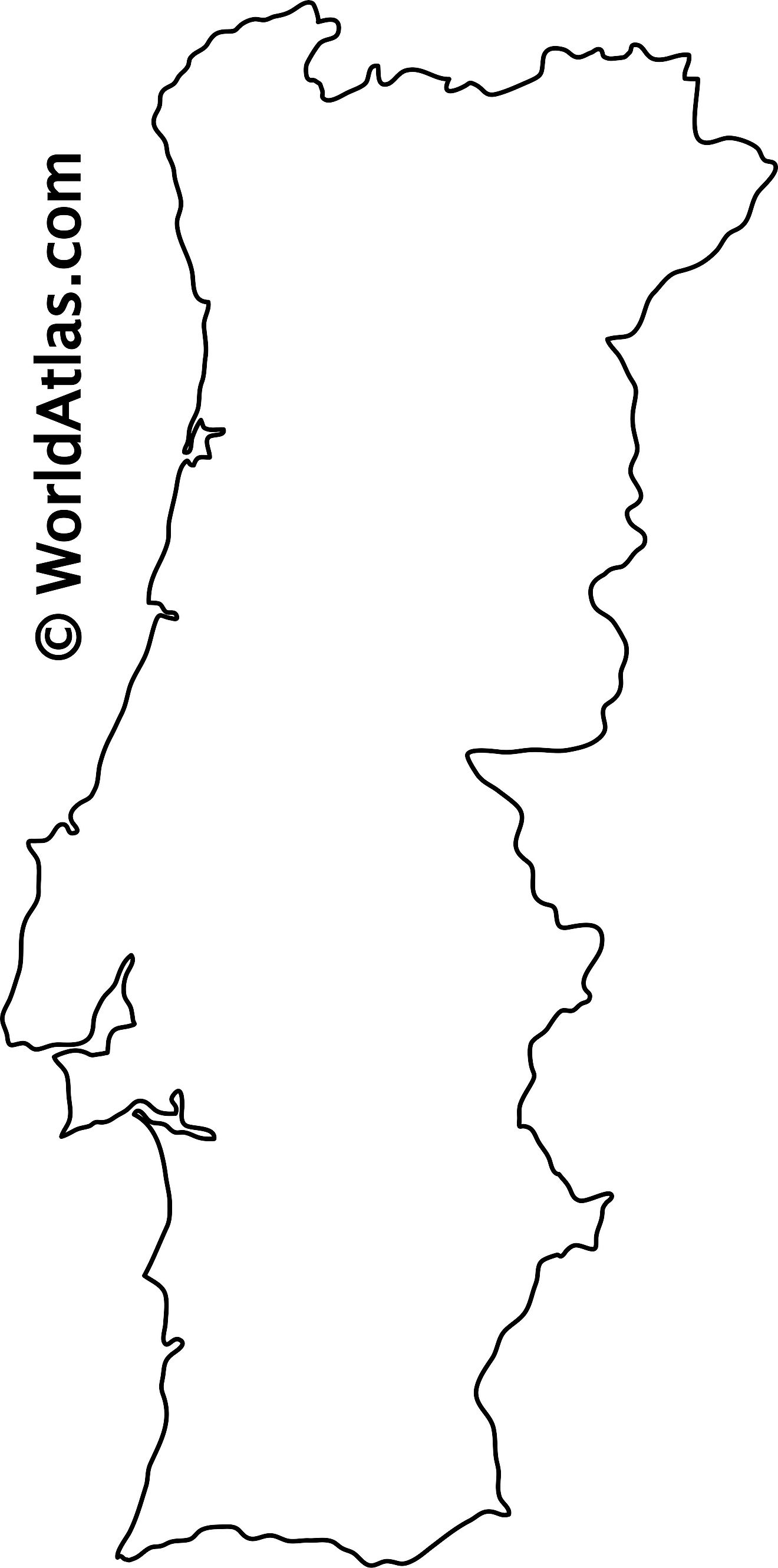
Outline Map of Portugal
Key Facts
| Legal Name | Portuguese Republic |
|---|---|
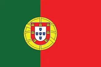
| Flag |
|
| Capital City | Lisbon |
| 38 43 N, 9 08 W | |
| Total Area | 92,090.00 km2 |
| Land Area | 91,470.00 km2 |
| Water Area | 620.00 km2 |
| Population | 10,269,417 |
| Major Cities |
|
| Currency | Euros (EUR) |
| GDP | $237.69 Billion |
| GDP Per Capita | $23,145.04 |
This page was last updated on August 21, 2026